
Tag:NSW

Australia’s largest flying Bird – The Pelican, is a familiar sight along the Australian coast. It is often seen roosting on sandbanks, rocky breakwaters, swimming in lagoons, bays and rivers, and congregating in large numbers around fishing villages or where fishermen clean their catch. They are large waterbirds with a long pink bill for catching fish and draining the scooped up contents before swallowing.

Appearance
Pelicans species are mainly white except for the brown and Peruvian pelicans. The Australian Pelican is the largest of all eight pelican species. However, it weighs just 7kg because it has the lightest bones of any bird in the world, with air sacs in the bones and a network of air sacs under its skin. Their bill, the largest of all the Pelican species, is 40-50cm long, and they are voracious eaters, consuming up to 9kg of food per day eating fish, shrimps and yabbies.

With a wingspan of 2.3 – 2.6, they can soar to a height of 3000m and fly 1,000 in 24 hours. They are found throughout Australia, Papua New Guinea and western Indonesia, with occasional reports in New Zealand and various western Pacific islands.

Behaviour
Pelicans plunge their bills into the water to catch their prey, using it as a net to scoop up prey. While they may feed alone, they more often work together to drive fish into a concentrated mass before herding the fish into shallow water or ever-decreasing circles. On a trip to Lake Menindee one year, we went out to shoot a sunset at the local weir. We found a flock of pelicans waiting at the wall for dinner on arrival. As fish swept over the top of the weir, they would scoop them up at the bottom. Pelican version of automatic food dispenser 🙂


During food shortages, they have been known to capture and eat seagulls or ducklings, holding them under the water until they drown and then eating them head first. They will also rob other birds of their prey and take handouts from humans.

Mythology
Pelicans also feature in many myths and Christian iconology, including the ‘Book of Beasts”, a Christian compendium of real and imaginary beasts, with the Pelican symbolising selflessness and sacrifice. Colin Theile wrote the beloved Australian book ‘Storm Boy’, the story of a young boy living a lonely life with his reclusive father on the beach in Coorong, an isolated wetland region in South Australia. The boy finds and raises three orphaned Pelican chicks forming a close bond with them. In 1976 the book was adapted into a film, with a sequel in 2019. Mr Percival, the Pelican, died in Adelaide Zoo in 2009, aged 33 years old.

Breeding Site
All Australian pelicans mainly derive from just two breeding sites. On islands in the north of the Coorong, S.A. – Storm Boy country – the rookery produces almost all of Australia’s pelican chicks. The other is on various waterways of the Lake Eyre basin during rare flooding events. This year there was also a large breeding colony on Lake Brewster NSW, a remote inland lake.
In 1990, around 100,000 pelicans (perhaps a third of all the pelicans in Australia) on Lake Eyre produced 80,000 to 90,000 chicks, which later dispersed throughout the continent, including Canberra’s lakes.
About Regional

Breeding
Pelicans are gregarious birds and are monogamous for a single season, breeding in large colonies. While up to four chalky white eggs are laid, the usual number is two. Incubation is for 32 to 35 days. After hatching, the larger chick is fed more, and the smaller one eventually dies of starvation or siblicide by the other chick. The young Pelican can fly at around three months of age but still depend on its parents for food.

Landing and Take Off
Pelicans can remain in the air for 24 hours. However, they cannot sustain flapping flights over long periods. They use thermal currents to swoop and soar and cover great distances to overcome this. The landing appears similar to an amphibious aeroplane landing on a water runway, gliding to a stop using its webbed feet as brakes. Then, they skim across the water on takeoff, building up speed, flapping wings, and lifting into the air.
Pelican Feeding
Where can you see Pelicans being fed? Every day at midday on the foreshore by the pier at San Remo, Vic. The Pelican feeding at The Entrance in NSW has been temporarily halted due to Covid. You can see them fed at Ian Dipple Lagoon on the Gold Coast at 1.30 pm daily. The pelican feeding has been permanently cancelled at Kingscote, Kangaroo Island, SA.


Ben Boyd National Park (NP) is to be renamed. The park lies south of Eden NSW and covers 47kms of rocky coastlines, sheltered inlets and crystal clear waters. The park, established in 1971, is named after Benjamin Boyd, a wealthy pastoralist, businessman and elected member of parliament. However, with the advent of the Black Lives Matter movement, in the wake of George Floyd’s death, Ben Boyd’s history of blackbirding has shone a light on the park’s name.

Benjamin Boyd (1801-1851) was a stockbroker and entrepreneur born in Penninghame, Scotland, on August 21 1801. Boyd was the second surviving son of Edward Boyd, a London merchant. He was an ambitious man, believing great opportunities awaited him in the new colony. Arriving in Australia in June 1842, flush with funds from loans at London banks, he began setting up his ventures.
Vast Holdings
Ben Boyd created a fleet of coastal steamships. These ships plied the route from Twofold Bay in Eden NSW to Hobart, Tasmania. In 1843 he purchased land near Eden and established Boydtown as his base. From here, he shipped livestock, wool, and tallow to Sydney and onto London. By 1844 he had become one of the largest landholders and graziers in the colony.

With his vast pastoral holdings, he constantly struggled to recruit suitable labour. This was due to a lack of immigrants and former convicts in sufficient numbers willing to work on outback stations. Consequently, he suggested a plan where convicts with tickets of leave in Tasmania could be granted pardons on the condition. Naturally, the pardon was on the condition they worked for him on the NSW properties. The government, however, declined this idea.
In evidence before the select committee on immigration on 27 September 1843 he claimed that he employed some 200 shepherds and stockmen, but despaired of the colony’s prosperity ‘unless we have cheap labour, and can bring the wages of the shepherd who will undertake large flocks to £10 a year with rations’; these included meat and flour, but not tea and sugar which he considered luxuries.
ANU

Blackbirding
Boyd then turned his sights on recruiting labour from the Pacific Islands. Because of this, he is considered Australia’s first Blackbirder. Blackbirding was the practice of shipping South Sea Islanders to the colonies. On arrival, they would be put to work and paid minimal wages. This ensured he evaded anti-slavery laws. Common blackbirding practice was to entice natives aboard the ship with food or goods. Then ships would up anchor and leave. Other times they abducted them at gunpoint.
In 1847 he brought around 200 natives from the New Hebrides and the Loyalty Islands back to Eden. He planned to put them to work as shepherds and labourers. However, many absconded and headed to Sydney. Here, they were seen starving and destitute on the streets of Sydney, begging for passage back to the islands. There were rumours of violence and murder during the “recruiting” practices. However, the attorney general in Sydney led an inquiry, Sir Charles Fitzroy, found them unsubstantiated.

With complicated and obscure methods of financing his pastoral activities, by 1846, he was in financial difficulty. Boyd lost a costly legal battle over his efforts to recover £25,000 insurance on his damaged steamer, the Seahorse. Adding to his woes was dissatisfaction from his London shareholders. Boyd was found to have submitted false reports to them. The shareholders forced him out in favour of his brother though the company failed to recover and ended in liquidation.

Financial Ruin
In 1849 to evade his creditors, he slipped quietly out of Sydney aboard his yacht “Wanderer”, bound for the California gold rush. The vessel stopped in New Zealand, where they loaded the ship with flour and Maori potatoes. These they then sold for a handsome profit in San Francisco. His efforts at finding a new fortune in California were futile. So he headed off again aboard the Wanderer, this time landing in Hawaii. He then sailed to Guadalcanal in the Solomons from Hawaii, unaware that it was the same harbour where another of his ships, the Velocity, had kidnapped islanders.
Death In The Islands
On October 15 1851, he went ashore with a native to shoot game. Two shots were heard 15 minutes apart and then silence. When he failed to return, his companions on the yacht went ashore searching for him. Crews recovered his belt and an expended firearm cartridge, but his body was never found. It was concluded he had been killed by natives in retribution for the blackbirding in 1847. The remaining crew went ashore armed with muskets and swivel guns, exacting their revenge with the death of twenty-five natives.
“It is clear from the expert historical analysis that Ben Boyd’s association with ‘blackbirding’ should not be reflected or celebrated in any way in our National Parks.”
Matt Kean, Environment Minister

Calls to Rename
There are also calls to rename Boydtown, Ben Boyd Road in Sydney, and a plaque in his honour has to be covered up after threats were received that it would be vandalised.

After years of lobbying by Aboriginal and Non-Aboriginal community members, the local Bega Valley Shire council pushed the State Government for a dual name change for the park earlier this year. The council submission asked them to review the park’s name in light of a review of Boyd’s history. However, the state government decided one name is less confusing than a dual name. Therefore, the state government decided to drop Ben Boyd’s name entirely from the park. Community discussions with local Aboriginal elders and the community will begin shortly. They hope to identify a new name for the national park recognising the Aboriginal cultural heritage of the area.

Continued from Part One
Tom’s Amazing Adventures continued the next day. After walking all morning, Tom had picked up a ride to Dubbo with a lovely old lady in a Vauxhall. She regaled him with stories of her childhood during the Great Depression of the ’30s and the hardship of the ’40s with WW2. It particularly offended her that people were protesting their current “hardship” with the lockdown. “pfft”, she said. “They have no idea what hardship is. Have any of them ever had bread and dripping sandwiches or eaten Tripe?”
Dubbo
More than a bit shamefaced with her words, Tom remained silent. After being dropped off in Dubbo, Tom decided to take a couple of days rest from the road and picked up some casual work repairing burst pipes. So it seems with all the excess eating of desserts. The cream was building up and causing the old pipes to crack.
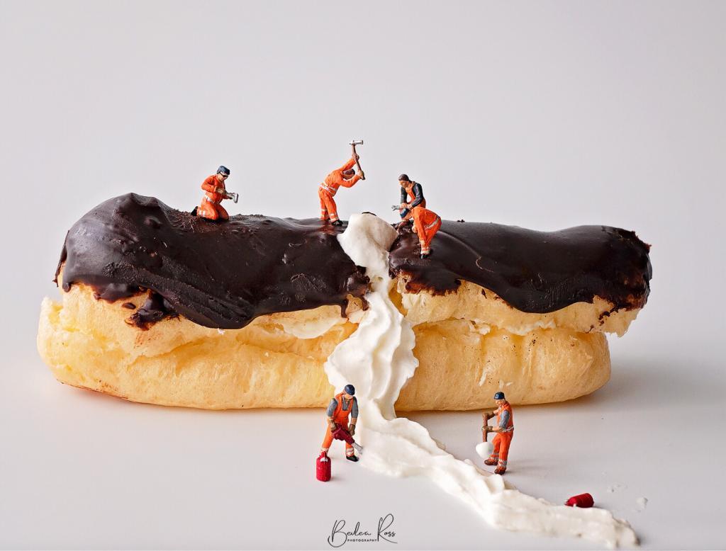
Tom had been in Dubbo for three days. With work on the pipes done, he spent a day relaxing. He had been sleeping rough under the bridge alongside the Macquarie River in Biddybungie Reserve. Wandering alongside the river, and through the town’s parks, he indulged his hobby of birdwatching.


This was also a good cover for keeping an eye out for checkpoints and police roadblocks. Next, Tom stopped off at the local Salvation Army Op shop. Taking a leaf out of his hero Jack Reacher’s life on the road, he purchased a change of clothes. He then discarded his old clothes in a bin. He would simply wear them until he needed to replace them. He then sneaked into the NRMA Dubbo holiday park for a shower. He planned to head up the Newell Highway the next day, hoping to get a lift as far as Walgett.
On the road to Walgett
Tom set out as the sun was coming up and started walking along the edge of the highway, thumb out. After about half an hour, he was picked up by a cattle truck heading north. Grateful that the wind was blowing south, Tom accepted the ride. He chatted with Bluey, the driver, all the way to Walgett. Walking into town, Tom found a café and ordered a coffee.

Chatting to a local, he found out that Walgett had artesian bore baths, naturally heated to a temperature of 41.5°. Even better, the baths were free. Having been on the road now for almost two weeks, a good soak sounded perfect.
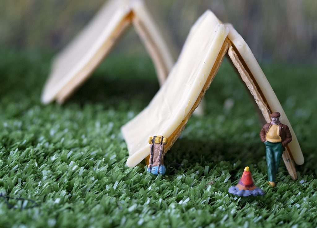
Tom’s goal of getting to Walgett was based on it being a quiet little town but a stop on the Great Inland Way. This was a tourist route that travelled 2,956 kilometres from Sydney to Cairns, through inland NSW. He surmised that he would have no trouble picking up a lift from travelling tourists. And camping in the national parks along the way would be easy. The border to Qld was also only an hour and a half away by car, though he planned to cross by foot. Again under the cover of darkness in a day or so. In the meantime, he would camp at the free campsite in Walgett to rest up and be ready for the night crossing.
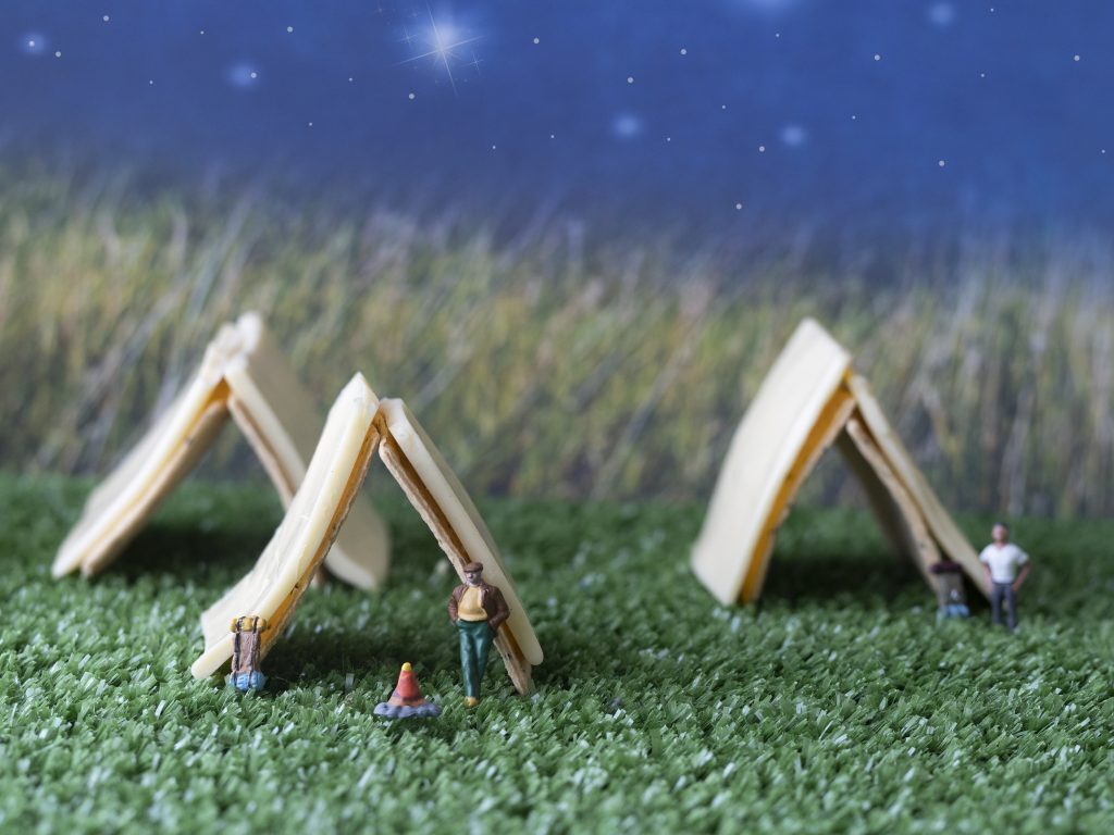
The giant Cos tree
After a comfortable night, Tom made himself a billy tea – and decided to go for a hike through Cos Valley. He had heard other campers talking about the valley in glowing terms. It had plenty of birdlife and the tallest Cos tree in Australia. So after a breakfast of sausages in bread, cooked on his campfire (god, he missed Bunnings), he packed his backpack with a few supplies and set off.

He hiked through Cos Valley and ate his lunch under the shade of the Cos tree. Tom enjoyed the solitude before he headed back to Walgett via an ancient Celery Forest, Where much to his surprise, he encountered Bill and the scout troop Bill, behaving as he didn’t know Tom, gave him a brief nod and said ‘afternoon sir, enjoying your walk?” and kept going.

Rendevous
Back at camp, Tom put the billy on and sat down. Then, realising it was Bill who had been watching his last night, he sat and waited. It wasn’t long before Bill ambled over. They greeted each other warmly, and Bill said to Tom, “you made good time then” “Yes, said Tom, I had some luck on the trip with picking up rides, But I didn’t expect to see you till I got to Lightning Ridge”.
“My dear old mum always said you were lucky bloke,” said Bill, “she said you would always land on your feet. But, mind you, I don’t see how that’s good. If I landed on my feet, I’d snap both ankles” They hung by the campfire and talked quietly. Bill explained with the good weather; he thought he had time to get an overnight trip in with the scouts before Tom arrived.

“Everything on your list is ready at the house,” Bill said. “Beryl was a bit annoyed at the start, but she’s come around and is looking forward to seeing you,” They said their goodbyes for now, and Bill headed back to the scouts’ Tom settled down for the night as he had an early start in the morning.

Lightning Ridge
The camp was still quiet. With most still sleeping in their tents, Tom packed up and left in the morning. He wandered through the sleeping town and hit the Castlereagh Highway just after 7 am. Walking along with his thumb out, he got his first lift from a truck as it pulled out of the Walgett Wheat Siding. He rode with the driver as far as the Gwydir Highway junction. From there, he was on foot again until he was picked up by a fossicker who took him all the way to Lightning Ridge.

Beryl had been thinking about Tom. Was he having a fantastic Adventure? However, she had to work that afternoon, so no time to think about Tom Beryl was a caddy at the Lightning Ridge Golf Club Tom and Bill decided to go with her and have a drink at the clubhouse while she worked then they would all stay for dinner “Not looking or smelling like that”, said Beryl “You,” she said, pointing at Tom, “are going to take a long, hot shower, WITH soap AND shampoo, and throw those clothes out the door into the hall You will find clean clothes and shoes in your room, because Bill, you are going to burn what’s he’s wearing They aren’t going in my washing machine, and aren’t fit for the oppy”.

In this post, we turn our sights to the Waterfalls of NSW. If you have read my previous waterfall posts, Waterfalls of Victoria and Waterfalls of Queensland, you have probably figured out I’m rather partial to waterfalls 🙂 On a recent trip to the Blue Mountains, I rambled around with a friend, uphill and down some very deep dales, to add a few more to my list.
Katoomba Cascades
Katoomba Cascades is a lovely, super pretty waterfall about 5 mins walk from the car park. It’s not to be confused with Katoomba Falls, a hard, grade 4 track. The cascades are in a pleasant little glade, surrounded two sides by trees, with a pond at the front and big stepping-stones across the pond so you can shoot from the front or either side. You can continue to the Kedumba River lookout if you like, but I was just interested in the cascades and went no further 😉

The sun rises over the top of the falls, so if shooting on a sunny day, it’s best to shoot either early morning or late in the day when it’s behind you. As I wanted long exposure for the silky water, but it was pretty shady below the cliff edges, I decided to bracket my shots. This also helped bring the colours out in the rocks. The above are three images shot two stops apart and merged in Photomatix.
Empress Falls

Unlike Katoomba Cascades, Empress Falls is NOT an easy walk. It’s a Gr 4 track under the Australian Walking Track Grading System, which is “Bushwalking experience recommended. Tracks may be long, rough, and very steep. Directional signage may be limited” I can vouch for it being very steep. And rough. Getting down was a series of wooden steps, metal stairs, dirt tracks, and stone steps, including stepping-stones across flowing water, all while carrying a tripod and 9kg of camera gear on my back! It’s only 1.1km, but it’s downhill all the way. We went from the cliff tops to below the tree line in this photo. If I ever talk about doing a grade 4 again, commit me. Stat.

The falls tumble through the canyon walls to a pool at your feet on arriving at the bottom. You are on a large stone plateau with a pool between you and the falls. Large moss-covered rocks and the obligatory log (ever noticed how there is one at EVERY waterfall? it’s like parks decor 101. Put a log in front of the waterfall)

The large, reasonably flattish rock surface makes it possible to shoot from several angles. Even with the difficulty of the walk, it’s a busy place, with lots of people stopping by for a photo before continuing (there are two more falls on the track). So we didn’t go any further. I wasn’t sure how long or even how I would get back up, so when we were done, we retraced our steps. Getting down took me about 20 mins. Getting back up was just over an hour.
Upper Leaura Cascades

After our suicidal walk the day before to Empress Falls, and with muscles still complaining the next day, we opted for a more accessible waterfall. The upper Leaura Cascades. Like Katoomba Cascades, they are only a few minute’s walk and half a dozen steps from the car park and adjacent pretty picnic area with man-made caves and arches. While not a large waterfall, it is quite lovely in a little tree-fern ringed pocket. There is a small viewing area to the side, but it’s reasonably easy to get down and in front of it.

Lower Leaura Falls
Once you are done with the upper falls, head back to the car park and to your right, under the arch, past the information sign and then down the steps. You’ll come to a small stone bridge with a view of the falls about 120m down. Keep coming for another couple of minutes, cross the footbridge and the falls and viewing platform are to your right.

The viewing platform is in front of a large rock overhang, and there are plenty of rocks to put your camera bag on rather than in the dirt. It’s wet there, though; either put your rain cover on the pack or bring a plastic bag to sit your camera bag on.

We were there mid-morning, and the sun was hitting the falls as it came through the trees. Not really ideal with the falls strongly backlit. I want to reshoot them, but next time, much earlier or later in the day.

Wentworth falls, Wentworth
The walk to Weeping Rock starts at the Wentworth Falls Picnic area. There are plenty of car parking spots, but it’s VERY popular, and the car park usually fills quickly, and people resort to parking in the surrounding streets. The walk itself goes past Fletchers Lookout with amazing views of the valley, then past Wentworth Falls Lookout before heading downhill to Weeping Rock and Wentworth Falls.

Weeping Rock, Wentworth
The path to the lookout is listed as a Grade 3 and 1.4km return. Grade 3 is considered a moderate track suitable for all ages with short, steep sections. For real people who don’t go to the gym several times a week, it’s my version of hard. Besides me, quite a few people were stopping to catch their breath on the way back. Kids did it standing on their heads. Mature age people, not so much.
When we got down to Wentworth Falls, a zillion people were doing selfies, sitting in the pool, and climbing over rocks. It was crowded! So many people I didn’t even bother trying to get a shot. We left Wentworth, turned back a little, and took the track off to the right on the way back to Weeping Rock. It’s only a very short track off to the side, and it was gloriously empty of hordes of people.

The steps bring you down to the front as you approach the waterfall. There is no designated viewing area, and you can walk around in front of it. The water comes over the top, flowing down into the pools in front and off to the right. Then over the cliff to link up with Wentworth Falls. The cliff edge is NOT fenced, so stay well away from it. If you only go from the start of the track to Weeping Rock and forget about Wentworth Falls (the view at the top is pretty forgettable), then it’s on a 950m return trip.

Note:
My ND filter of choice is Zomei. I know there is a lot of debate around the brands. Some people swear by Lee, others by Nisi, some by Cokin. Both the Lee and Nisi are well out of my price range, but cheap ND filters are worthless. They give off unwanted magenta or brown colour casts that you CANNOT remove in post-processing. While the Zomei optical glass filters aren’t ‘cheap’, they are about 75% cheaper than Lee or Nisi. My ND10 and ND64 were both around $80 each and worth every cent. As you can see from the images above, there is no loss of clarity or colour cast.
if you enjoyed Waterfalls of NSW, check out Waterfalls of Qld.

We were still Rambling The Outback. After a very comfortable night’s sleep in the big king-sized beds at Mungo Lodge, I was up around 5.30 and out the door just after six. Along with Lisa and Amy, we jumped in with Roy and Julie and headed off to the Mungo Lookout for a sunrise. The location was average. It was recommended to us by John at reception as a good sunrise spot. It was for viewing the sunrise. But for, shooting a sunrise it left a lot to be desired. There is no foreground interest and miles and miles of endless flat plain to the sun on the horizon. In the future, when someone recommends a spot to me, I will ask, “are you a photographer” if the answer I no, I will disregard them!

Once the sun was up, we drove down to the Historic Shearing Shed just a few minutes down the road.
The woolshed


Paddy Melons
After about an hour, we headed back to mungo lodge for showers, breakfast and checkout. Breakfast was a delicious cooked buffet in the restaurant. Leaving Mungo, we came across Paddy Melons growing beside the road.
Paddy melon (Cucumis myriocarpus) and Afghan melon (Citrullus lanatus) is both prostrate annual melons germinating in spring and summer. Their growth is favoured by good moisture relations and bare or fallowed paddocks. Melons can stabilise areas prone to wind erosion and provide stock feed when food is scarce (although opinions vary greatly). Horse, sheep and cattle losses have been associated with eating the melon, but the smell of the plants generally makes them unpalatable. Dept of Agriculture


Dirt Roads
From Mungo, we were heading first to Balranald and then onto Swan Hill. Between Balranald and us lay 154kms of dirt road. According to google maps, it’s a 5-hour drive. Maybe they assume you are driving a horse and cart as we did it in just over 2 hours. Just out of Balranald, we finally got the bitumen back.

Swan Hill
We stopped off in Balranald for coffee and comfort stop and were then on our again. Finally, driving on lovely bitumen, we arrived in Swan Hill around midday. I popped into the motel and made sure all was ready for the arrival of those travelling behind us. Then headed over to the Pioneer Settlement and organised the tickets for the evening light show, settlement entry, and Pyap Paddlesteamer ride. We wandered around the settlement for a while, bumped into a few of the group who had arrived, took a paddle steamer ride and then headed back to the hotel to relax for an hour before dinner.

Dinner was at Spoons Restaurant beside the settlement. Sitting outside on the deck, the sky started to turn a glorious orange-red. Everyone started looking and then dashed off for a couple of shots with phones—fantastic sunset, and most of us there without cameras.

After a delicious dinner, we headed over to the settlement for the Heartbeat of the Murray Laser Show. Excellent show using water, laser, and sound, it recently won a prestigious multimedia award. With the closing of the show, we went back to our motel for the night; it was the end of a fabulous week We Got to know some people better and met others for the first time by the close of the week; we had all become closer, had a million memories, and about as many photographs 🙂 The following day it was packed up and headed home and back to ‘real life’. Thank you to all who took this journey with me.

For me, this was the highlight of the trip.. remote, isolated, heritage-listed, and with a landscape, unlike anything I had seen before. Mungo National Park.
Menindee

We left Broken Hill around 7.30 am and headed towards Menindee to get there. Unfortunately, mobile reception became almost nonexistent at 7.32 am (Telstra only, and then even that eventually gave up). Though we knew that wouldn’t last long, we had good bitumen roads to start us on the way. Menindee lakes had been empty for a couple of years but now had water in them again, something we wanted to see. While not the best time of day to see them (sunrise and sunset are superb), the lakes were pretty and worth the stop.

if you ever get a chance to go to the Menindee Lakes – go for a sunrise or sunset. It’s just beautiful. The birds are active. It has a much different feel at sunset, serene. Tranquil.
Pooncarie
We headed out of town from Menindee towards Wentworth, our destination Pooncarie. The only town between Menindee and the Mungo turnoff. About 10kms out, we hit the dirt roads apart from bitumen on the cattle grids; we had dirt roads for about the next 40kms. There was no petrol at Mungo, so we refuelled the cars and headed to Pooncarie’s Telegraph Hotel for lunch. Not the best choice, though. It was the only game in town. Onions on burgers were cold; the burger pattie was burnt outside and raw on the inside. The lady behind the bar just shrugged her shoulders when we complained. Luckily none of us came down with food poisoning. Leaving Pooncarie behind, we headed off again toward Mungo. We stopped for a photo-op at the car on the pole.


We continued until we hit Top Hut Road. From here, it was around 60kms of dirt road to Mungo Lodge just outside the park. All roads leading into Mungo are dirt roads. And they get closed in bad weather. Did I mention it was isolated?
Mungo National Park
Booking in, we met the lovely John, who had been chatting back and forth with me in the preceding weeks organising everything for us. The accommodation was all cabins set in a circle around a central park area. Rooms were fantastic, king beds, lovely clean ensuites, and back porches on each cabin. Touch of luxury in the middle of nowhere! Around 5 pm, we met our guides at reception, and we followed them off into the national park itself. The first stop was the Walls of China lookout.


Walls of China
After a brief stop there, we were back in the cars and heading down onto the walls of china. Access to the great walls is strictly by guide only to ensure the area is protected. The guides carried our packed dinner for us (provided by Mungo Lodge) as we planned to shoot and then eat dinner at sunset.

Aboriginal artifacts and remains dating back 50,000 years had been found here. Making it one of the oldest places occupied by humans since ancient times.. the remains of a 40,000-year-old female found in the dunes of Lake Mungo are believed to be the oldest ritual cremation site in the world. Back then, it was a lush lake area, part of the Willandra Lakes region, teeming with life as the lake dried up. The tribes moved on.


As it got darker, we started shooting the stars. And I ticked off a second bucket list .an orb at Mungo.


Days End
by the time we headed back to the cars, it was pitch black. Bobbing torches in convoy followed the guides back to the vehicles, then the hair-raising drive back to the lodge. In the dark following, clouds of dust from the car in front reduced visibility to about 3 feet. If any roo had jumped out, he would have been on our laps. We’d have no chance of seeing him in time to stop. I had planned to do some more light painting back at the lodge, but after all the walking and driving, everyone just headed for their rooms and crashed out.

Day 3 of our outback adventure
Our plans for today were Silverton and the Daydream Mine. While I slept through the sunrise, some of the group went out hunting down a good sunrise spot. Elsewhere, two of the group went out tracking down the Indian Pacific as it stopped in town. The morning skies were sunny, blue with a light breeze, but the afternoon forecast the cloud. So it was a free morning for all. Some went to Bells Milkbar, and some checked out the Palace Hotel. Others roamed the galleries. We met up for lunch with part of the crew, and then everyone met at Bells Milkbar to head out to Silverton.

Daydream Mine
The historic Daydream Mine lay between us and our destination, just out from Silverton and 20kms from Broken Hill. Established in the 1880s the mine, and the town surrounding it were once home to around 500 workers, wives, and children. It closed a few years later when the ore ran out—the NSW government heritage listed the site in 1999. Today, above ground, only the foundations of the old town and part of the smelter remain. The road in was around 10km of uphill and down dale, winding dirt roads and through two gates.


Below Ground
After the above-ground tour, we had to gear up with hard hats and lights for the underground section. Three levels underground, down narrow steps (and I do use the term loosely) cut into the rock underground. The entrance tunnel was just a tad bigger than our bodies. If I hadn’t been in the lead behind the guide, I would have turned back with everyone else behind me. But I couldn’t get past them!


It did get taller in parts (small parts) where we could stand upright. But most of the time, the tunnels were about 4ft high. It was built for short people!

Silverton
Back up top, we got our heart rate down and air intake back to normal. Then we headed 6kms down the road to the Silverton Pub. we plopped ourselves in the beer garden, downed a couple of quick drinks, and declined to move. Until tomorrow.

Mundi Mundi Plains
While the others who could all walk (because they hadn’t done the mine either through farsightedness or cowardice) headed off for the Mundi Mundi Plains lookout and the sunset. We stayed put. We were drinking and groaning. Until Bill announced, the sunset was starting to look good. Photographic OCD got us up moving. Just as far as next door where we had a clear view. an off some shots and limped, hobbled back to the pub

Lightpainting
After dinner at the pub the entire group relocated to across the road for some more light painting…no steel wool as Bill was reluctant to start a fire and burn the town down…. but we had fun with LEDs

At the end of the night we took a careful drive back into BH, dodging a few roo’s, rabbits and goats making it safely to our motel. The next morning was to be an early start as we had to be on the road by 7.30am and heading to Mungo……
Coming Up Next Day: Mungo NP and Great Walls of China

Tuesday morning, as pre-arranged the night before, everyone was up in the dark, out the door by 6 am and heading down to the Mildura Wharf for sunrise.
Sunrise On The River
The river was still and quiet, save for the morning bird calls and the odd early morning jogger going past. We were set up on a lovely wooden walkway that gave a good view down (up?) the river to the bridge over the Murray. But, even at that hour, there was a constant stream of traffic across the bridge.

By 6.45 am, the sun was coming up, more joggers and walkers were going past, and traffic was picking up… the river and the houseboats all remained quiet, though.

Back On The Road
Once the sun was up, we headed back to the motel for breakfast and showers, then booked out and headed to Broken Hill, 296kms up the Silver City Highway. The road is well-maintained bitumen but long, with the occasional bend to keep you on your toes. Between Mildura and Broken Hill, reception drops off quickly once out of Mildura, and you don’t get it back till about 20kms out of BH. There is only one little general store between Mildura and BH and three unattended rest stops. Apart from that, it’s just you and the goats..lots and lots of wild goats beside the road and the emus.


Broken Hill
We made it to BH by around 1 pm – where the group met up again at the Demo Club. The club began life as the Barrier Democratic Social Club, a working man’s club similar to the RSLs, but it has evolved into a curious cross between a pub and an RSL. There are no half-full wine glasses here.. every glass was a millimetre from the top and half the price of the victorian pubs. We booked into our rooms at the motel from the demo club, unpacked, and took a brief rest before heading off again. This time we were off to the Line Of The Load, a miner’s memorial overlooking BH. It has the name and cause of death of every miner who has worked the mine in BH… and there was a lot. No such thing as OH & S a hundred years ago.

Sculptures In the Desert
From the memorial, we headed just outside Broken Hill to Sculptures in the Desert – 12 sandstone sculptures on a hilltop. With Bill and Deanne Holmer from Melbourne Light Painting, we would shoot the sunset and then do a little bit of light painting before the ranger kicked us out at 7 pm to lock the gates.


Right on clockwork, the Ranger turned up at 7 pm and dispersed the party…then it was back to BH for dinner at Mario’s Palace Hotel…made famous from the movie Priscilla Queen Of The Desert.

Last week, a trip that was a year in the planning finally rolled around. Our first day was from St Arnaud to Mildura. After that, we had one week rambling around outback NSW. We took in Broken Hill, Silverton and Lake Mungo, and all the little towns between.
Our motley crew
My travelling companions were fellow photographers from the Victorian Photographers Collective plus their spouses. Thirteen of us left Melbourne on Sunday and met up with two more in Broken Hill and Mungo. Sixteen photographers in total, everyone got on great and looked out for each other. We laughed, groaned at the walking and had a ball. We covered around 2000 km, and a fair amount of that was dirt roads. However, I think I am cured of dirt roads for the next year!

St Arnaud
Our first overnight stop was at St Arnaud. Solely based on it was the closest proximity to Rapunyup that had reasonable accommodation. It’s also where another silo was in the progress of being painted. So we stayed in a very nice budget motel in St Arnaud and headed off on the 40 min journey to Rapanyup next morning. The organisers of the silo art trail boast about the extra tourists the silos are bringing to the region, but accommodation and cafes are thin on the ground (if not invisible), and everyone just stops, shoots off a few pics and travels on. So the towns still have a ‘lost and neglected’ feel to them. Shops are boarded up and empty. No one was on the street.
Rupanyup
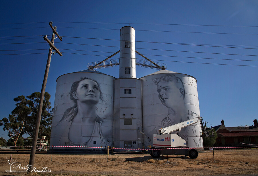
Monday morning, we woke to glorious sunny blue skies… warm enough for t-shirts too!. We left St Arnaud after breakfast and headed to Rapanyup. The silos are smaller than the huge concrete ones painted already—the artist Julia Kolchkova from Russia. Julia started about a week ago. At the rate, she is going; they will be finished in the next week or so. Behind the silo’s is a disused Railway Station – apparently, it has been sold, but I don’t its purpose be. It’s probably too much to hope that it will be a cafe and gift shop or B & B.


Sheep Hills
The next stop on our trip heading North West was Sheep Hills, just 42kms down the road. These were much taller than the Rupanyup Silo’s and were painted by Matt Adnate. Again, an incredibly realistic Aboriginal face gazed down on us, the detail on them is amazing. The chap in the red shirt saw us all pull in and checked it out too. He hadn’t heard of them. But he gives you an idea of the size of the silos.


Brim
After stopping off in Warrackanabeal for lunch and a wander around, we headed towards Brim. The Brim silos were the first to be painted, and their popularity led to the others. The Brim Silos stand beside the Henty Hwy and are the work of Guido Van Helton. They feature four locals from the area. Driving into town, you can see them from miles out. They dominate the skyline as you drive in.


Patchewollock
The next stop was Patchewollock, 87kms up the road. It was the longest gap between painted silo’s, as the two more scheduled to be added by the end of the year, are in Rosebery and Lascelles. They will be between Brim and Patchewollock. There is no cellular reception in town, or the surrounding area so don’t rely on your phone as a GPS. You’re going to need paper maps to direct you to the next town. There was also no petrol or food that we saw in Patchewollock. So fill up both the car and yourself in Warracknabeal. Alongside the silo look for the old Patchewollock Station. Old machinery and carts gracefully rusting into the red Mallee earth are dotted around the station.


Red Cliffs, Mildura
From Patchewollock, relying on paper maps we headed first to Walepeup, then Ouyen and finally Mildura. Our overnight destination for the day. Just before Mildura, we stopped off at Red Cliff’s lookout. And drove around in circles for a while with everyone’s GPS telling them different things. We eventually found the lookout. damaged and fenced off, but with a fence low enough to be overcome 😉


Unfortunately, there was a glitch with our booking for the night, and there was no room at the inn. The motel owner found us alternate accom quickly, and we settled in down the road at Cottonmouth Motel. Lovely hosts, eager to help us and settle us in after the mix-up. The changing of motels and getting organised blew our plans for sunset out of the water, though. so we settled on a nice dinner at the local RSL

It was our second and last morning in Eden, and we were on our way back up the coast on the return journey to Sydney. This time we headed to Quarantine Bay, not far from where we were staying. Our route would take us from Quarantine Bay to Kiama, but we planned to get another sunrise in first and hopefully spot more pelicans.

Quarantine Bay
Yet again, we were blessed with a beautiful sunrise. The weather gods were being genuinely kind to us.

Desperate times
Driving from Quarantine Bay to Kiama, we headed off in search of coffee. Desperately in search of coffee. Heads up, in Eden on a Sunday, NO coffee shops, cafes, bakeries, or anything remotely similar to coffee sellers are open before 9 am. It was only 7.30 am. So we started heading out of Eden with the naive hope of something open in the next town. No. Nor the next one, nor the one after that. It wasn’t until we went through Cobargo around 8.30 am that we found a little bakery that sold coffee and cakes. To this day, the baker remains blissfully unaware of the role she played in our survival.

Fortified and revived, we stopped at Corunna Lake and Tuross River before reaching the Ulladulla Lighthouse’s first planned photo stop.
Warden Head Light, a.k.a Ulladulla Lighthouse
The Warden Head lighthouse is an active lighthouse on a headland south of Ulladulla. Constructed in 1873, the original oil lamp was replaced in 1920 with a flashing light powered by acetylene gas for automatic operation, before being converted to electricity. in 1964 The light is now battery operated. It is also one of the only two lighthouses in NSW made from iron plates.

Point Perpendicular
From Ulladulla, we headed to our next lighthouse stop – the Point Perpendicular Lightstation. Point Perpendicular is still an operating military base, and we were required to show ID to enter, along with a headcount of the car. I was waiting for them to get out the mirrors on long poles to check under the car 😉

The travel brochures promised, “Drive through natural scrub and beautiful spring wildflowers to Point Perpendicular Lighthouse, and the spectacular escarpment at Jervis Bay”. Unfortunately, we saw no wildflowers and no escarpment. Did do another few km’s on NSW Parks favourite surface, though. The rutted, potholed, gravel and dirt roads. And while this lighthouse didn’t reward us with snakes, we did see a wallaby and a rabbit.


Kiama
We finally arrived in Kiama late afternoon and, with fading light, headed for the Kiama Lighthouse (we were on for a hat trick) and the Kiama Blowhole.
The Kiama Lighthouse was erected in 1887 with an oil burner light visible for nine miles. It was subsequently upgraded to gas in 1920 and decommissioned. In 1969 it was connected to mains electricity.

The Kiama Blowhole
The Kiama Blowhole was discovered by George Bass in 1797 and sits alongside the Kiama Lighthouse. Huge, spectacular plumes of water shoot up from the blowhole every few seconds. We spent a pleasant hour at the blowhole and lighthouse before heading into town for dinner and then to our B’n’B for the night.


Today our plans were for Kiama and Cathedral Rocks. We were halfway through our trip along the south coast and chose Kiama for an overnight stop as Kiama and Bombo are only a few minutes apart. So, after a night at a B & B in Kiama, we headed down to Cathedral Rocks, Bombo, to set up at the ungodly hour of 5.30. With excellent hindsight, we had scouted the location the day before to find it in the dark, so getting there and setting up was problem-free. Cathedral Rocks are 10m high basalt columns, sea stacks, and a 20m high cliff that forms a 1km headland.

It was a gorgeous sunrise, and we were working on getting the sun – and slow exposures on the rocks. I had an ND1000 on and couldn’t work out why it was coming out so dark until I realised I still had the CPL on from the day before. Once I took that off and just used the ND, things started to come together.
We stayed there till about 8 am with the sun fully up… it was just a fabulous place. I would have liked to go to the Bombo Quarry or Boneyard after that, but we couldn’t find them the day before, so we just settled for the entire shoot at Cathedral Rocks. Which wasn’t a bad thing 🙂

Bombo is a must-do place for anyone who loves landscape photography… for me, it’s also a ‘must go back. However, I definitely still want to get the Boneyard and the Quarry.
Cathedral Rocks is located off Cliff Drive, take the Kiama Downs to turn off from the Princess Highway, and cross under the railway bridge at Bombo Beach.

After our whale cruise and lunch at the pier, we drove to the Green Cape Lightstation and Ben Boyd National Park. Our goal was the Green Cape Lightstation at the end of the park on the tip of the peninsula. The roads are listed as 2wd dirt roads?… NSW Parks is very impressed with the capabilities of 2wd cars. While not as bone-shaking as our trip to Kichega National Park, it was still a bumpy, potholed, rutted dirt road for 21 km.

Green Cape Lighthouse
At the end of the road, the Green Cape Lighthouse rises 29ft overlooking the peninsula. The Green Cape Lighthouse was the first cast concrete lighthouse built in Australia. It also distinguishes it as NSW’s second tallest and most southernmost lighthouse.

A fence surrounds the lighthouse, so it’s impossible to get into the light station grounds (rented out as holiday rentals), but we found that heading down towards the cliffs gave us a good viewpoint.
The Pinnacles
Once on our way again and still within Ben Boyd National Park, we drove to the Pinnacles. Once you park the car, it’s an easy 1.1km loop to the pinnacles and back. The Pinnacles were formed due to erosion of the cliffs. They formed about 65 million years ago and are made of soft white sands and red gravel clay. When part of the cliff fell away, it exposed the red clay and white sands. Fortunately, we didn’t see any more snakes. But we kept a good eye out and thanked our forethought for wearing leather hiking boots!
Davison Whaling Station
Our final stop at Ben Boyd National Park was pretty underwhelming. The lady at the Information Center recommend that the Davison Whaling Station was well worth a visit. It may have been once. But there is a quaint little shack, but there isn’t much else. The whaling station itself was a couple of signs and an old tin pot.

