
Tag:country

Shepparton’s Museum of Vehicle Evolution claims to be one of the largest regional museums in Australia. And large it is. The vast expanse of vehicles under the one roof is impressive.

As well as the display of vintage vehicles, the museum also houses trucks that played a significant part in Shepparton’s transport history. Also on display is The Furphy Collection, the Farren Vintage Bicycle Collection, the Clayton Collection (gramophones, telephones and radio) and Loel Thomson Costume Collection.
History
Move began life in 2012 as the Shepparton Motor Museum and Collectables. A $5.3m upgrade started in September 2020. The Victorian Government provided a large grant. Funds also came from the Greater Shepparton City Council and donations from local residents. The upgrade finished in 2021 and expanded the museum’s floor space to 10,000 square metres. It was then renamed the Museum of Vehicle Evolution (Move)
Vehicle Collection

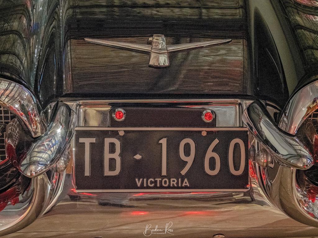
Taking up a large part of the ground floor is the vintage cars. Starting with early model Fords and progressing through Austins, massive Cadillacs, and Chevrolets to gleaming Mustangs and Thunderbirds. Visitors can stroll past a Ferrari the same model as Tom Selleck drove in Magnum or gaze in amazement at Johnny O’Keefes Thunderbird. The sheer size of the older cars is jaw-dropping. Compared to today’s modern vehicles, they are beyond huge with massive boots, bonnets and Of course, it goes without saying that parking them would be a nightmare in today’s crowded parking lots.


The Truck Collection
An extensive collection of trucks are also on display at Move. The curators approached Shepparton’s many trucking businesses for money and truck donations. As a result, trucks that once gathered dust in sheds are spruced up and sparkling under lights. There’s even a ’50s pioneer coach, a vintage fire truck and a truck driving simulator that kids of all ages will love.


The Furphy Collection
Born in Moonee Ponds to Irish immigrant parents in 1842, John Furphy began his blacksmith and wheelwright business at 22 years old. In time, he grew the company, adding a foundry and producing farm and agricultural implements. His patented grain stripper, which preceded the combine harvester, was awarded the first prize at the 1884 Grand National Show.

John is credited with inventing the “furphy”, a water cart used by the Australian Army in WWI. The term “Furphy” also became slang for gossip and tall stories, as many Furphy water cart drivers were supposedly spreaders of rumours and gossip.


The Farren Bicycle Collection
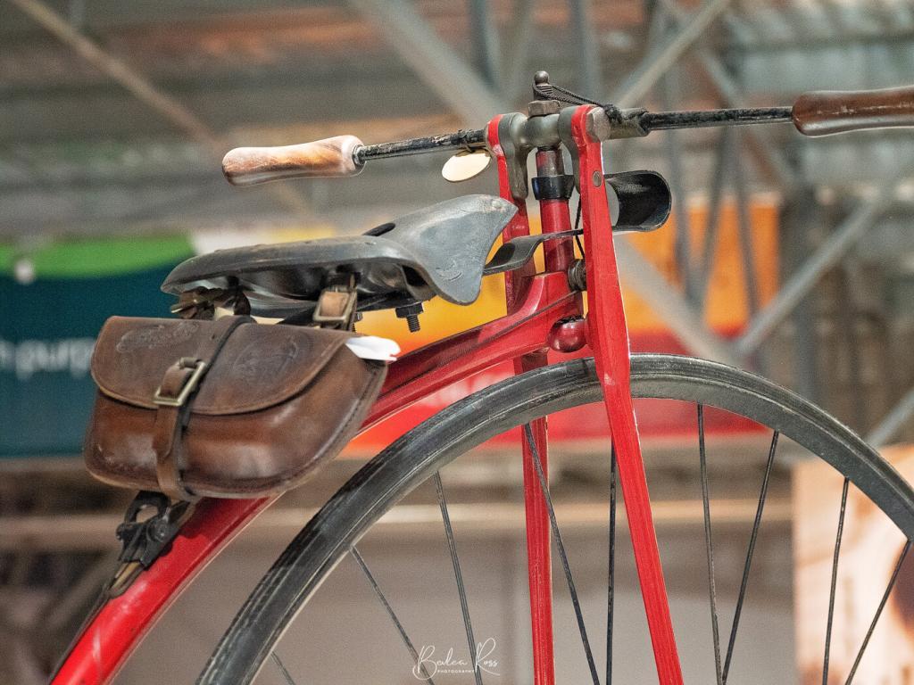
Over 30 years, Paul and Charlie Farren collected over 200 bicycles. Their collection includes bamboo bikes, adult tricycles, women’s side saddle bikes, tandems, and three-seater bikes that predate 1910. Look for the Penny Farthings; it’s hard to imagine riding these.


The Loel Thomson Costume Collection
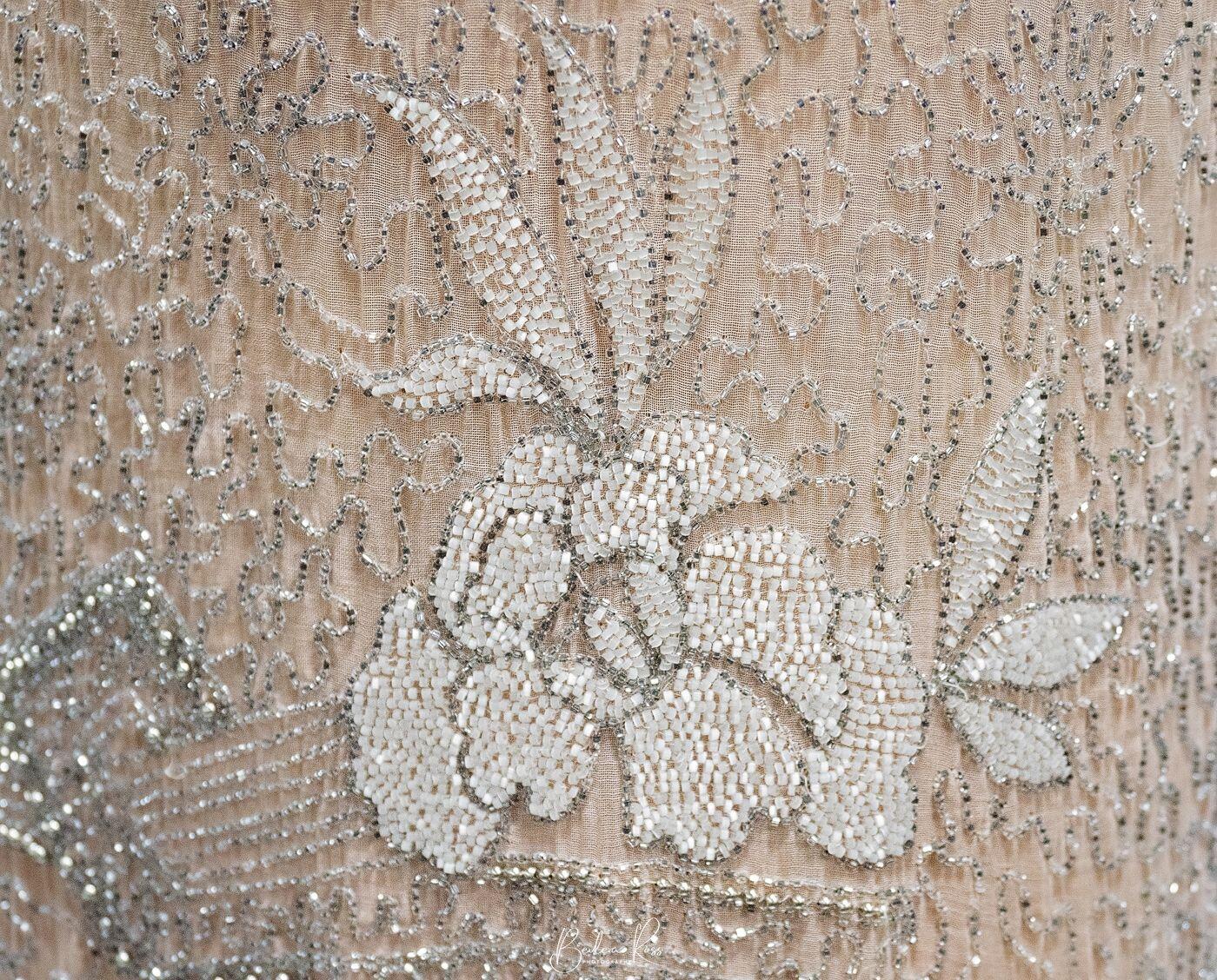
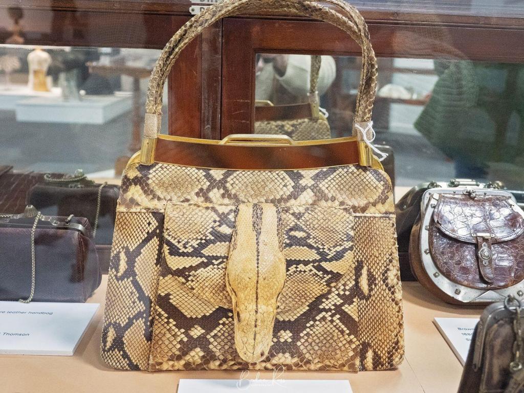
Loel Thomson, a former school teacher, spent forty years collecting the history of everyday Australian fashion. She said it was a “hobby that grew”. While some items are high-quality designer fashion, most of the collection is clothing that ‘ordinary’ people wear. Her collection is primarily women’s wear. However, it also includes some men’s and childrenswear. Subsequently, the collection grew to include approximately 10,000 items. It is regarded as the world’s most extensive and best organised private collection of Australian fashion. Items in the collections date from the 1770s to 2000.




Move Museum is at 7723 Goulburn Valley Highway, Kialla, Vic 3631 and is open daily from 10 am to 4 pm.
Ticket prices depend on if you visit all or part of the museum. Entry to all the exhibitions is $24 for adults, $20 for Concessions, and for children 5 to 16, it’s $12. Children under 5 are free. (Family ticket $60)

At the end of Mangalore Road, just off the Goulburn Valley Highway, between Seymour and Shepparton, lies the Mangalore Flora and Fauna Reserve. As it’s only 78 hectares, it’s not a huge reserve. However, this makes for a pleasant walk if you don’t like long distances.

I visited in early June as winter was just starting to bite, and apart from the quiet serenity, there wasn’t much else. I did manage to find a few teeny tiny mushrooms, but they were certainly few and far between. Considering it was damp with puddles, moss and loads of lichen, I would have thought there would be more. Unfortunately, it seems the other side of the Great Dividing Range isn’t the best spot to go fungi hunting.

Birding Hotspot
Mangalore Flora and Fauna Reserve is on eBird but barely qualifies as a ‘hotspot’. It has 156 species of birds seen, but to be a genuine hotspot, it requires 200 species or more. Typically, as is usually my experience, I didn’t see one bird on the day I was there.


Flora Walk
The flora walk at Mangalore Flora and Fauna Reserve is 3.5km long on a well-defined, firm track of sandy clay and quartz pebbles. Rated easy on walkingmaps.com.au, the track is a circuit taking you through a Grey Box Eucalypt forest with native grevilleas and acacia trees. In spring, it’s said to be a wildflower haven with the native orchids, daisies and Lillies flowering. However, the brochures say fungi are found in winter, so maybe I was there too soon. According to the same brochure, echidnas, goannas, and kangaroos also inhabit the reserve, but again, they were invisible the day I was there.


Amenities
The car park at the end of the road will take about four cars; from there, it’s an easy walk into the reserve. There are no toilets, and you must take all your rubbish with you. Dogs, 4wd and dirt bikes are not permitted.

Winton Wetlands is an ‘ephemeral wetlands’, meaning the wet areas rise and fall, changing with the seasons, rainfall and climate. This regular cycle allows native species to breed and thrive in the different water levels. When we visited in late April, heavy rains had come through the week before, and some shallow water areas still prevailed. Usually, the wetlands would be dry at the end of summer, but good summer rains have seen water in the wetlands again.
History

Winton Wetlands Reserve covers 8,750 hectares in northeast Victoria between Benalla and Glenrowan. The area encompasses 33 ephemeral wetlands and hosts over 30 endangered or vulnerable flora and fauna.
In the early 1800s, squatters had moved stock into the wetlands for stock grazing. However, in the 1840s, squatters Alexander Cheyne and William Gibb registered Goomalibee Station and took up 98,000 acres. The Selection Acts of 1861 encouraged families to farm the land. As a result, Goomalibee Station was subdivided into smaller farms for cropping, livestock, viticulture and timber harvesting. The industrious farmers lobbied for a school to be built plus a post office, sports ground, church and hall. In 1903 a creamery was built to process the butterfat from local dairy farms. Goomalibee Butter was even exported to the UK. However, all that came to an end in 1970, when a 7.5km long dam was built to establish the Lake Mokaon storage reservoir.
Restoring the landscape
The lake was never a true ‘success’. Constant algal blooms and high evaporation rates meant it was a costly exercise to maintain the lake in a healthy condition. Consequently, a decision was made by the state government to drain and abandon the lake. Forty years after it was flooded, Lake Mokoan was decommissioned and drained in 2010. Work then commenced restoring the landscape. A Committee of Management is tasked with constructing infrastructure, developing tourism, and repairing the landscape.
Thus far, a visitor centre and cafe have opened. Interpretive information signs, four campgrounds, picnic areas, public toilets, 60km of roads and 30 km of trails and cycling paths have also been added. Artworks in the form of ‘art in the landscape’ are also a drawcard. It is estimated it will take 100 years to restore the wetlands to the same condition they were before the area was flooded with the creation of Lake Mokoan.
Art in the landscape

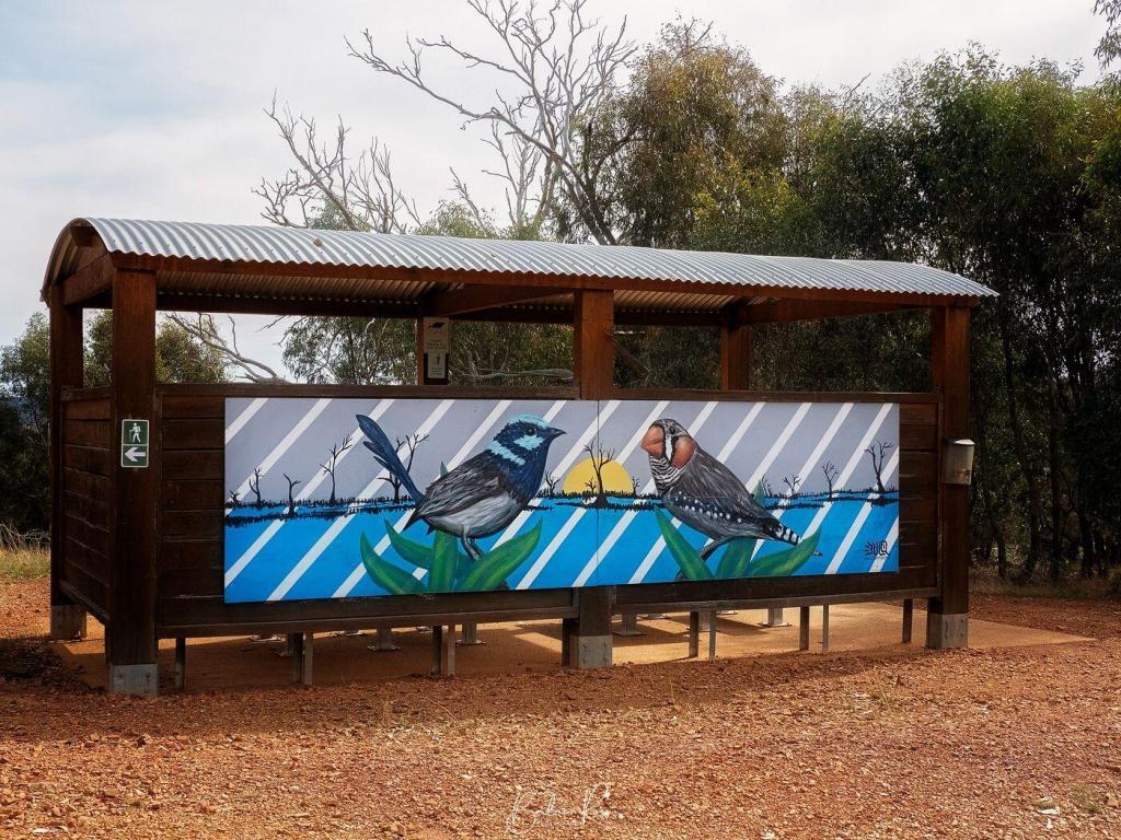
Across the Wetlands are several works of art by noted artists. The most well known and easily accessible works by Guido Van Helton (the CFA water tank) and Tim Bowtell (Fish Trees)

Bird Populations
Since 2013 the Birdlife Murray Goulburn group has undertaken quarterly bird surveys at the wetlands. Over time, there has been an increase in the bird species visiting the wetlands. In their last survey, they noted 168 species across 16 sites. The most abundant species were Sulphur-Crested Cockatoos and Grey Teals. However, Red-rumped Parrots, Galahs, Magpies, Tree Martins, Welcome Swallows, White Plumed Honeyeater, Pacific Black Duck and Superb Fairy Wren were also seen. We saw plenty of Cockatoos, Pacific Black Duck, Herons, and Magpies on our visit. And one black snake that we steered well clear of.
Wildlife
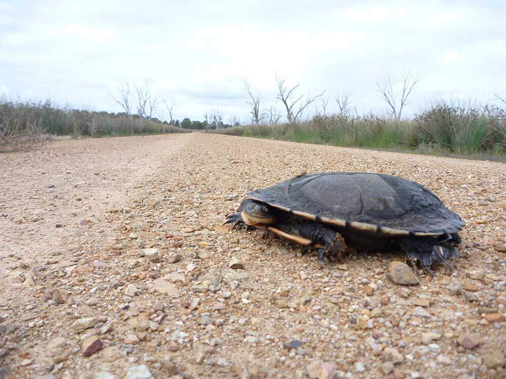
Eastern Long-necked Turtles and Murray River turtles have returned to the wetlands and use the shallow edges of the wetland swamps for laying eggs. They are seen almost daily over October each year as they travel between the swamps laying eggs. Growling Grass Frogs were last recorded in the wetlands in the 1970s. The Winton Wetlands trust is now working toward reintroducing the frogs back to the swamps and hopes to have a small population by the end of 2022.
River Red Gums

The flooding of the wetlands in the 1970s also caused the death of 1500 river redgum trees. Their skeletal trunks and branches still line roads within the wetlands today. Telegraph poles also dot the landscape. They were the only means of communication for the far-flung farms in the early days. It’s an eerie, silent and still landscape. With no sound save for the occasional screeching cockatoo, its not hard to imagine the isolation of the original farmers.


The charming town of Nagambie is just 138 km from Melbourne. Situated on the Goulburn Valley Highway, it’s around halfway between Seymour and Shepparton in the heart of the Nagambie Lakes wine region. It is full of history, horse studs, vineyards and waterways. Nagambie was named in 1872, and in the local aboriginal language means “still waters”. The area is well known for its beautiful lake, attracting fishermen, rowers, and water skiers.

Black Caviar Statue
Black Caviar’s life-sized bronze statue is located at Jacobson’s Outlook in High Street Nagambie. Created by sculptor Mitch Mitchell, the statue was formally opened in October 2013. The statue is based on a photograph of jockey Luke Nolen riding Black Caviar in the Schweppes Stakes at Moonee Valley in October 2011.

Champion racehorse Black Caviar was born on 18 August 2006 at Gilgai Farm, Nagambie, growing up to become the fastest horse globally, winning all 25 of its races and earning $8 million in prize money. In 2013, Black Caviar retired from racing.

Lake Nagambie
Behind the Black Caviar statue lies beautiful Lake Nagambie. It is man-made and the largest body of water in the area covering 170 hectares. Before the construction of the Goulburn Weir, the “lake” was a swampy lagoon. Since its creation, however, it has become an increasingly popular destination. Fishing is a hugely popular pastime on the lake. The annual Go Fish Nagambie takes place each February and sees fishermen vying to catch the biggest Murray Cod for an $80k prize. In addition, rowing and yachting regattas, including the ‘Head of the River’, occur on the lake. Lake Nagambie recently also hosted the International Rowing Championships.
The lake’s eastern shore follows the tree-lined High Street with a wide centre median boasting a grassy picnic area with tables and public toilets.
Jacobson’s Outlook
A Methodist church originally stood on the site where Black Caviar now stands. The church was built in 1885 by the townspeople and stood for 118 years. However, in June 2003, a semi-trailer veered off the highway, colliding with the church. The semi-trailer came to rest inside the church, which resulted in the collapse of the building.
Goulburn Weir

The historic Goulburn Weir was built between 1887 to 1891 to regulate water flow for irrigation in Victoria. It is the first significant diversion structure building for irrigation in Australia. The dam wall is 209 metres long and 16 metres high. The Goulburn Wier diverts water via the Stuart Murray Canal and Cattanach Canal for later irrigation of nearby farming crops. The design of the Goulburn Weir was considered very advanced. It was so unique that the back of half sovereigns and ten shilling notes featured the design from 1913 to 1933.

The weir also contained one of the first two hydroelectric turbines in the southern hemisphere. In 1983 and 1988, stabilising and refurbishment works were undertaken. However, two original gates and gear have been preserved to recognise their place in Victoria’s history. The lush park around the weir includes a playground, picnic tables, electric BBQs and public toilets.
Kirwin’s Bridge

The heritage-listed Kirwin’s Bridge is a short 6km north of the lake. Kirwin’s bridge is a single-lane timber bridge, 310 metres long. The bridge opened in 1890 and is still used today for motor traffic. It features a unique design with a mid-river bend and two passing bays for vehicles. Kirwins Bridge is one of Victoria’s oldest timber bridges still in operation.
Chinamans Bridge

The heritage-listed Chinamans Bridge opened in 1891 and is another of Victoria’s oldest surviving timber road bridges. The bridge was one of several “strutted-stringer” river bridges built in Victoria. However, its timber lift span made it unique, which was constructed to allow riverboat traffic to pass under. The bridge takes its name from the Chinese market gardeners who farmed the rich soils of the Goulburn River.
Royal Mail Hotel


The Royal Mail Hotel is known by locals as the ‘The Top Pub’ and sits on the top end of High Street. Built in 1871, it was originally a stopover for mail delivery for Cobb & Co. and passenger accommodation.
Tahbilk Winery
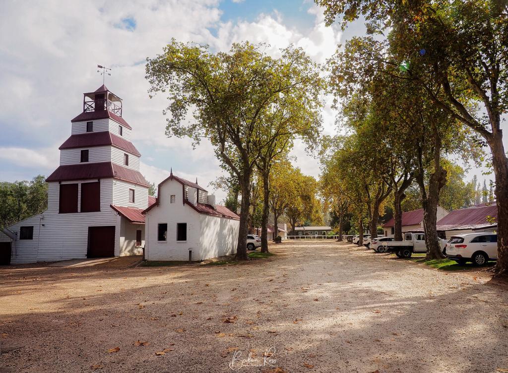
The handmade brick and mudstone winery was built alongside the Goulburn River in the 1860s. Tahbilk celebrated its 160th birthday in 2020 and has been in the Purbrick family for five generations. As a result, Tahbilk is recognised as the oldest winery in Victoria and gained heritage status in 2004. The area Tabilk-Tabilk, meaning “place of many waterholes”, by the local Daung-wurrung clans. The cellar door is open daily, and the original underground cellar is still available for visitors to wander through.

Cellar Door Hours
Weekdays 9 am to 5pm Weekends and Public Holidays 10 am to 5pm
Tahbilk Eco-Trail and Wetlands Walk


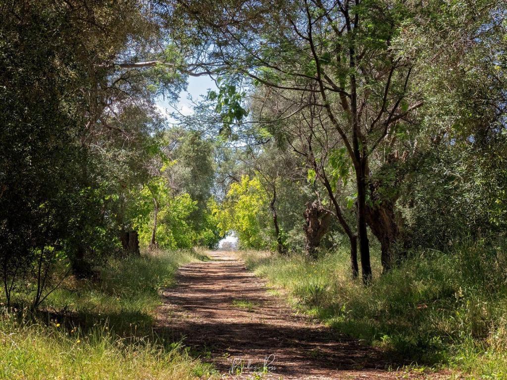
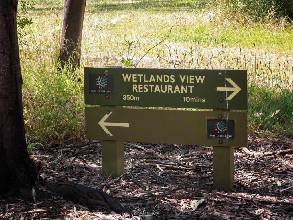
Behind the Tahbilk Wetlands View Restaurant lies a hidden oasis of wetlands and a walking trail. The 6.3km trail follows the Goulburn River as it meanders through billabongs, river flats, bridges, bird hides and past lily ponds. Visitors must register at the restaurant before beginning the walk. Dogs are not permitted on the trails. In addition, on days of a total fire ban, the walk is closed.
Mitchelton Winery

Famous Architect Robin Boyd CBE (1919-1971) drew up the plans for the winery, cellar door and tower, and renowned architect Ted Ashton completed them. The first crop of vines were planted in 1969. The winery was named after historic explorer Major Thomas Mitchell.

The iconic building opened in 1974 and boasts a world-class restaurant surrounded by lush lawns, making it a popular destination for outdoor concerts in the ‘on the green’ setting. Gerry Ryan OAM purchased Michelton in 2011. A $16m luxury boutique hotel and day spa were added in 2016. The ‘Airstream Hotel’ opened in 2020 with seven full-sized, sparkling silver RVs for guests. The winery has vineyards in Nagambie and Heathcote and purchases grapes from growers across Victoria.
Cellar Door HOURS
Open 7 Days Mon-Thurs 10:00 am – 4:00 pm and Fri-Sun 10.00 am – 6.00 pm for Wine Tastings, Education and Wine Sales.

The Wedge-tail Eagle, known colloquially as a ‘wedgie’, is the largest Australian raptor (bird of prey), standing at a metre tall. A truly magnificent bird, the Wedge-tail Eagle has an average wingspan of 2.3 metres though it can be up to 2.8 metres. They are Australia’s biggest bird of prey and one of the biggest eagles in the world and are similar in size to the American Bald Eagle. The Wedge-tail Eagle has a pale pink to cream beak, dark brown eyes, off-white feet and a wedge-shaped tail. They have a lifespan of 20 to 40 years. Males are 3.2 to 4 kg, while females are a slightly paler colour, larger and heavier at 4.2 to 5kg. Both sexes become progressively darker for the first ten years of their life.
Habitat & Distribution

The Wedge-tailed Eagle prefers wooded, forested land and open county. However, they can also be found in the mountains, near the sea, soaring in the air, or high in trees surveying their territory. The Wedge-tail is located in mainland Australia, Tasmania, and New Guinea. However, the Tasmanian Wedge-tail eagle is a distinct sub-species with genetic testing revealing the two species separated 200 to 1000 years ago. The Tasmanian population was established by mainland individuals flying across Bass Strait. Tasmanian Wedge-tails are darker in colour, have larger bodies and produce only one egg per clutch.
Diet

The Wedge-tails’ primary food source is carrion, preying on ground-dwelling animals and attacking with a fast swooping motion. Their diet consists of rabbits, mammals, lizards, possums, foxes, feral cats and carrion, and the eggs of other birds. They can carry prey up to 5kg in weight in their talons.
Eyesight
The Wedge-tail has binocular vision in which they can see their prey from great distances and in 8 times more detail than humans. In addition, their uniquely adapted eyes allow them to squeeze and extend their eyeball, enabling them to use their eyes similar to the zoom lens on a camera. Eagles have a third eyelid called the nictitating membrane. This eyelid is translucent and sweeps quickly across the eye from the inside corner. The eagle will sweep the nictitating membrane across the eye every few seconds to moisten and lubricate it. While it’s not completely clear, it still allows them to see.
Breeding
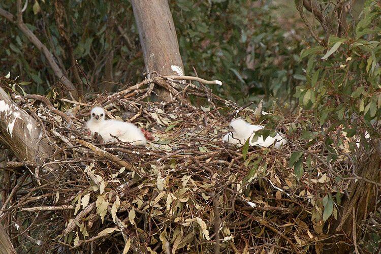
The breeding season occurs from June to October. They are monogamous, mating for life. Both the male and female groom each other during the breeding season. They build the nest together from sticks and leaves in the tallest tree in their area. The nest measures up to two metres wide and three metres deep. They often reuse the same nest year after year. A breeding pair usually only lays one clutch of eggs a year.

The female Wedge-tail lays a clutch of between 1 to 3 eggs over several days. Because of this, the eggs also hatch at different times. The female primarily incubates the eggs, while the male lines the nest daily with fresh leaves. The eggs hatch after 45 days, and chicks emerge covered in white downy feathers. The first chick that hatches is always the largest and sometimes kills the other chicks. The chicks are dependent on their parents for food for the first five weeks. The young Wedge-tail eagle leaves the nest after 12 weeks. However, they are not fully mature for six to eight years.
Threats

Wedge-tail Eagles are very common in Victoria. Sadly, farmers once considered them a menace. Convinced that the eagles carried off lambs, thousands of eagles were shot or poisoned. Subsequent research has found this false, as they rarely attack healthy lambs and never full-grown sheep. Current threats to Wedge-tails are loss of habitat due to clearing land and secondary poisoning from eating animals that have died from pesticides and baits. Road vehicle accidents also account for many deaths, with cars hitting the eagles while they are on the road eating roadkill. Additionally, wind farms also have an impact on their numbers.

Status
Wedge-tail eagles are protected in Victoria. Their status in Victoria is ‘secure’, and fines of up to $8000 apply to anyone found “killing, harassing or disturbing” the eagles.

While the Great Ocean Road actually starts at Anglesea, the seaside town of Lorne known as the gateway due to the Memorial Arch. Lorne is a popular spot for surfers, with thriving shops and cafe culture. There is an arts community, Qdos ARTS, with a gallery and sculpture park at Lorne. In addition, Teddy’s lookout, the Memorial Arch, and many waterfalls are just out of town.
The Memorial Arch
The Great Ocean Road was built in memory of Australians who lost their lives in World War One. At 240km long, the road is officially the world’s largest war memorial. The current arch is the fourth iteration of the arch. It spans the road at Eastern view – the site of the original toll booth that helped fund construction costs. It was rebuilt in 1974 after a truck hit the arch and demolished one side. 1983 saw the Ash Wednesday bushfires destroy the arch again, leading to a new metal arch built to resist fires. In 1990 a storm brought the arch down once more, resulting in the last rebuild.
Surprisingly the original “great ocean road” sign has survived the fire, storm and truck. It has been rehung over the arch each time the arch was rebuilt. A sculpture to the left of the arch depicts two men working on the road alongside two plaques added for the 50th and 75th anniversary of the road.
Teddys Lookout

Teddys Lookout is located at 53 George St, Lorne, Teddy’s lookout gives one of the best views of the road where the St George River empties into a small cove. Park at the end of George St, and then it’s a short walk to the two lookouts.
Erskine Falls
Where: Erskine Falls Access Road, Lorne
A 10km drive out of Lorne will bring you to Erskine Falls. Two lookouts on this well-known waterfall offer scenic views of water cascading 30 metres down into a gully. A short walk from the carpark brings you to the first lookout. You can take the 310 steps down to the lower lookout if you have a good fitness level.
Lorne Beach
Lorne beach has two distinct sections. The surf beach and the Main Beach. The sheltered 2km Main beach is located on the coast of Louttit Bay near the Lorne Swing Bridge. The main beach is the only part of the coastline that Life-Saving Victoria patrols during the summer months. The surf beach is on Mountjoy Parade.


In 2009, following weeks of drought and extreme heat, Victoria was a tinderbox waiting for the match to fall. The devastating bushfires that swept across Victoria on February 7, 2009, now famously known by all as Black Saturday, was the realisation of that nightmare. Just 95km from Melbourne via The Black Spur, Marysville was almost wiped from the map that day. However, Marysville has risen from the ashes in the thirteen years since then.
Black Saturday
The Black Saturday fires started on February 7, with over 400 burning across victoria. It remains the worst bushfire regarding lives lost in Australia’s history to this day. The fires followed an extreme heatwave, coupled with low humidity. This led to Melbourne enduring 43°C for three consecutive days, reaching 46°C on Saturday. As a result, Premier of the day John Brumby issued a public warning that Saturday was expected to be the “worst day for fire conditions, in the state’s history”.

On Saturday, Victorians woke to winds above 100km an hour, bringing hot air down from Central Australia. The Kilmore East/Kinglake fire began at 11.47 am when the winds brought down power lines at Kilmore East, and the sparks ignited the dry grass. Crucially, that single powerline fault led to the deaths of 119 people within hours.
Fire Outbreaks
By 1.58 pm, the Kilmore East fire had burnt through light forests and grassy paddocks. It threatened homes at Wandong before heading towards Mt Disappointment. The strong winds blew embers as far as 40 kms ahead of the main fire front, causing spot fires to break out. By 7 pm, it entered the Kinglake National Forest. As a result of a wind change, the eastern flank suddenly became the fire front, and the town of Kinglake came under heavy ember attack.
The Murrindindi fires that decimated Marysville began near the Murrindindi Mill at 3 pm before spreading through the Murrindindi State Forest and Black Range. After burning through Narbethong, it hit Marysville at 6.45 pm before burning through Buxton and Taggerty. A coronial inquest into the Murrindini fire found it began with the failure of AusNet electricity poles 5 and 6 and broken conductors lying across a fence on Wilhelmina Falls Road, Murrindindi. As a result, the fence became electrified and ignited the vegetation. This fire resulted in the loss of 500 properties and the deaths of 40 people at Marysville, Buxton and Narbethong. Ausnet settled a claim for $260m without admitting liability.

Stastistics
The statistics are heart-rending. 173 lives were lost, 120 in the Kinglake area alone. A further 414 were injured, 3,500 buildings were lost, including 2,029 homes. The RSPCA estimated up to one million wild and domestic animals perished. 200,00 trout boiled in the water at a trout farm. Fires ranged over 450,00 hectares of land. The 400 homes and buildings lost at Marysville included the primary school, police station, Bruno’s Garden, the Cumberland Guest House and Steavensons Falls infrastructure. Arson was the cause of most of the bushfires. However, some fires resulted from collapsed power lines in the 100km winds that day, and lightning strikes also started other fires. Burning for 26 days, the Murrindindi forefront that decimated Marysville was not extinguished until March 13.
The Kinglake Fire Complex was the most significant fire which evolved from the merging of the Kilmore East and Murrindindi fires on 8 February. It swept through state forests and national parks with flames recorded at 30 metres in height.
National Museum Australia
In the years since businesses have rebuilt, Marysville is once again a thriving community, with gardens, wineries, golf course, trout farm and galleries. Two of my favourites are Steavensons falls and Bruno’s sculpture garden.
Steavensons Falls
A short 4kms out of Marysville on the Steaveson River will bring you to one of the tallest falls in Australia. The bushfires of Black Saturday destroyed all of the picnic areas, toilet blocks, walks and paths etc. and decimated the surrounding forest. Parks Victoria has since rebuilt new amenities blocks and added new paths and walking tracks.

The falls are an easy 700-metre walk from the carpark with improved paths and infrastructure. Steaveson Falls has five cascades and plummet 84 metres into the Steavenson River. The cross-flow turbine generates electricity and powers the lights on the falls from dusk to 11 pm.

Bruno’s Art and Sculpture Garden
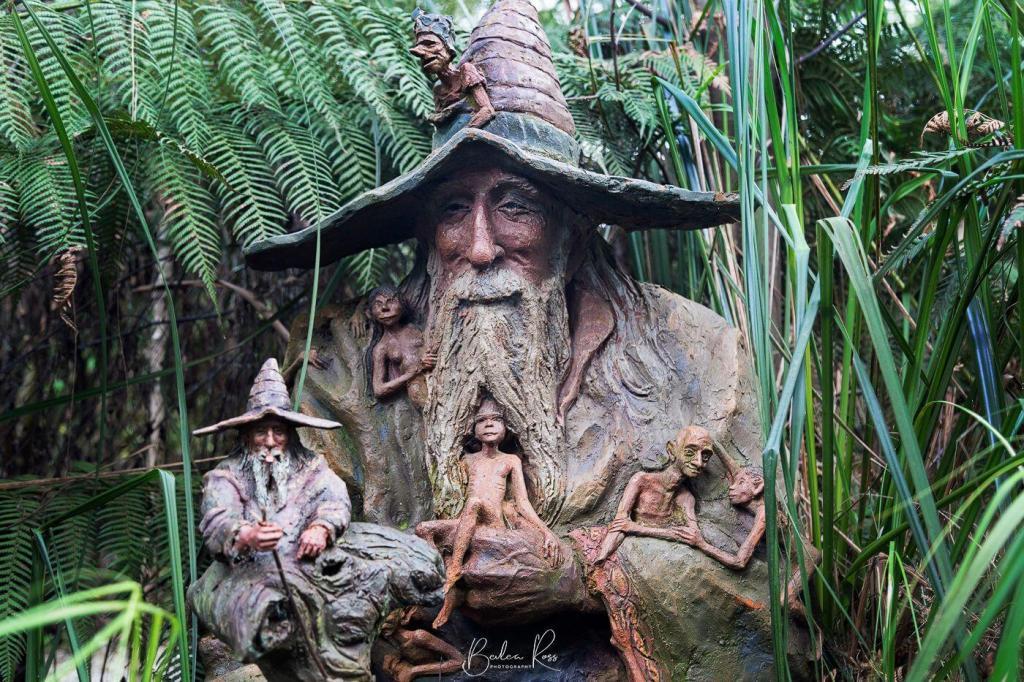
It was days before the residents of Marysville were allowed back to the remains of their shattered town. When Bruno returned, he found his Art and Sculpture Garden a blackened, charcoal wasteland. Gone was his home, workshop, and years of work.
With the help and support of family, friends, and strangers from across the globe who had visited and loved the garden, Bruno began the painful task of rebuilding. First, Bruno repaired the Sculptures and since then added new ones. Thirteen years later, it is again a lush wonderland with barely a trace of the devastation that was. The garden is a testament to a skilled artisan’s tenacity and fertile imagination.


Where to find it?
Bruno’s Art & Sculpture Garden, 51 Falls Road Marysville, 3779
Adult entry is $10 for the garden ($15 if you include the gallery). Under 16 is $10, and for children under five, it is free.
The garden is open seven days a week from 10 am to 5 pm. The gallery is open Saturday, Sunday and public holidays.

Narooma NSW is a little slice of heaven on the NSW far south coast. With pristine blue waterways, it’s a popular destination for photographers, fishermen or families who want to chill out or surf spectacular beaches. Unfortunately, our schedule only allowed for two days. So sadly, we didn’t get to see and do all we wanted; how I would have loved to stay longer.

History
Narooma takes its name from the Aboriginal language meaning “clear blue waters”, and with the intense blues and greens of the area’s waters, it’s not hard to see why. After discovering gold in nearby Central Tilba, the town sprung up in 1883. A school was added in 1886, and the post office followed in 1889. The oyster industry was established in 1900. The Narooma Oyster Festival is held in May each year – celebrating the heart of Rock Oyster country.

Getting There
From Sydney, it’s a pleasant 350km drive to Narooma, following the coast along the Princes Highway. The route is 220km via the Kings and Princes Highways from Canberra or 684kms from Melbourne via the Princes Hwy. While the journey from Melbourne is longer, you get to drive through Lakes Entrance, Eden, and Bermagui. All are great seaside towns and deserving of an overnight visit.

Attractions and Landmarks
While we were there for the photography, Narooma had plenty to keep everyone happy.
- Cycle or stroll along the Mill Bay Boardwalk and spot the stingrays, dolphins or seals
- Hit a few balls at the Narooma Golf Club and the famous Hogans Hole.
- A stroll along the surf beach will take you to Glasshouse Rocks
- At Bar Beach, you can enjoy a swim or snorkel in its sheltered waters where NZ and Australian fur seals also enjoy a sunbake
- Forsters Bay is perfect for kayaking around the oyster farms on the western side of town
- Bermagui – Camel Rock and Horse Head rock – only 30 mins away
- Montague Island. It boasts a historic lighthouse and nature reserve. If only we could have gone there. Because there is no bridge, you have to take a ferry – and none were running that day due to a heavy swell, so we missed out. Tours are available from Montague Island Tours or Narooma Charters

Accommodation
We stayed at the Narooma Golfers Lodge, which was very good. While not golfers, we picked it for its views, price and the easy walk to the Golf Club Bistro. They offer clean and comfortable one and two-bedroom apartments at very reasonable prices. Airbnb also has loads of accommodation options in the area, and there are plenty of hotels and motels.


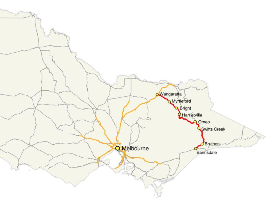
Victoria’s Great Alpine Way is one of the most scenic drives in the world and belongs on everyone’s bucket list. It is 304km long and starts in Wangaratta. The road travels through Myrtleford and Bright before winding its way up and through the Victorian Alps before terminating at Metung in Bairnsdale. It passes through mountains, valleys, forests, rivers, farms and vineyards. Like its coastal cousin, The Great Ocean Road, it hugs cliffs and clings to ridges providing spectacular views at every turn. The Great Alpine Way is Victoria’s highest sealed, year round, accessible road.
History
The Bright to Omeo section was upgraded in 1883 from packhorse to a wide road to allow horse-drawn coaches. It carried goods and people to the Ovens Valley, Omeo, Cobungra and goldfields. The route was a combination of the Ovens Highway and the Alpine Road and was renamed the Great Alpine Way when the final section was sealed in 1998. It’s a drive that requires respect. The Harrietville to Mount Hotham section is particularly steep, with a few extreme hairpin bends with sheer drop-offs requiring extra care in that section.

As it passes over Mount Hotham, the road has an altitude of 1,840 metres, carpeting it with snow in winter. Snowploughs clear the road daily. Extreme conditions still see the road closed from time to time. Take the road slow. It will be safer and allow you to enjoy the spectacular scenery.

Which Direction?
Which is the best way to do it? Southeast from Wangaratta to Bairnsdale or northwest from Bairnsdale to Wangaratta? The main factor in your decision is the sun. Between April and September, the sun is lower in the sky and taking the bends or going over crests will be more problematic if not downright nerve-wracking driving into the sun. Driving late morning/early afternoon Wangaratta to Bairnsdale is the best option as the sun will be behind you. The views and photography are much better if not shooting or squinting into the sun. If you are travelling early morning – then Bairnsdale to Wangaratta is better.


Mount Hotham
Mount Hotham, named after Charles Hotham, Governor of Victoria from 1854 to 1855, is Australia’s highest alpine village. With its short, cool summers and long, freezing winters, Mount Hotham’s climate is Subantarctic.


Planning on a few days to do it? NRMA has a great itinerary
Wallaces Hut

As you drive through Falls Creek, keep your eye out for Wallace’s Hut. Park in the Wallace’s Hut parking area and walk 750m down the path to the hut. The three Wallace brothers built the oldest surviving cattlemen’s hut in the Victorian Alps was built in 1889 by the three Wallace brothers. The family had a large ‘run’ at Kergunyah near Beechworth and grazing land on the banks of the Kiewa River. As was the custom, they took the cattle up the mountain to fatten the herd over spring and summer, allowing the home pastures to recover from the Winter.

Bogong High Plains
In 1889 the three brothers took a herd up to the Bogong High Plains. While there, they decided to build a hut to shelter from the extreme mountain weather. They searched for a site sheltered from winds. But one was close enough to water and firewood before choosing a site nestled among snow gums with a rocky outcrop at the back. They constructed the hut from snow gums and used straight mountain ash as roof shingles. The roof pitched at a steep angle to ensure snow wouldn’t settle heavily on it. Finished in six weeks, it measures just 6.3 mt x 3.5mt.
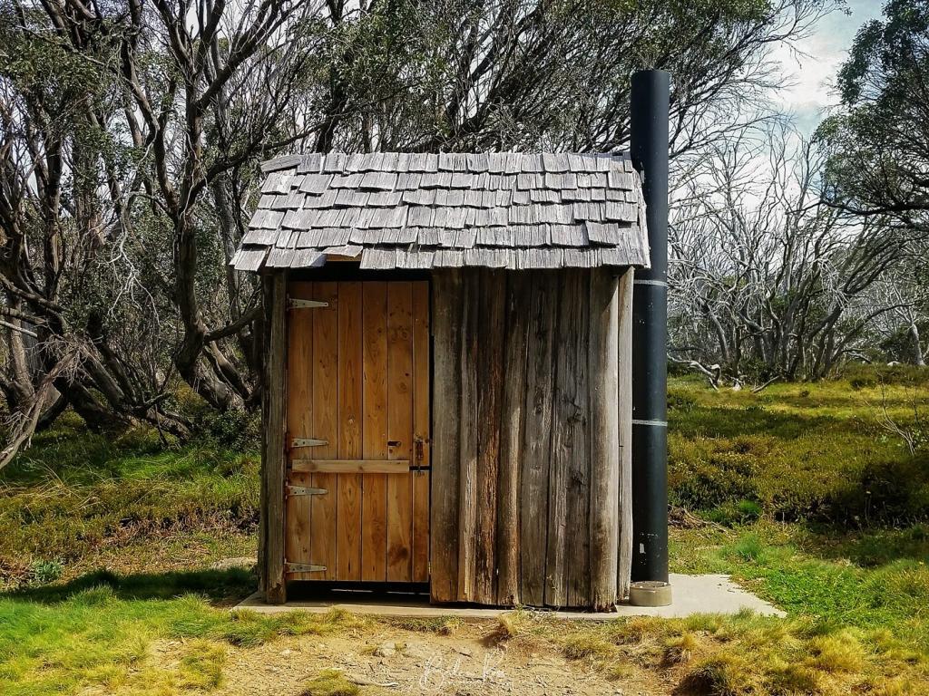
Wallace’s hut is now classified by the National Trust, owned by Victoria, and managed by Parks Victoria.

Seven km south of Rushworth and ten km south-west of the Waranga Basin reservoir lies the abandoned gold mining town of Whroo. The name is pronounced ‘roo’ and comes from an Aboriginal word meaning lips. The town is completely gone with little evidence of its existence, save for Whroo cemetery. The final resting place of 400 of the town inhabitants. Whroo is abandoned but not forgotten as the Whroo Cemetery trust works to restore the graves.
Gold!
In October 1854, the year after Rushworth, two sailors, John Thomas Lewis and James Meek Nickinson discovered gold at Whroo on Balaclava Hill. Balaclava Hill was a rich field and was later mined by open cut. The call of gold brought thousands of miners to Whroo; however, the population had shrunk to around 450 by 1858.
By 1865 Whroo had a flourishing gold mining industry. Serviced by a mechanics’ institute, library, two churches, three hotels, a cordial factory and three ore crushing mills. By 1933, at the last census, the population had dwindled to 52, and by 1955 it was a ghost town. Walking there today it is a silent, empty place of dry, dusty earth and ironbark forest.

Whroo Cemetery
The Whroo cemetery epitomises the difficulties of living in a harsh, unforgiving environment before modern medical care. Regardless of status, health, age or nationality, a simple illness or accident led to death. Chinese miners account for 15% of 400 graves. The Chinese were a significant part of the community as miners, puddling machine operators and market gardeners. Of the 400 graves, only around 200 names have been identified by the Whroo cemetery trust due to the deterioration of the grave markers.

Many of the graves are of children. These were either stillborn or died when Diptheria, Typhoid or dysentery swept through the town. Tuberculosis was also a common cause of death at the time. Among the graves is six children from one family. The eldest of which was a girl who died at just two years old. Their mother is also buried with them, who passed in her early 40s. Other graves as those of miners who died of illness or mining accidents

The cemetery trust is working on naming all the graves, and to that end, it has unveiled a new plaque with the names of all those interned there.


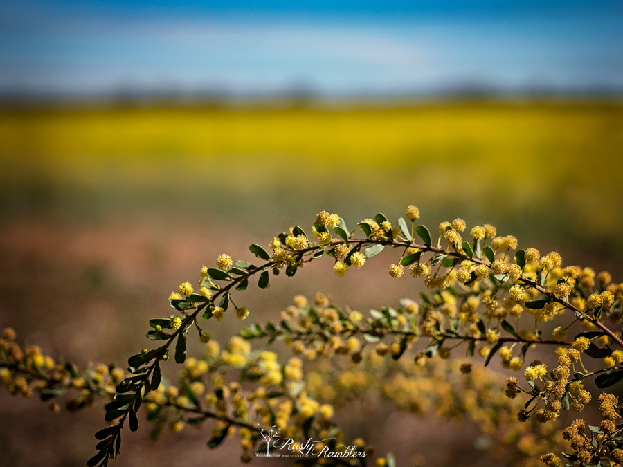
With a gorgeous day forecast for Sunday, we took a drive up to Tahbilk Winery at Nagambie before going to the Pink Cliffs at Heathcote. Along the way, we found and stopped for Canola fields bordered by Wattle shrubs and Gum trees.


Established in 1860 Tahbilk is the most beautiful and historic family owned winery in Australia, located in one of the nation’s premium viticultural areas. The property itself comprises some 1,214 hectares of rich river flats with a frontage of 11 kms to the Goulburn River and 8 kms of permanent backwaters and creeks.
Tahbilk Winery
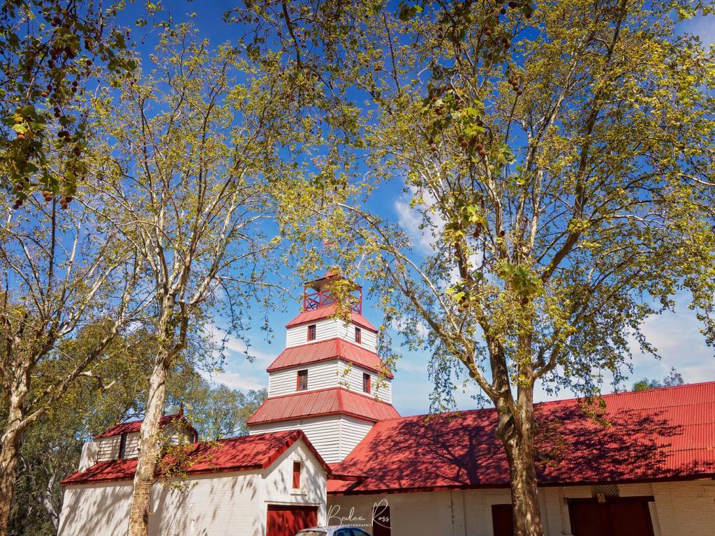
The Winery
Tahbilk is a lovely old winery, established in 1860 and bordered on two sides by the Tahbilk Lagoon and Goulburn river. The cellar door is open seven days a week, and the very popular cafe is definitely one you need to book for. Its been in the Purbrick family since 1925, with five generations of the family at the helm.
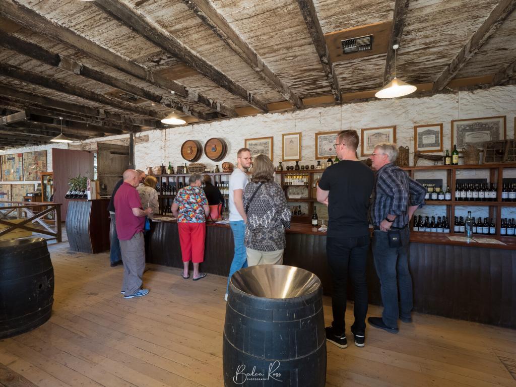
We tried the Sauvignon Blanc and Verdelho.. and liberated a bottle of the Verdelho to bring home with us.

Downstairs from the cellar is the old, old cellars still in use. They’ve been there since 1867. The floor is worn in front of the barrels. You wonder how many people have worked there over the last 151 years


Leaving Tahbilk winery, we drove to Mitchelton winery. However, they had a large wedding with people and cars everywhere, so we moved on and stopped at Nagambie lakes for lunch before heading to Heathcote and the Pink Cliffs.
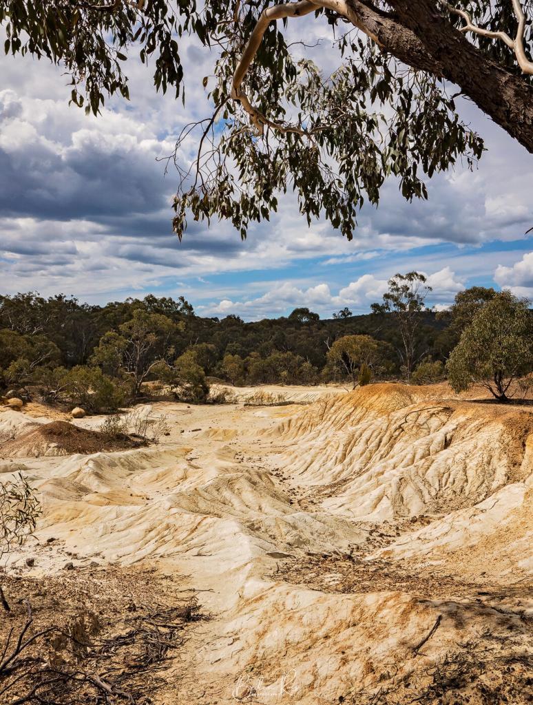

Pink Cliffs
I found the cliffs VERY underwhelming. They are a series of small, sandy white and reddish rocks and mounds, with a few boulders and lots of gravel and sand. I did do one HDR, which turned out ok. But overall, they are not a place I would bother returning to, and ‘pink’ is drawing a very longbow.

Update
It turned out we were in the wrong place. We were only on the outer, smaller edge of the pink cliffs. I found the area everyone was raving about – and it was fabulous.

Kyneton Daffodil and Arts Festival was on as we headed up to Bendigo for White Night, so we decided to stop at a few places. Running from August 30 to Sept 9, the festival covers open gardens, exhibitions, and a parade.
We drove along the old Calder hwy through town (Burton Avenue) for the ‘Golden Mile of Daffodils’…. the weather being intermittently overcast, sunny, showery, and windy made for a challenging stop…


Our plan was to get some shots in Kyneton and then head to Bringalbit in Sidonia. However, the GPS had a mind of its own (or none at all) that neglected to tell us to turn, and we ended up miles from where we wanted to be.


Getting ready to turn around and head back, we spotted an open garden sign and went in there.
Roseberry Hill
Pastoria Road, Pipers Creek. $4 entry.
10 acres of mature trees, shrubs and thousands of naturalised daffodils. Long avenues of Poplar, Roman Cypress, Red and Cork Oaks, Box hedge and dwarf Spruce. Rare plants, a more than century old Cork Oak, and quirky topiary


On the way home Sunday, we tried again and this time found Bringalbit.. which was fortuitous as if we had been there the day before, we would have missed the lambs born late on Saturday.
Bringalbit
512 Sidonia Road, Sidonia
Bringalbit is a unique part of Australia’s rural history and the setting is stunning. The huge, old trees, ornamental lake and gardens provide a rare mood of peace and tranquility. Art, peacocks, guinea fowl, ducks, chickens, suffolk sheep and Scottish highland cattle.

The Peahens had apparently been taken by foxes.. and the three Peacocks were strutting around, shimmying a tail feather trying to attract the chickens.. not surprisingly, to no avail.


While there, we also enjoyed the tea and cakes available… for another $2.50, you got a bottomless coffee and choice of 3 cakes for a further $2.50. It was lovely sitting in the beautiful gardens with a cuppa watching the ducks, chickens, and peacocks strut around.


