
Tag:country

Tuesday morning, as pre-arranged the night before, everyone was up in the dark, out the door by 6 am and heading down to the Mildura Wharf for sunrise.
Sunrise On The River
The river was still and quiet, save for the morning bird calls and the odd early morning jogger going past. We were set up on a lovely wooden walkway that gave a good view down (up?) the river to the bridge over the Murray. But, even at that hour, there was a constant stream of traffic across the bridge.

By 6.45 am, the sun was coming up, more joggers and walkers were going past, and traffic was picking up… the river and the houseboats all remained quiet, though.

Back On The Road
Once the sun was up, we headed back to the motel for breakfast and showers, then booked out and headed to Broken Hill, 296kms up the Silver City Highway. The road is well-maintained bitumen but long, with the occasional bend to keep you on your toes. Between Mildura and Broken Hill, reception drops off quickly once out of Mildura, and you don’t get it back till about 20kms out of BH. There is only one little general store between Mildura and BH and three unattended rest stops. Apart from that, it’s just you and the goats..lots and lots of wild goats beside the road and the emus.


Broken Hill
We made it to BH by around 1 pm – where the group met up again at the Demo Club. The club began life as the Barrier Democratic Social Club, a working man’s club similar to the RSLs, but it has evolved into a curious cross between a pub and an RSL. There are no half-full wine glasses here.. every glass was a millimetre from the top and half the price of the victorian pubs. We booked into our rooms at the motel from the demo club, unpacked, and took a brief rest before heading off again. This time we were off to the Line Of The Load, a miner’s memorial overlooking BH. It has the name and cause of death of every miner who has worked the mine in BH… and there was a lot. No such thing as OH & S a hundred years ago.

Sculptures In the Desert
From the memorial, we headed just outside Broken Hill to Sculptures in the Desert – 12 sandstone sculptures on a hilltop. With Bill and Deanne Holmer from Melbourne Light Painting, we would shoot the sunset and then do a little bit of light painting before the ranger kicked us out at 7 pm to lock the gates.


Right on clockwork, the Ranger turned up at 7 pm and dispersed the party…then it was back to BH for dinner at Mario’s Palace Hotel…made famous from the movie Priscilla Queen Of The Desert.

Last week, a trip that was a year in the planning finally rolled around. Our first day was from St Arnaud to Mildura. After that, we had one week rambling around outback NSW. We took in Broken Hill, Silverton and Lake Mungo, and all the little towns between.
Our motley crew
My travelling companions were fellow photographers from the Victorian Photographers Collective plus their spouses. Thirteen of us left Melbourne on Sunday and met up with two more in Broken Hill and Mungo. Sixteen photographers in total, everyone got on great and looked out for each other. We laughed, groaned at the walking and had a ball. We covered around 2000 km, and a fair amount of that was dirt roads. However, I think I am cured of dirt roads for the next year!

St Arnaud
Our first overnight stop was at St Arnaud. Solely based on it was the closest proximity to Rapunyup that had reasonable accommodation. It’s also where another silo was in the progress of being painted. So we stayed in a very nice budget motel in St Arnaud and headed off on the 40 min journey to Rapanyup next morning. The organisers of the silo art trail boast about the extra tourists the silos are bringing to the region, but accommodation and cafes are thin on the ground (if not invisible), and everyone just stops, shoots off a few pics and travels on. So the towns still have a ‘lost and neglected’ feel to them. Shops are boarded up and empty. No one was on the street.
Rupanyup
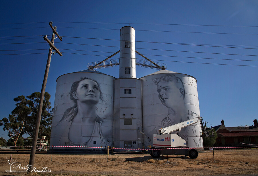
Monday morning, we woke to glorious sunny blue skies… warm enough for t-shirts too!. We left St Arnaud after breakfast and headed to Rapanyup. The silos are smaller than the huge concrete ones painted already—the artist Julia Kolchkova from Russia. Julia started about a week ago. At the rate, she is going; they will be finished in the next week or so. Behind the silo’s is a disused Railway Station – apparently, it has been sold, but I don’t its purpose be. It’s probably too much to hope that it will be a cafe and gift shop or B & B.


Sheep Hills
The next stop on our trip heading North West was Sheep Hills, just 42kms down the road. These were much taller than the Rupanyup Silo’s and were painted by Matt Adnate. Again, an incredibly realistic Aboriginal face gazed down on us, the detail on them is amazing. The chap in the red shirt saw us all pull in and checked it out too. He hadn’t heard of them. But he gives you an idea of the size of the silos.


Brim
After stopping off in Warrackanabeal for lunch and a wander around, we headed towards Brim. The Brim silos were the first to be painted, and their popularity led to the others. The Brim Silos stand beside the Henty Hwy and are the work of Guido Van Helton. They feature four locals from the area. Driving into town, you can see them from miles out. They dominate the skyline as you drive in.


Patchewollock
The next stop was Patchewollock, 87kms up the road. It was the longest gap between painted silo’s, as the two more scheduled to be added by the end of the year, are in Rosebery and Lascelles. They will be between Brim and Patchewollock. There is no cellular reception in town, or the surrounding area so don’t rely on your phone as a GPS. You’re going to need paper maps to direct you to the next town. There was also no petrol or food that we saw in Patchewollock. So fill up both the car and yourself in Warracknabeal. Alongside the silo look for the old Patchewollock Station. Old machinery and carts gracefully rusting into the red Mallee earth are dotted around the station.


Red Cliffs, Mildura
From Patchewollock, relying on paper maps we headed first to Walepeup, then Ouyen and finally Mildura. Our overnight destination for the day. Just before Mildura, we stopped off at Red Cliff’s lookout. And drove around in circles for a while with everyone’s GPS telling them different things. We eventually found the lookout. damaged and fenced off, but with a fence low enough to be overcome 😉


Unfortunately, there was a glitch with our booking for the night, and there was no room at the inn. The motel owner found us alternate accom quickly, and we settled in down the road at Cottonmouth Motel. Lovely hosts, eager to help us and settle us in after the mix-up. The changing of motels and getting organised blew our plans for sunset out of the water, though. so we settled on a nice dinner at the local RSL

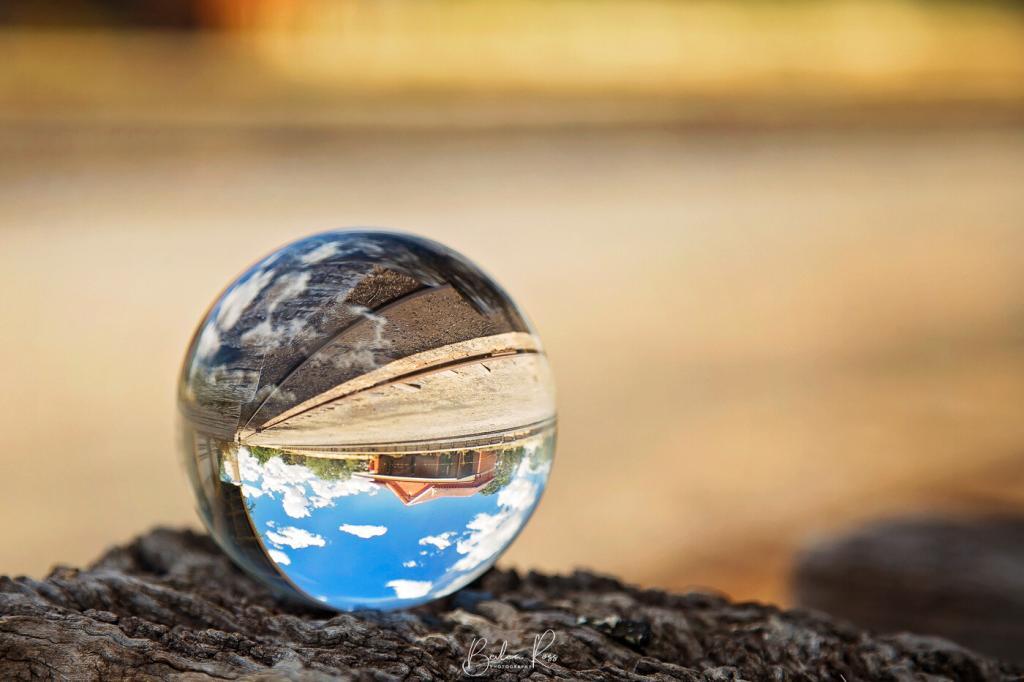
Crystal Ball photography has become extremely popular, but how do you do it, or where to start? Due to the shape of the ball, it’s refractive—meaning anything viewed through it is reversed—and it gives you a fish-eye effect without a fish-eye lens.
Crystal balls come in several sizes from 40mm to 110mm and are readily and cheaply available on eBay (though I have seen a 200mm!) While they are referred to as crystal balls, most are glass. The ball in these images is a glass 80mm. While the bigger sizes are more straightforward to photograph and fill more of the scene, their weight is considerable. I have a 40mm on the way… it will be much lighter, but the trade-off is what I can shoot. I’ve also dropped my 100mm or had it roll off a surface a couple of times, so it now has a couple of tiny dings in it, so I also have a 110mm on the way.

Photographing the Ball
To have your crystal ball stand out from the background, you need a wide aperture – F4 or lower. Stand back from it and zoom in to get the soft, blurred-out background. The image above was shot at F4, 105mm, and about 4 feet away. Duck down so you are looking straight onto it or lower. Don’t shoot from above, as you will only get what it’s sitting on. Instead, focus on the main point of interest in the ball and shoot your image. Out of direct sunlight is best to avoid reflection (see the top right where the sun hit it on the ball above).
Positioning the Ball
To place the ball, you can either put it on a pole, a flat surface, in a shot glass, or water. (I’m going to try a golf tee next!). Location-wise, you need something interesting behind it. Place the ball and move your feet until you have a pleasing composition. It all depends on the angle. Keep a lint-free cloth handy to clean it between shots, or wear cotton gloves to keep the fingerprints off. Then shoot and have fun.
Rightside Up or Upside Down?
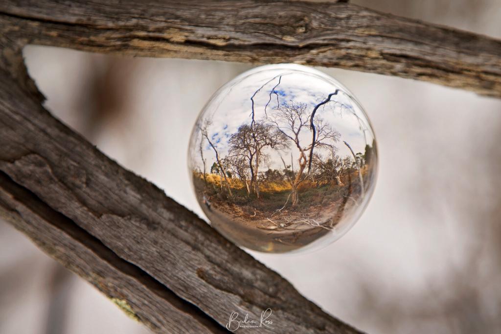
Because of the refractive aspect, your images are always upside down when shot… but you can flip them right side up using your editing program. For example, to get the shot of the wetlands below, we wedged the ball into the fork of a tree. Then, I flipped the image in Photoshop so it was right side up.
Floating?
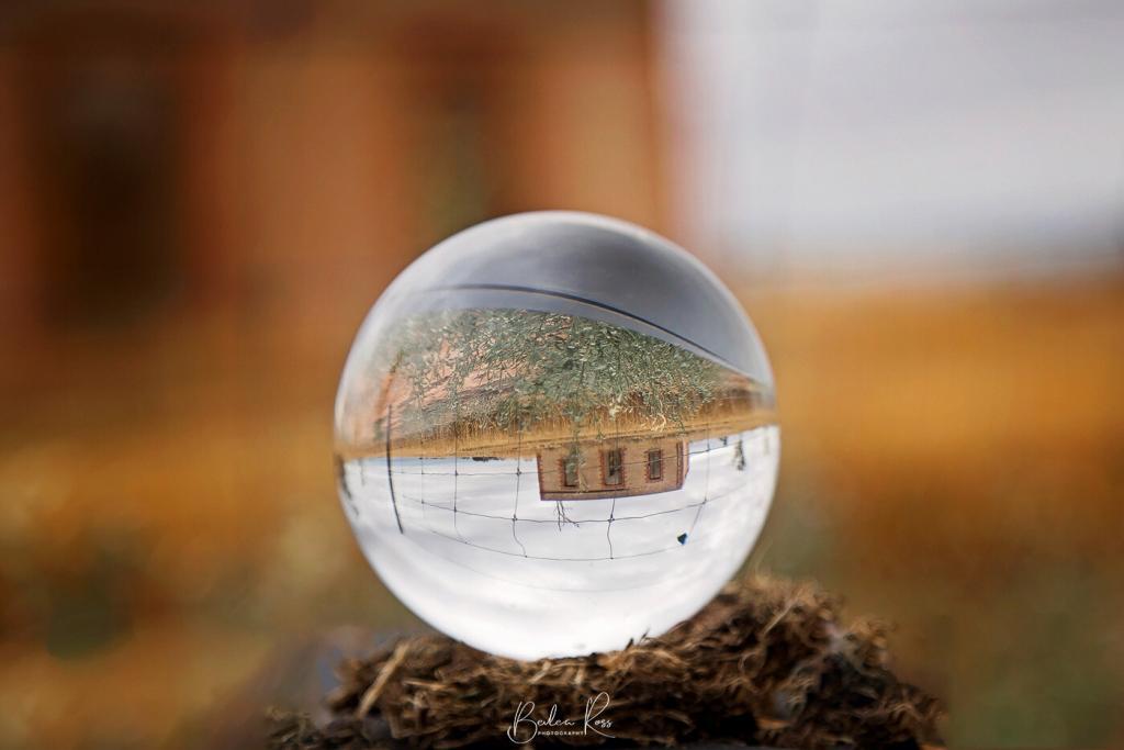
I wanted to get a shot that looked like the ball was floating/hovering in the air, so I placed it on a post and then removed the post in Photoshop. To do this, you can either go around the pole with the polygon lasso or use the elliptical marquee tool. It’s a bit fiddly using the elliptical tool, but I found it worked better as it was round like the ball. The polygon tool, however, is great for objects with irregular edges.

The first step is to drag the elliptical tool over your ball to fit. This may take a couple of goes till you get the size right. The marching ants around the ball mean that it only affects the ball, whatever you do.

However, we need to invert the selection so the area outside the ball is selected and the ball is protected. The keyboard shortcut on a PC is ‘Ctrl + Shift + I’ or on a Mac, it’s Cmd + Shift + I

Now, the marching ants are around the edge of the image and the ball. The ‘active’ area now includes everything except the ball, so you can safely clone out the post using your clone tool.
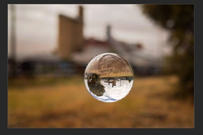
Now, all you need to do is ‘Ctrl + D’ on a PC or Cmd + D on a Mac to deselect the selection, close the marching ants, and make final adjustments or crop to your liking.
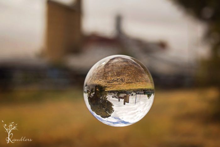
A word of warning
These balls can be dangerous in the sun! They concentrate the sun’s rays into an intense, direct beam of heat and light… I had seen a tripod begin smoking after just a few minutes when a ball was placed on one… and when I drove around all day with my 80mm crystal ball sitting in the console between the front seats, it melted the plastic underneath! So always keep your ball in a cloth bag when not in use, never leave it in the sun unattended, and if you are shooting it in dry grass… work quickly!

It was late May, and the photography tour to the South Island, New Zealand, that I had been waiting almost a year for finally rolled around. We flew out of Melbourne via Jetstar to Queenstown, NZ.
The flight
The flight was only around half full, so we had room to spread out. We approached Queenstown in a blanket of low clouds and rain just over three hours later. The pilots must have done 100% of the approach on instruments because we didn’t see the ground until we were only about 100 feet above it. The landing was comfortable, though, and we were through customs and biosecurity and out the door within a short time. Into rain, snow-capped mountains, and cold. Very cold.

Queenstown
We quickly found a shuttle bus that drops you off at the hotels in Queenstown, and for the princely sum of $13NZ, we were shortly deposited at the door and to the warmth of our hotel for the night. Looking at the weather, we dined in the hotel restaurant that night while the rain came down outside. The following day we were up eager to be collected by our tour host Jarrod from Jarrod Castaing Photography; we flung back the curtains to greet the day.

Funny thing about rain. When you start heading up the mountain in zero degrees and get to 700-800 feet above sea level, the rain becomes snow.

Coronet Peak
After picking up everyone, we drove up to Coronet Peak. Roads were icy, the lookout under a heavy blanket of snow. We had prepared well with our thermals, windproof pants, and feather down coats, but I should have also packed a full face balaclava. The wind off the snow was icy, pretty, but icy. Driving from Coronet Peak to Lake Tekapo, we went through the usually brown plains of Lindis Pass. They also were blanketed in snow, and it was still coming down quite heavily as we drove through it.
Church Of The Good Shepherd
Arriving safely in Lake Tekapo, we drove straight to the Church Of The Good Shepherd, which was oddly deserted. -1° Celcius and heavy snow falling go figure 😉

The plan was to do a sunset shoot at the church, but as getting one looked as likely as a heatwave, we all decided to relax in our rooms until dinner time. Fast forward to the following day, and the snow had stopped overnight, and the sky was clear. So we headed back to the church around 6 am, in the pitch dark, and set up the tripods to wait for the sun.

After standing around in the cold and the dark, the image that ended up as my favourite was the one above. Taken about 5 mins before we left as the sun came up. Leaving the church, we drove to Lake Alexandrina. Gorgeous place. totally empty of tourists, shhhh, I don’t think they know about it yet 😉


Mount Cook
From Lake Alexandrina, we headed for breakfast and then off towards Mount Cook. Passing by Lake Pukaki, we stopped in for a quick shoot. Lake Pukaki is a sparkling blue lake fed by the alpine glacier lakes. Sir Peter Jackson chose this part of the Southern Alps – the main divide stretching north-south the length of New Zealand’s South Island – as the setting for ‘Lake-town’ in The Hobbit: The Desolation of Smaug.


Arriving at Mount Cook, we booked into the Hermitage and got ready for the planned afternoon shoot at the Hooker Valley. I had been looking forward to this part since I first signed on to the tour. But I had drastically overestimated my ability to walk 1.5hrs each way, uphill and down dale. And about 40 mins into the walk, we turned back and left the others to finish. It was mean (but rewarding) to hear later that the others also struggled with the walk, and the light was dreadful when they got there, and no one got their postcard shots.

Hooker Valley trail
The Hooker Valley trail leads to Hooker Lake. the valley is ruggedly beautiful, and I still haven’t seen the lake in real life, but I can live with that.


Wanaka Tree
The following day, the sun was out. As it rose and hit the snow-capped peaks, they turned a glorious golden yellow. Coming from a city that never sees snow, it was a sight to behold. After breakfast, we headed off again. Our destination was Lake Wanaka and that famous tree. We were scheduled to do a sunrise and sunset there. Sunset cooperated with us, but sunrise just didn’t happen. It was drizzling as we arrived for the sunrise, and heavily by the time we sought the refuge of the van.


Leaving the lake, we headed into town for breakfast and dried our coats, hats, gloves, etc., on the grate around the fire while we ate breakfast. Following breakfast, we headed towards Milford Sound, going over the Crown Range, which had been closed to traffic a few days before due to heavy snowfalls.

Milford Sound
We passed down the Crown Range road, through Queenstown and headed towards Te Anau for lunch. Then the last 2-hour leg to our final and last night destination Milford Sound. Once we left Te Anau and got closer to Milford Sound, we lost mobile reception. The last 21 kms before the tunnel is an avalanche zone, and no stopping is allowed. like so many bridges in NZ, the tunnel is single lane – one car at a time – so we stopped to shoot some pics while we waited for our turn to enter

Envisaged by early settler Henry Homer in 1890, the tunnel was eventually started during the Great Depression in 1929. Five men armed with picks and shovels hacked through to the solid bedrock of the Homer Saddle and brought in the heavy machinery to start drilling. Years later, the tunnel was complete when the workers finally emerged into the Cleddau Valley. Unfortunately, several men had died over the years from avalanches, including one avalanche proof hut in 1945.

Sunset at Milford was beautiful. and a very accommodating Egret decided to sit in the foreground for the tourists 🙂 We were staying at Milford overnight. They really have a seller’s market, being a long way from anywhere and with limited accommodation options. Our accommodation was backpacker style, at prices dearer than our plush hotel in Queenstown!
Sunrise
As the sun came up, it lit up the snow-capped mountains. Again we were there from 6 am – and sunrise was about 8 am. This shot was taken at about 8.20 am. I wasn’t moving until I got the alpine glow on the mountains!

Back To Queenstown
After breakfast, we piled our gear back into the van to head back to Queenstown, stopping along the way at Mirror Lakes and Cascade Forest.
We arrived back in Queenstown late afternoon, picked up our hire car and headed to our hotel. Had a fabulous time. I learned lots and finally have my head around histograms lol I was left wondering a few things though New Zealand is a funny country.
- why so many single-lane bridges? didn’t they think cars or horse and carts might like to pass each other? and if it dates to horse and cart…geez a couple of hundred years later and they haven’t widened them?
- Things that we buy over the counter here in Australia you need a script for in New Zealand
- For a country with more sheep than people, why are all the woolen products so expensive?
- And possums… supposedly they are vermin to be eradicated. Yet to buy anything made from possum fur – you could have bought a mink coat!
- Petrol….$2.05 a litre!!???
As an infamous redhead said, please explain, lol

Photography on Kangaroo Island had been on my bucket list for some time. Its part of South Australia is 155 km long and lies just off the coast of Adelaide. You either take the Sealink Ferry or fly via Rex Airlines to get there.

The Carry-On Dilemma
Travelling with a friend and fellow photographer, we chose to fly, which turned into quite a challenge with all our camera gear that we didn’t want to check the equipment in. We were allowed 15kg at check-in but only 7kg in cabin baggage. Handbags included. We’re lucky they don’t weigh passengers with the gear we secreted in pockets.

Kingscote
Landing at Kingscote on Kangaroo Island, we collected our hire car from Hertz and were armed with loads of info from the very helpful chap at the counter. So we headed off to our first stop. Karrata via the Playford Highway. We had booked in at Western Kangaroo Island Caravan Park and Wildlife Reserve to use as our base while exploring Flinders Chase National Park. Cabins were roomy, clean, and handy to the national park. The wildlife roaming around ‘our’ park was a bonus.
We visited Hanson Bay Wildlife Reserve, but I feared all the animals were on holiday. Saw a few birds, one koala waaaaay up the top of a tree. The staff assured us that other visitors who had seen several koalas and one chap counted 15. For me, ‘seeing’ a koala is not the same as photographing it. Up the top of a tree, bum nestled in a fork, yep, saw it. It wasn’t a Kodak moment. We did enjoy their scones with jam and cream, though.
With nothing to show for our Hanson Bay trip, we returned to our cabin and decided to take a walk on their wildlife trail. Saw a kangaroo, a few wallabies, and one koala ambling through the bush, changing trees for dinner.


Flinders Chase National Park

Remarkable Rocks
The following day we headed into Flinders Chase and made for Remarkable Rocks. From a distance, they look attractive but not remarkable. Up close, the sheer size of them is, well, remarkable. That you can still walk up to and around them is fantastic. Parks Victoria would have fenced it off by now and have you viewing from a ‘safe’, bland distance.


Cape du Couedic Lighthouse
Leaving Remarkable Rocks, we headed to Cape du Couedic Lighthouse. This would have to be the prettiest lighthouse I have seen. Pristine Sandstone and a white double door entry with a red hat, she’s just gorgeous.


Admirals Arch
From Cape du Couedic, we headed to Admirals Arch. We had been told NZ fur seals lived around the arch’s base and were looking forward to seeing them and the arch. Nature didn’t disappoint. Access to the arch is via a long descending boardwalk which becomes stairs once you reach the arch. Photography at the arch is a challenge. The arch entrance is dark, the sun bright on the other side, and lots of mist drizzling down from the wave sprays. I took two photos, exposing one for the rocks and the other for the ocean and blending in PS. Coming back up was much slower, and I think I availed myself of every rest stop along the way. Lunch was at the Flinders Chase Cafe. Delicious burger and superb coffee.


Vivonne Bay
After lunch, we headed to Vivonne Bay. Vivonne Bay was voted one of Australia’s top beaches by the University of Sydney (because of its clear water, cleanliness, and privacy). And yes, the water is that blue.

Seal Bay
The following day we headed to Bales Beach for a brief stop before going to Seal Bay for a guided tour. Stunning pristine white sand and blue water. Does Kangaroo Island know any other kind?

We had decided on the guided tour at Seal Bay to get closer to them, but because big fat Sea Lion Bulls can still move fast and pack a wallop, we still had to stay 10 metres from them. Lolling and relaxing on the beach were a hundred or so seals, including a few mothers still nursing babies.


Stokes Bay
From Seal Bay, we headed to Stokes Bay. Stokes Bay is known for its ‘secret’ bay (that everyone knows about). You walk across the beach from the carpark towards the enormous boulders and see a small sign on the rocks with an arrow “to the beach”. You enter the gap in the rocks, duck, and weave and come out the other side on another beach. Heading and weaving around boulders in the narrow passage, I felt like Indiana Jones on a voyage of discovery. Thankfully no sword-wielding black warriors awaited me on the other side.


Heading back to our accommodation, we took another walk through the grounds. This time the lagoon rewarded us with Spoonbills, Kangaroos and an Echidna.


Cape Willoughby Lighthouse
The following day we packed up and headed back to Kingscote for the last two nights of our stay. We took in the Dudley Peninsula, Cape Willoughby Lighthouse, Antechamber Bay, American River, and Pennington Bay.


Kingscote Pelican Feeding
That evening we headed down to Kingscote Wharf for the nightly pelican feeding. At $5 per head, it’s a great show.


After the show, we hung around the harbour, and suddenly the sunset took off. We weren’t prepared for it with tripods and such, so we only managed a few shots, but what a sunset it was.

Raptor Domain
The following day we had our Raptor Domain Booking, A private 2-hour session with the keeper, five owls, five eagles, kookaburra, Kestrels, Sea Eagle, Red-Winged Black Cockatoo, and Crimson Rosella. After our private session, we stayed for the flight show before heading off for lunch and Emu Bay.


Flying Home
The following day we packed up again, loaded the bags and ourselves ‘strategically’ to pass Rex’s weight rules and headed for the airport. Fabulous trip and lots of great memories, And way too many images for one post. To see all the photos from the trip, go to Gallery.
Footnote: while most roads were great (a lot are dirt), we only once travelled at dusk. And significantly, very slowly Driving early before 8 am. After 5 pm meant dodging all manner of wildlife Every morning, we saw LOTS of roadkill.. one day alone was 25 in about 100 kms. We had to stop for roos and echidnas crossing the road during the day. When driving on KI, you need to stay alert!
If you are looking for a holiday were you can give the camera a good workout – you can go past Photography on Kangaroo Island

Bright, set in the Victorian High Country, is famous for the fall colours of its European trees changing colour in the autumn, and it’s something I have wanted to photograph for a while. But unfortunately, I arrived about a week too early, and while the trees had started to change, the glorious fall colours were minimal.

Mount Buffalo
We drove up to Mount Buffalo on the way into Bright. It is a very, very winding road to the top (but nowhere to stop and photograph it). The Chalet at the top has been closed for a few years now, but plans are to restore and reopen it in the future.


Bright
We stayed in the heart of Bright at Willow Dene Apartments. They were reasonably priced, comfortable and handy to the town centre. Using Bright as our base, we took a day trip on the 230-km Bogong Alpine Way (part of the Great Alpine Road). This road loops through Bright, Mount Beauty, Falls Creek, Dinner Plain and Mount Hotham.

Wallaces hut
Driving past Falls Creek, we stopped off and walked to Wallaces Hut. The hut was constructed in 1889 by the Wallace brothers (Arthur, William and Stewart). An easy 700m walk from the carpark hut will bring you to one of the oldest mountain huts in the Alpine National Park.


Deer farm
On our third day, we called in at Wandiligong before heading to Beechworth and visited a Deer and Emu farm on the way back.

Our third day was visiting Walnut Farm and Brown Brothers Winery at Milawa.


The weather was great—sunny blue skies with crisp mornings. We tried covering as much ground as possible in our three days but still didn’t see everything. However, a trip in winter to the waterfalls is looking good.

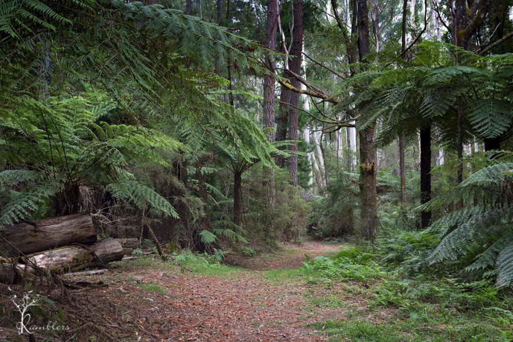
In 1930, the then Board of Works created a Redwood Forest at Warburton. This one predates the Otways Redwood Forest by about nine years.
They cleared some eucalypt trees and planted Bishop Pine, Douglas Fir, and Californian Redwoods in their place. This was done for “experimental purposes as part of the Board’s hydrology research program”. Over 1476 trees range from 20 metres to the tallest being 55 metres. I don’t know what happened to the program, but the trees are still there for unrestricted access, and the site is just magic. The site is now heritage listed on the Victorian Heritage Database, ensuring survival from logging.

The Yarra River runs along the back of the forest…
and we headed to this first, trekking through a narrow goat track and undergrowth to find the river, and then found a wide path coming back. In the forest, none of us thought to record our Indiana Jones moment 🙁
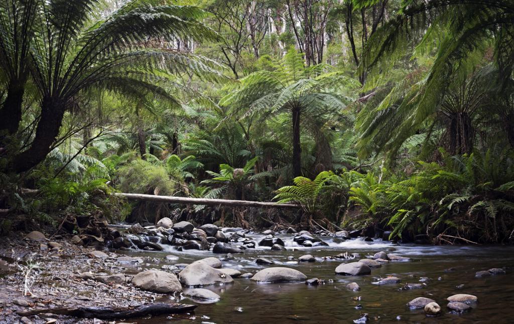
The river is lined with lush green tree ferns, water tumbled and washed over rocks. Not a sound except for running water and the birds. We were only able to get down to the river at one point, with high banks preventing access most of the length, but the spot we found was beautiful, and we spent about an hour there.
Back in the forest, we found more ‘odd’ evidence on what happens in a Redwood Forest (on a full moon?). Dotted throughout the forest were circles made from twigs and branches and, in one instance, a small shelter. There were dozens of the circles, a couple shaped like large nests, more than a bit ‘Blair Witch’ and no way would I go in there after dark 😉
Getting there:
Drive through Warburton, following the Warburton Highway until it becomes Woods Point Road. After about 7 km, take Cement Creek Road on the left. The road is unsealed and a little rough in places, but 0.7 km along, you will find a small parking area on the right along a fenceline and a small gate barrier. Walk through the gate, and there you are. Walking through the plantation will lead you down to the river, following the walking tracks each way.

The Grampians (Gariwerd) is a series of rugged sandstone mountain ranges and forests rich in wildlife. One of Victoria’s most popular holiday destinations, the Grampians are the destination of day-trippers and campers. They all come for rock climbing, scenic drives, bushwalks, and nature. The tiny and bustling yet laid-back town of Halls Gap is at the heart of Grampians. Its popularity is evident in many accommodation options, from backpackers to luxurious resorts and its many dining options.
Bushfires
On 15 January 2014, a bushfire which was sparked by a lightning strike started in the Grampians National Park. It was one of 68 fires burning across Victoria during this time.
The fire coincided with a heatwave across Victoria with temperatures reaching over 40 C in the Grampians region from 15 – 20 January. The fire eventually burnt 52,000 hectares including bushland and farms and was declared contained on 21 January 2014. Many residents from Dadswell’s Gap, Wartook, Brimpean, St Helen’s Plain, Roses Gap Pomonal, Bellfield, Lake Fyans, Lake Lonsdale, Heatherlie and Ledcourt were affected by the fires. Halls Gap was threatened by the fire front and ember attack and most of the town evacuated. Relief centres were set up in Horsham, Stawell and Ararat for the hundreds of people who were evacuated from their homes. Farmers lost large numbers of sheep that were either killed by the fire or later culled. At least 7000 sheep in total were lost.
A 12 km wide pyro cumulus cloud column of smoke and fire was created by the fire, generating its own weather pattern including lightning and thunder. This cloud gathered burning embers into the sky, which then scattered for many kilometres beyond the fire front, potentially starting new fires .
Australian Emergency Management

Halls Gap
In January 2015, and stayed in a fabulous little house near town that backed onto the National Park. We had a constant stream of wildlife visitors from when we arrived until we left three days later. Kangaroos, Cockatoos, Finches, Emus, and Crimson Rosellas were always nearby.

Break it up, kids
Boroka Lookout
We saw many of the lookouts had been rebuilt due to the last bushfire. Unfortunately, gone were the old wooden railings lost in the fires. In their place, however, were lovely new stainless steel railings at Boroka Lookout. The lookouts at McKenzie Falls have also been rebuilt, along with new amenities blocks. However, the kiosk that stood there is gone and hasn’t been rebuilt. Just the chimney remains.


One of our favourite gardens is Alfred Nicholas Gardens in Sherbrooke. We visited during the summer and made plans to return in the autumn to see the English trees changing colours.
Picnic Lunch
Expecting to spend most of the day there, we packed the cameras and a nice picnic lunch with cakes and wine and set off. The gardens are in the Dandenong Ranges, and the property is hilly and steep, as stunning as the gardens are. Very hilly and steep. By the time we got back to the car, I had wished we had packed an oxygen tent instead of the wine. However, we drank it anyway. So we were sitting on the car’s tailgate sipping wine while everyone else going back to their vehicles looked just as winded and puffed as we were.
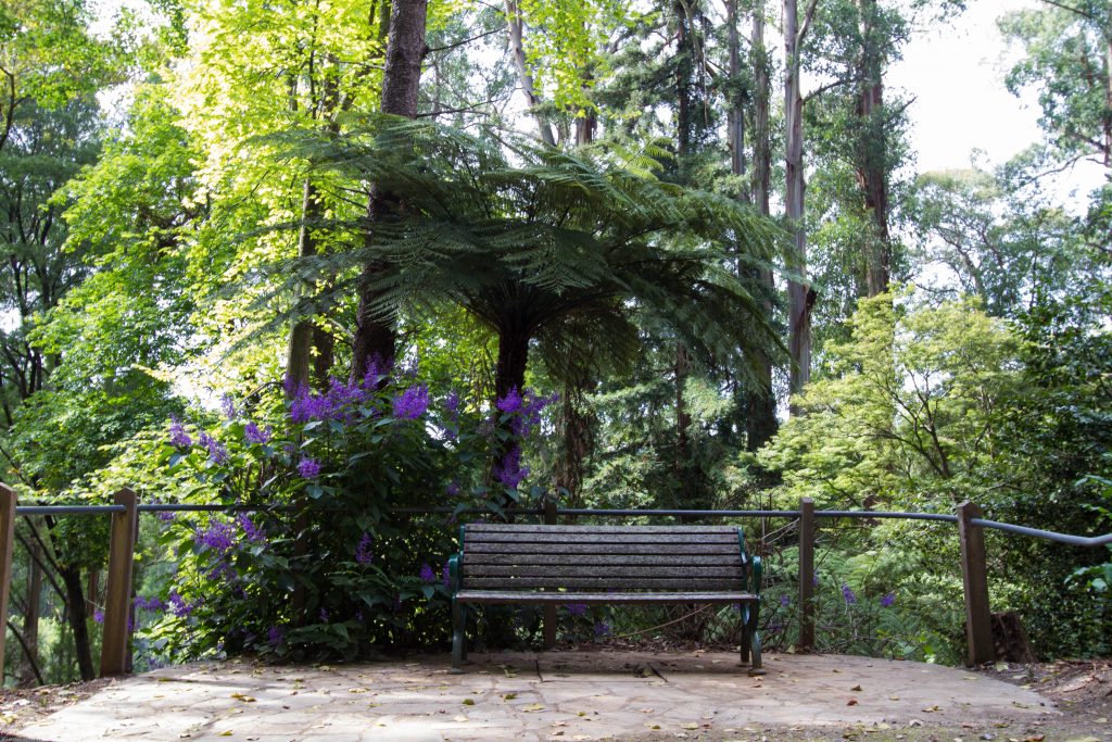
Burnham Beeches
Originally named Burnham Beeches, it was built in the 1920s and owned by Alfred Nicholas, the ‘Aspro’ magnate. The beautiful gardens cover about 13 acres and feature tree ferns, mountain ash trees, lakes and waterfalls. Walking down to the ornamental lake brings you to a small series of islands connected by footbridges At the end of one is a small boathouse.
The gardens are alive all season long with masses of plantings. We had hoped to photograph the gardens as the leaves turned. But the unseasonably warm weather had kept everything green. So we decided on the way out that we would have to back again next year, but much later in autumn.

The Gardens
The gardens are worth a visit, but plan your day well. Unfortunately, there is no cafe on site. You need to carry everything in if you plan to eat there. Bins are scarce, so we carried our rubbish around for a while until we found one. And bear in mind, it’s a long way back up! Take the paths. They are easier than the steps! As you can see from the images, we didn’t leave it late enough in autumn to get the shots we wanted. Consequently, another trip is planned for the future.

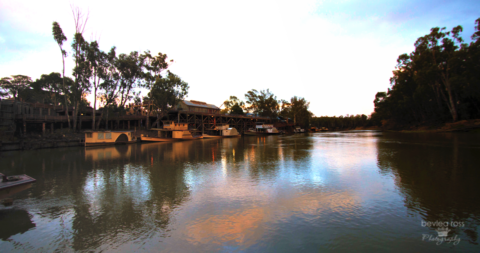
The historic Port of Echuca is nestled along the picturesque banks of the Murray River in Victoria, Australia. This riverside town is steeped in rich maritime history and offers visitors a glimpse into Australia’s bustling river trade of yesteryears. Echuca was established in the mid-1800s during the height of Australia’s paddle-steamer trade. The Port of Echuca played a pivotal role in transporting goods and passengers along the Murray River. Today, Echuca’s heritage buildings and bustling wharf area are meticulously preserved and serve as a living museum, inviting visitors to immerse themselves in the sights and sounds of the past.

History
Echuca was founded by Henry Hopwood, a former convict, in 1850. Hopwood purchased a small ferry to transport people and goods across the Murray River near the Campaspe junction. The settlement, initially known as Hopwood’s Ferry, later became the town of Echuca. The Hopwood’s Punt Post Office opened around 1854 and was renamed Echuca Post Office in 1855. One of the main attractions of the Port of Echuca is its authentic steam-driven sawmill. The sawmill showcases the power of steam as it cuts the timber, just as it did over a century ago. Additionally, the Port features a collection of beautifully restored historic buildings. These include the Echuca Wharf, the Customs House, and the Port of Echuca Discovery Centre.
Paddle steamers
A visit to the Port of Echuca is incomplete without a relaxing cruise on one of its famous paddle steamers. The PS Emmylou, or the PS Canberra, will take you on a nostalgic journey down the mighty Murray River.

Sunday morning, the rain had thankfully stopped. We decided to go to the Port early in the morning to get some river shots as the sun rose. The Port Precinct is home to the world’s largest paddle steamer fleet. This includes the world’s oldest operating wooden hulled paddle steamer, the PS Adelaide, built in 1866. Many of the old original buildings are still standing. And a stagecoach you can ride pulled by this lovely pair of greys.
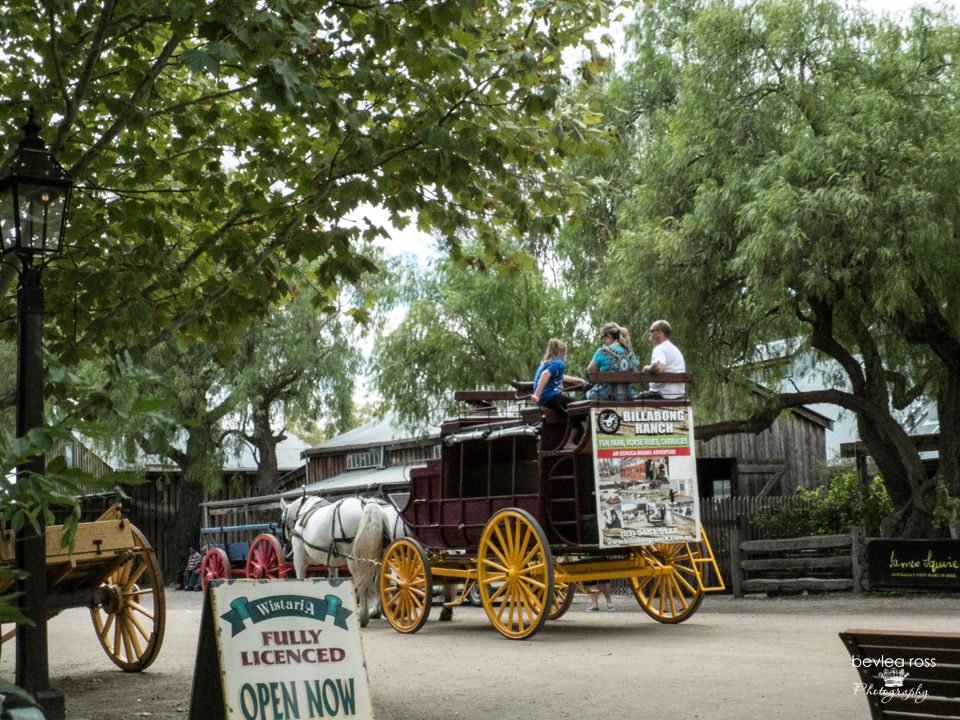
We took the ride. Kudos to the pioneers. I didn’t realise how awkward climbing in and out of the old coach was. I don’t know how the ladies of the 1800s managed in long dresses and corsets!
A visit to the historic Port of Echuca is more than just a journey through time – it’s an opportunity to connect with Australia’s rich maritime heritage and experience the beauty of river life firsthand. Whether you’re drawn to the nostalgic allure of paddle steamers, the captivating stories of the past, or simply the tranquil beauty of the Murray River, the Port of Echuca promises an unforgettable adventure for visitors of all ages. So, step back in time and prepare to be captivated by the timeless charm of this riverside gem

Today, we were heading home. This leg would take us from Menindee to Mildura.
After the wind and overcast day yesterday at the Menindee Lakes. We awoke to a gentle breeze and brilliant sunshine. As it was our second to last day, and the following day would be in the ‘civilisation’ of Mildura, we decided to cook up the last of our supplies for breakfast. Fried eggs, Tomatoes and toast. I cooked, and the short person was a ‘toast girl’. Sister had a rare lie-in. After we had eaten and cleaned up, we headed off around 8.30. into the ‘town’ of Menindee, turn right at the General store with no bread and past the supermarket with no meat. Turn right again and head towards Wentworth.

Dirt Roads
About 10 km out, we hit the dirt road, and except for the excellent bitumen cattle grids, it stayed like that until we were about 6 km out of Pooncarie – 106 km of dirt road!
We saw almost no roadkill for the first 50 km. The speed you needed to drive ensured you had time to avoid anything! Saw lots of emu’s in scrub beside the road – had to stop a couple of times from allowing them to pass. We sat in the car (in the middle of the road), snapping away for so long that they got curious and started walking toward us.
Middle of Nowhere

These were the only two live roos we saw on our entire trip. And that’s not a driveway—that’s the road we were travelling on! They were sitting in the middle of the road, and we stopped until they took off. We made it into Pooncarie and sealed roads at about 10:30—it took nearly two hours to do 120 km. After that, we headed off again to Mildura, this time on sealed roads all the way.
Perry Sandhills

We arrived in Wentworth around 1 p.m. and decided to detour to the Perry Sandhills for a picnic lunch. We sat under this large river of red gum in the canopy’s shade. Its trunk is buried in the dunes. It was just beautiful there. Silent, quite spiritual, with nature vibes, it was easy to visualise what it would have been like a couple hundred years ago as Burke and Wills came past.

Geologists say the Perry Sandhills originated after an ice age (40,000 years ago) and are formed by wind erosion over thousands of years. The dunes are located six kilometres outside of Wentworth and are a unique land formation of 400 acres of continuously shifting dunes.

Mildura
After lunch, we headed to Mildura. Booked back into the Mildura Motor Inn. The pool was clean and open, so the short person was straight off for a swim. We all showered a ton of the Perry Sandhills off us, put on our glad rags and headed into town for the last night’s dinner. We spotted a restaurant called Rendezvous earlier in the day and decided to go there. They had a lovely outdoor dining area, and the menu looked good. It was better than good; the food was exceptional.
We started with Warm Turkish bread accompanied by house-made dukkah, Robinvale Estate olive oil & lemon (knocked Stefano’s bread and dipping sauce out of the park). Followed by Veal chops (the short person had the child’s eye fillet again but requested ‘medium rare’ when she ordered), our meals were to die for, and we would return to Mildura again to eat there. We then ordered two desserts and three spoons to finish the night off. First, warm Chocolate berry pudding served with raspberry ice cream & topped with a hot chocolate fudge sauce and Chocolate Indulgence. Chocolate cake, choc mousse, choc ice cream, chock fairy floss cream. Yummo!! After that meal, we rolled back to our room: lights out and goodnight.

Our last day was a straight run home.
With alarming regularity, we were awake early. Sister and I read in bed while the short person snored away till we woke her at 7.30 – packed the car and out the door by 8 am Breakfast at McDonald’s (hotcakes), then in the car and home. We stopped in Sea Lake for average coffee and cake. Then continued to Inglewood. We picked up excellent fish and chips, which we ate in the car while we drove, arriving home safe and sound at 3 pm. In total (city to city, not counting smaller trips to dinner and sightseeing), we did 1820 kms. Fabulous holiday. Great company. Already planning the next one 🙂
Monday, we woke to wonder where our sun had gone. It was still warm but quite overcast and cloudy. But, as was ‘de rigueur’ of our days, we were up, fed, showered, car packed and on the road by 8.30 am (a bit of a sleep-in today). Today, we travelled from Broken Hill to Menindee and had a van booked at the Menindee Lakes Caravan Park. Menindee is 112kms from Broken Hill so that it would be an easy run. We filled the tank before we headed out (driveway service, too! I haven’t seen that since 1920!)
Road Kill abounds
The road from Broken Hill to Menindee was excellent, with a single lane each way and little traffic. What little we did see was kept to 110 km; there was not a slow caravan in sight. We were seeing so much Road Kill that we started counting it. If you’re planning a trip from Broken Hill to Menindee – it is a 16 RK (RoadKill) trip 🙂

We saw lots of dead roos. Seriously, it’s not a busy road. Can’t they wait 2 mins till the car passes. or look left? I came around one corner and across a dead wild mama big and piglet, two roo’s and a lizard – talk about dead man bend. I hope it wasn’t just one car that collected them! Loads of floodplain signs along the road and depth markers for the water, but nary a drop of water is in sight. And passed quite a few dry creek beds.
Menindee
We arrived around 10 am and called in at the general store for bread… “that’s delivered at 11 am. Do you want me to save you a loaf?” umm ok, then over to the supermarket. “do you have any fresh meat”? “no, that’s delivered tomorrow” Sheesh, save me from tiny towns! We found our caravan park with directions from the general store with no bread. We unpacked and looked around. 5mins that was done. So we made lunch with the last of our bread and sliced meat. We decided to check out the Kichega National Park.
Kichenga National Park

I had heard lots of good things about Kichega. However, It is definitely a 4WD place only. Dirt roads are everywhere, even though they said it’s 2WD, and they are BAD dirt roads. I thought we were going to shake the car apart. We did stop off at the Kichega Woolshed, which was great, except for the very friendly swarming flies. That drove us back to the car pretty quickly and smartly. I would have hated it out there in the 1800s

Kichega Woolshed
Remarkable for its size and design, the Kichega woolshed was constructed in 1875. It illustrates the vast scope of pastoral holdings in the arid areas of inland Australia. Kinchega lies amongst the beautiful Menindee Lakes, fed by the Darling River amid forests of river red gum, coolabah and black box trees.

I had been driving that morning – letting my sister take it easy as she still wasn’t 100%. But she took over as we left as she wanted to get out of there and felt I needed a break while we drove around in circles for a while (no signs) along shuddering, bone-jarring dirt roads. We had visions of our whitened bones being found years from now. Eventually, we found the exit and returned to the general store to claim our bread. Last loaf, lucky she saved it, and bless her, she also had roast chickens to take care of dinner. We returned to the cabin and chilled out reading for a while, which turned into nana naps for all of us.

Sunset on the lake
Towards sundown, with more directions on the best spot to photograph the lakes, we headed up the road. “go up the bitumen, cross over the channel, and turn left at the first dirt road. There’s no sign. Drive to the end. You can’t miss it. Sure. They don’t know us! We missed it, turned left at the dirt road after the creek (thinking that was the channel) and took the first dirt road to the end. Parked the car, walked across the railway line and to the water… fab spot! I could see where we were meant to be, but this one was good!

The light was amazing. Almost naturally monochromatic. It had been such a dusty day that the sky was full of dust, creating total haze across the sun. On the side of the channel we were on, the other side was a weir with water spilling through the channel into the lakes. Lined up at the weir was a back row of pelicans. And a front row of Seagulls, all waiting for the channel to spit out dinner. A little silvery fish would come through and down the spillway every few minutes, and they would dive on it. It went on for ages and was hilarious to watch 🙂 Gradually, the light changed as it got darker, and bearing in mind all the roadkill we had seen thus far, we packed up and headed back to the cabin before it got totally dark.


The cabin beds were comfy, and the shower was ‘ok’ (rain tank, no water pressure), but we were fed, showered and comfy, and in bed again, lights out by 9.30. tomorrow was back to Mildura.
