
Tag:photography

Photography on Kangaroo Island had been on my bucket list for some time. Its part of South Australia is 155 km long and lies just off the coast of Adelaide. You either take the Sealink Ferry or fly via Rex Airlines to get there.

The Carry-On Dilemma
Travelling with a friend and fellow photographer, we chose to fly, which turned into quite a challenge with all our camera gear that we didn’t want to check the equipment in. We were allowed 15kg at check-in but only 7kg in cabin baggage. Handbags included. We’re lucky they don’t weigh passengers with the gear we secreted in pockets.

Kingscote
Landing at Kingscote on Kangaroo Island, we collected our hire car from Hertz and were armed with loads of info from the very helpful chap at the counter. So we headed off to our first stop. Karrata via the Playford Highway. We had booked in at Western Kangaroo Island Caravan Park and Wildlife Reserve to use as our base while exploring Flinders Chase National Park. Cabins were roomy, clean, and handy to the national park. The wildlife roaming around ‘our’ park was a bonus.
We visited Hanson Bay Wildlife Reserve, but I feared all the animals were on holiday. Saw a few birds, one koala waaaaay up the top of a tree. The staff assured us that other visitors who had seen several koalas and one chap counted 15. For me, ‘seeing’ a koala is not the same as photographing it. Up the top of a tree, bum nestled in a fork, yep, saw it. It wasn’t a Kodak moment. We did enjoy their scones with jam and cream, though.
With nothing to show for our Hanson Bay trip, we returned to our cabin and decided to take a walk on their wildlife trail. Saw a kangaroo, a few wallabies, and one koala ambling through the bush, changing trees for dinner.


Flinders Chase National Park

Remarkable Rocks
The following day we headed into Flinders Chase and made for Remarkable Rocks. From a distance, they look attractive but not remarkable. Up close, the sheer size of them is, well, remarkable. That you can still walk up to and around them is fantastic. Parks Victoria would have fenced it off by now and have you viewing from a ‘safe’, bland distance.


Cape du Couedic Lighthouse
Leaving Remarkable Rocks, we headed to Cape du Couedic Lighthouse. This would have to be the prettiest lighthouse I have seen. Pristine Sandstone and a white double door entry with a red hat, she’s just gorgeous.


Admirals Arch
From Cape du Couedic, we headed to Admirals Arch. We had been told NZ fur seals lived around the arch’s base and were looking forward to seeing them and the arch. Nature didn’t disappoint. Access to the arch is via a long descending boardwalk which becomes stairs once you reach the arch. Photography at the arch is a challenge. The arch entrance is dark, the sun bright on the other side, and lots of mist drizzling down from the wave sprays. I took two photos, exposing one for the rocks and the other for the ocean and blending in PS. Coming back up was much slower, and I think I availed myself of every rest stop along the way. Lunch was at the Flinders Chase Cafe. Delicious burger and superb coffee.


Vivonne Bay
After lunch, we headed to Vivonne Bay. Vivonne Bay was voted one of Australia’s top beaches by the University of Sydney (because of its clear water, cleanliness, and privacy). And yes, the water is that blue.

Seal Bay
The following day we headed to Bales Beach for a brief stop before going to Seal Bay for a guided tour. Stunning pristine white sand and blue water. Does Kangaroo Island know any other kind?

We had decided on the guided tour at Seal Bay to get closer to them, but because big fat Sea Lion Bulls can still move fast and pack a wallop, we still had to stay 10 metres from them. Lolling and relaxing on the beach were a hundred or so seals, including a few mothers still nursing babies.


Stokes Bay
From Seal Bay, we headed to Stokes Bay. Stokes Bay is known for its ‘secret’ bay (that everyone knows about). You walk across the beach from the carpark towards the enormous boulders and see a small sign on the rocks with an arrow “to the beach”. You enter the gap in the rocks, duck, and weave and come out the other side on another beach. Heading and weaving around boulders in the narrow passage, I felt like Indiana Jones on a voyage of discovery. Thankfully no sword-wielding black warriors awaited me on the other side.


Heading back to our accommodation, we took another walk through the grounds. This time the lagoon rewarded us with Spoonbills, Kangaroos and an Echidna.


Cape Willoughby Lighthouse
The following day we packed up and headed back to Kingscote for the last two nights of our stay. We took in the Dudley Peninsula, Cape Willoughby Lighthouse, Antechamber Bay, American River, and Pennington Bay.


Kingscote Pelican Feeding
That evening we headed down to Kingscote Wharf for the nightly pelican feeding. At $5 per head, it’s a great show.


After the show, we hung around the harbour, and suddenly the sunset took off. We weren’t prepared for it with tripods and such, so we only managed a few shots, but what a sunset it was.

Raptor Domain
The following day we had our Raptor Domain Booking, A private 2-hour session with the keeper, five owls, five eagles, kookaburra, Kestrels, Sea Eagle, Red-Winged Black Cockatoo, and Crimson Rosella. After our private session, we stayed for the flight show before heading off for lunch and Emu Bay.


Flying Home
The following day we packed up again, loaded the bags and ourselves ‘strategically’ to pass Rex’s weight rules and headed for the airport. Fabulous trip and lots of great memories, And way too many images for one post. To see all the photos from the trip, go to Gallery.
Footnote: while most roads were great (a lot are dirt), we only once travelled at dusk. And significantly, very slowly Driving early before 8 am. After 5 pm meant dodging all manner of wildlife Every morning, we saw LOTS of roadkill.. one day alone was 25 in about 100 kms. We had to stop for roos and echidnas crossing the road during the day. When driving on KI, you need to stay alert!
If you are looking for a holiday were you can give the camera a good workout – you can go past Photography on Kangaroo Island

Bright, set in the Victorian High Country, is famous for the fall colours of its European trees changing colour in the autumn, and it’s something I have wanted to photograph for a while. But unfortunately, I arrived about a week too early, and while the trees had started to change, the glorious fall colours were minimal.

Mount Buffalo
We drove up to Mount Buffalo on the way into Bright. It is a very, very winding road to the top (but nowhere to stop and photograph it). The Chalet at the top has been closed for a few years now, but plans are to restore and reopen it in the future.


Bright
We stayed in the heart of Bright at Willow Dene Apartments. They were reasonably priced, comfortable and handy to the town centre. Using Bright as our base, we took a day trip on the 230-km Bogong Alpine Way (part of the Great Alpine Road). This road loops through Bright, Mount Beauty, Falls Creek, Dinner Plain and Mount Hotham.

Wallaces hut
Driving past Falls Creek, we stopped off and walked to Wallaces Hut. The hut was constructed in 1889 by the Wallace brothers (Arthur, William and Stewart). An easy 700m walk from the carpark hut will bring you to one of the oldest mountain huts in the Alpine National Park.


Deer farm
On our third day, we called in at Wandiligong before heading to Beechworth and visited a Deer and Emu farm on the way back.

Our third day was visiting Walnut Farm and Brown Brothers Winery at Milawa.


The weather was great—sunny blue skies with crisp mornings. We tried covering as much ground as possible in our three days but still didn’t see everything. However, a trip in winter to the waterfalls is looking good.

In 1930, the then Board of Works created a Redwood Forest at Warburton. This one predates the Otways Redwood Forest by about nine years.
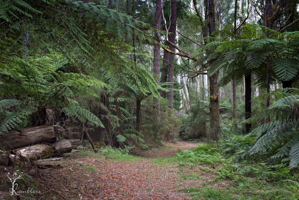
They cleared some eucalypt trees and planted Bishop Pine, Douglas Fir, and Californian Redwoods in their place. This was done for “experimental purposes as part of the Board’s hydrology research program”. Over 1476 trees range from 20 metres to the tallest being 55 metres. I don’t know what happened to the program, but the trees are still there for unrestricted access, and the site is just magic. The site is now heritage listed on the Victorian Heritage Database, ensuring survival from logging.

The Yarra River runs along the back of the forest…
and we headed to this first, trekking through a narrow goat track and undergrowth to find the river, and then found a wide path coming back. In the forest, none of us thought to record our Indiana Jones moment 🙁
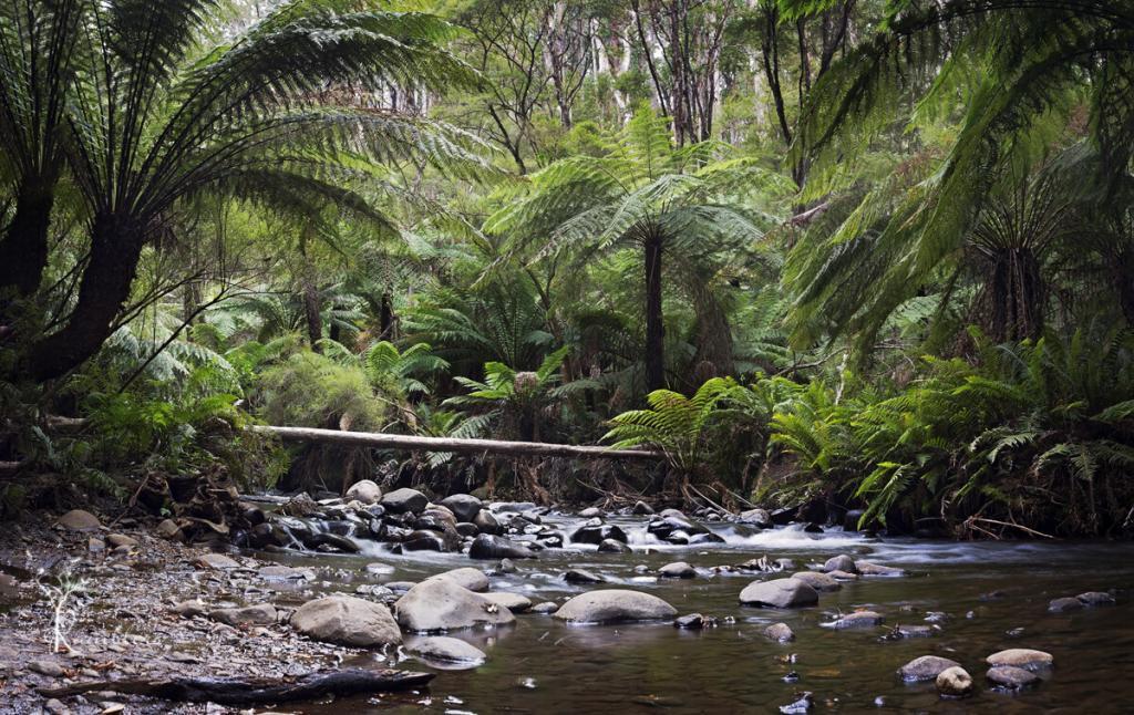
The river is lined with lush green tree ferns, water tumbled and washed over rocks. Not a sound except for running water and the birds. We were only able to get down to the river at one point, with high banks preventing access most of the length, but the spot we found was beautiful, and we spent about an hour there.
Back in the forest, we found more ‘odd’ evidence on what happens in a Redwood Forest (on a full moon?). Dotted throughout the forest were circles made from twigs and branches and, in one instance, a small shelter. There were dozens of the circles, a couple shaped like large nests, more than a bit ‘Blair Witch’ and no way would I go in there after dark 😉
Getting there:
Drive through Warburton, following the Warburton Highway until it becomes Woods Point Road. After about 7 km, take Cement Creek Road on the left. The road is unsealed and a little rough in places, but 0.7 km along, you will find a small parking area on the right along a fenceline and a small gate barrier. Walk through the gate, and there you are. Walking through the plantation will lead you down to the river, following the walking tracks each way.

I spent the weekend at Apollo Bay & Otway Ranges in late February with the MPE family of addicted photographers. We started our weekend with Hopetoun Falls. Then a picnic lunch at the Redwood Forest and afternoon tea in town at Cafe 153 before dinner at the Brewhouse. That night we did some light painting at the Breakwater with Deanne and Bill Holmer from Melbourne LightPainting.
Midway along the Great Ocean Road is the seaside town of Apollo Bay. With the lush green slopes of the Otway Ranges at her back and the blue seas of Cape Otway at her feet, Apollo Bay is a great staging point to visit the valleys, rainforests, rivers and streams, waterfalls and light station.
Sunday was an early start for a 6 am sunrise that never eventuated. Cafe 153 for breakfast, then off to the light station. It was a quick 36-hour visit, but my exhaustion when I got home was a testament to how much we crammed into it 🙂
Hopetoun Falls

Getting here is easy. If you come through Colac or the Great Ocean Road, head to Binns Road, and it’s well signposted. Once at the carpark, you have a one-way in and one-way out downhill walk.
Hopetoun Falls has a good flow for just about all year. Even though it was February, we still found a good flow coming over the top and into the Aire River below. The walk from the carpark to the first lookout is an effortless downhill walk of about 20 metres. The one-kilometre return trip of 200 plus steps to the bottom lookout (and 200 back UP) is a test of endurance for my old legs. It’s definitely worth the walk down, though. You can’t see a lot from the top lookout, and the walk through the ferns along the boardwalk to the base of the falls is impressive.
Redwood Forest

Just a few minutes away from Hopetoun Falls in the Otway Ranges is the Redwood Forest. I hadn’t been here before, didn’t even know it was there until recently, but what a fabulous find it is. Heading towards Apollo Bay from the carpark to the forest is on your right-hand side, just before a little single-lane bridge. There are picnic tables and chairs and a long drop toilet on the other side of the road. We stopped and had our picnic here before spending an hour wandering through the forest.

Running along the back of the forest is the beautiful fern-lined Aire River. The forest itself has a fantastic atmosphere.. you feel the quiet and serenity as soon as you step off the path into the trees. While I didn’t see them, others found some fabulous pagan? Stuff down back, twisted vines and things hanging from trees. The mind boggles as to what goes on in there.

Sundown
We hoped to get a sunset at the Apollo Bay Boat Harbour before light painting started. But it fizzled out on us. However, I did manage to get a pinkish sky using a 0.9 ND Grad.


Light Painting
We held our light painting session down at the Breakwater Led lights, steel wool spinning pixel sticks fabulous night.


Sunday Morning – Sunrise Failure
Sunday morning, despite getting up in the dark and heading down to the breakwater full of enthusiasm, it fizzled out on us again.

Cape Otway Lightstation
It sometimes gets sunny at the light station, but I seem to bring clouds. I have been there a few times, and getting a photo of the lighthouse in full sunshine against a blue sky is very hit-and-miss. It was a patchy cloud, then a full cloud for a quick, brief bit of sun and back to clouds when we headed there.


We came across two french girls guarding an injured Koala and reported it to the conservation centre for pickup (rang the next day, and the koala is doing fine). So down to the lighthouse for some shots and a walk around before heading back to the car for the 3-hour drive home. Fabulous weekend and we are already planning the next one.

The Grampians (Gariwerd) is a series of rugged sandstone mountain ranges and forests rich in wildlife. One of Victoria’s most popular holiday destinations, the Grampians are the destination of day-trippers and campers. They all come for rock climbing, scenic drives, bushwalks, and nature. The tiny and bustling yet laid-back town of Halls Gap is at the heart of Grampians. Its popularity is evident in many accommodation options, from backpackers to luxurious resorts and its many dining options.
Bushfires
On 15 January 2014, a bushfire which was sparked by a lightning strike started in the Grampians National Park. It was one of 68 fires burning across Victoria during this time.
The fire coincided with a heatwave across Victoria with temperatures reaching over 40 C in the Grampians region from 15 – 20 January. The fire eventually burnt 52,000 hectares including bushland and farms and was declared contained on 21 January 2014. Many residents from Dadswell’s Gap, Wartook, Brimpean, St Helen’s Plain, Roses Gap Pomonal, Bellfield, Lake Fyans, Lake Lonsdale, Heatherlie and Ledcourt were affected by the fires. Halls Gap was threatened by the fire front and ember attack and most of the town evacuated. Relief centres were set up in Horsham, Stawell and Ararat for the hundreds of people who were evacuated from their homes. Farmers lost large numbers of sheep that were either killed by the fire or later culled. At least 7000 sheep in total were lost.
A 12 km wide pyro cumulus cloud column of smoke and fire was created by the fire, generating its own weather pattern including lightning and thunder. This cloud gathered burning embers into the sky, which then scattered for many kilometres beyond the fire front, potentially starting new fires .
Australian Emergency Management

Halls Gap
In January 2015, and stayed in a fabulous little house near town that backed onto the National Park. We had a constant stream of wildlife visitors from when we arrived until we left three days later. Kangaroos, Cockatoos, Finches, Emus, and Crimson Rosellas were always nearby.

Break it up, kids
Boroka Lookout
We saw many of the lookouts had been rebuilt due to the last bushfire. Unfortunately, gone were the old wooden railings lost in the fires. In their place, however, were lovely new stainless steel railings at Boroka Lookout. The lookouts at McKenzie Falls have also been rebuilt, along with new amenities blocks. However, the kiosk that stood there is gone and hasn’t been rebuilt. Just the chimney remains.


Over the bridge in Phillip Island is the turnoff to Churchill Island Heritage Farm. It has been farmed since the 1850s and became the holiday retreat of the Lord Mayor of Melbourne, Samuel Amess, when he purchased it in 1872.

A day on the farm
Last Sunday myself, and a dozen or so photographers from Melbourne Photography Excursions travelled down to the island for the day to visit the farm. It’s tiny, only 57 hectares but has heritage gardens, historic buildings and fantastic views over Port Phillip Bay.
We stayed in Cowes overnight as I hoped to get a sunset and sunrise. Unfortunately, that turned out to be a total bust with thick clouds moving in the late afternoon. It was going to be a hot day, though, on Monday, so we called in at the Forrest Caves near Cape Woolami.


Cowes
We missed low tide so that we couldn’t get to the caves, so we dodged sand flies for an hour while trying to get some long exposure shots from the beach. It’s a beautiful spot but a challenging walk. A big staircase up and down over the dunes, we were all puffing like ten pack a day smokers by the time we made it back to the car.


It was our second and last morning in Eden, and we were on our way back up the coast on the return journey to Sydney. This time we headed to Quarantine Bay, not far from where we were staying. Our route would take us from Quarantine Bay to Kiama, but we planned to get another sunrise in first and hopefully spot more pelicans.

Quarantine Bay
Yet again, we were blessed with a beautiful sunrise. The weather gods were being genuinely kind to us.

Desperate times
Driving from Quarantine Bay to Kiama, we headed off in search of coffee. Desperately in search of coffee. Heads up, in Eden on a Sunday, NO coffee shops, cafes, bakeries, or anything remotely similar to coffee sellers are open before 9 am. It was only 7.30 am. So we started heading out of Eden with the naive hope of something open in the next town. No. Nor the next one, nor the one after that. It wasn’t until we went through Cobargo around 8.30 am that we found a little bakery that sold coffee and cakes. To this day, the baker remains blissfully unaware of the role she played in our survival.

Fortified and revived, we stopped at Corunna Lake and Tuross River before reaching the Ulladulla Lighthouse’s first planned photo stop.
Warden Head Light, a.k.a Ulladulla Lighthouse
The Warden Head lighthouse is an active lighthouse on a headland south of Ulladulla. Constructed in 1873, the original oil lamp was replaced in 1920 with a flashing light powered by acetylene gas for automatic operation, before being converted to electricity. in 1964 The light is now battery operated. It is also one of the only two lighthouses in NSW made from iron plates.

Point Perpendicular
From Ulladulla, we headed to our next lighthouse stop – the Point Perpendicular Lightstation. Point Perpendicular is still an operating military base, and we were required to show ID to enter, along with a headcount of the car. I was waiting for them to get out the mirrors on long poles to check under the car 😉

The travel brochures promised, “Drive through natural scrub and beautiful spring wildflowers to Point Perpendicular Lighthouse, and the spectacular escarpment at Jervis Bay”. Unfortunately, we saw no wildflowers and no escarpment. Did do another few km’s on NSW Parks favourite surface, though. The rutted, potholed, gravel and dirt roads. And while this lighthouse didn’t reward us with snakes, we did see a wallaby and a rabbit.


Kiama
We finally arrived in Kiama late afternoon and, with fading light, headed for the Kiama Lighthouse (we were on for a hat trick) and the Kiama Blowhole.
The Kiama Lighthouse was erected in 1887 with an oil burner light visible for nine miles. It was subsequently upgraded to gas in 1920 and decommissioned. In 1969 it was connected to mains electricity.

The Kiama Blowhole
The Kiama Blowhole was discovered by George Bass in 1797 and sits alongside the Kiama Lighthouse. Huge, spectacular plumes of water shoot up from the blowhole every few seconds. We spent a pleasant hour at the blowhole and lighthouse before heading into town for dinner and then to our B’n’B for the night.


Today our plans were for Kiama and Cathedral Rocks. We were halfway through our trip along the south coast and chose Kiama for an overnight stop as Kiama and Bombo are only a few minutes apart. So, after a night at a B & B in Kiama, we headed down to Cathedral Rocks, Bombo, to set up at the ungodly hour of 5.30. With excellent hindsight, we had scouted the location the day before to find it in the dark, so getting there and setting up was problem-free. Cathedral Rocks are 10m high basalt columns, sea stacks, and a 20m high cliff that forms a 1km headland.

It was a gorgeous sunrise, and we were working on getting the sun – and slow exposures on the rocks. I had an ND1000 on and couldn’t work out why it was coming out so dark until I realised I still had the CPL on from the day before. Once I took that off and just used the ND, things started to come together.
We stayed there till about 8 am with the sun fully up… it was just a fabulous place. I would have liked to go to the Bombo Quarry or Boneyard after that, but we couldn’t find them the day before, so we just settled for the entire shoot at Cathedral Rocks. Which wasn’t a bad thing 🙂

Bombo is a must-do place for anyone who loves landscape photography… for me, it’s also a ‘must go back. However, I definitely still want to get the Boneyard and the Quarry.
Cathedral Rocks is located off Cliff Drive, take the Kiama Downs to turn off from the Princess Highway, and cross under the railway bridge at Bombo Beach.

After our whale cruise and lunch at the pier, we drove to the Green Cape Lightstation and Ben Boyd National Park. Our goal was the Green Cape Lightstation at the end of the park on the tip of the peninsula. The roads are listed as 2wd dirt roads?… NSW Parks is very impressed with the capabilities of 2wd cars. While not as bone-shaking as our trip to Kichega National Park, it was still a bumpy, potholed, rutted dirt road for 21 km.

Green Cape Lighthouse
At the end of the road, the Green Cape Lighthouse rises 29ft overlooking the peninsula. The Green Cape Lighthouse was the first cast concrete lighthouse built in Australia. It also distinguishes it as NSW’s second tallest and most southernmost lighthouse.

A fence surrounds the lighthouse, so it’s impossible to get into the light station grounds (rented out as holiday rentals), but we found that heading down towards the cliffs gave us a good viewpoint.
The Pinnacles
Once on our way again and still within Ben Boyd National Park, we drove to the Pinnacles. Once you park the car, it’s an easy 1.1km loop to the pinnacles and back. The Pinnacles were formed due to erosion of the cliffs. They formed about 65 million years ago and are made of soft white sands and red gravel clay. When part of the cliff fell away, it exposed the red clay and white sands. Fortunately, we didn’t see any more snakes. But we kept a good eye out and thanked our forethought for wearing leather hiking boots!
Davison Whaling Station
Our final stop at Ben Boyd National Park was pretty underwhelming. The lady at the Information Center recommend that the Davison Whaling Station was well worth a visit. It may have been once. But there is a quaint little shack, but there isn’t much else. The whaling station itself was a couple of signs and an old tin pot.


Day Three of our South Coast road trip brought us to the highlight (for me) of our journey. And the main reason we were in Eden – the Eden Whale Watching cruise on Twofold Bay.
Whale Watching Cruise
Cat Balou run cruises all year round from a 72 seat vessel, but September to November is whale watching time during the Humpback Whale southern migration. Whales travel a distance of around 10,000km on their migration. While the whales pass Eden on both the southern and northern migration, it’s only on the southern migration that they are close enough to shore to see. Most are only seen further out to sea on the northern migration. And only a very few venture into Twofold Bay.
Twofold Bay
Leaving Snug Cove at Eden Wharf, we cruised around the Bay for three and half hours. We sighted pods of dolphins, a few seals and three whales. Twofold Bay is one of the deepest natural harbours globally. It is also the only port on the Sapphire Coast with direct ocean access and no sand bars to negotiate.

Ben Boyd Tower
From the 1820s until 1930, men in open wooden boats hunted whales in Twofold Bay. A pack of killer whales assisted them. Ben Boyd Tower was initially planned as a lighthouse but was used as a whale spotting tower. After being hunted close to extinction, the population was estimated at 200 in 1962. In 2013 the whale population was estimated at 14,000 and increased by 11% a year.

I had been hoping to get a whale leaping out of the water, but they weren’t cooperating that day. We had to settle for several ‘breachings’ where the whale generates enough upward force with its powerful tail flukes to lift two-thirds of its body out of the water before coming down in a thunderous splash.

The underpart of each tail fluke is like a ‘fingerprint’ with no two tails having the same markings. Whale Facts

Day Two of our Sapphire Coast road trip along the South Coast of NSW took us from Glasshouse Rocks, Narooma to Eden. After doing three abandoned locations the day before, we were now up early to catch a Glass House Rocks sunrise in Narooma.

Narooma Surf Beach
The Narooma surf beach is beautiful, a one km long, semi-circular cove overlooking Montague Island, with the Glass House Rocks at the southern end and Australia Rock at the northern. The Geological Society of Australia recognises the Glasshouse Rocks as between 510 and 440 million years old. They are the result of volcanic activity hundreds of millions of years ago. Unfortunately, we got so involved with admiring the sunrise we never walked over to see the Glasshouse Rocks up close 🙁

Our ‘plan’ we had been to was to go out to Montague Island after breakfast. Still, none of the tours was running that day due to heavy seas out on the ‘bar’, so after breakfast overlooking the beach wandered down to Australia Rock before heading off towards Eden.

Camel Rock
Leaving Narooma, we headed down the Princes Highway to Bermagui and Camel Rock. The second part of the plan that didn’t go as planned was that Horsehead Rock was inaccessible by now due to no longer being low tide. Horsehead Rock is past Camel Rock, across a short rocky beach only accessible at low tide. So scratch Horsehead Rock this trip.

Camel Rock is ten minutes north of Bermagui along Wallaga Lake Road. The surf and rock formations are fabulous. I could have stayed there all day.


Blue Pool
Also in Bermagui is the Blue Pool. A large rock pool at the base of a dramatic cliff. There are two pools there. One seems full all the time, and the first pool feeds the other as the tide comes in. Something we didn’t realise until the water came gushing over the lip as we stood in the empty pool photographing the full pool!


Wallaga Lake
Our last stop before Eden was Wallaga Lake. We were driving past and spotted some Pelicans, and Pied Cormorants on the sandbar, so we pulled in for some shots.


They were probably bout 100ft from shore. but my travelling friend got out her ‘big boy’, and we got them just fine 🙂


Well worth a day trip is Trentham Falls and the Railway Station. And if coming in from Melbourne, the bakery at Woodend is a must to stop at! Trentham is a little town with a population of 1,411 nestled at the top of the Great Dividing Range. It’s halfway between Woodend and Daylesford and is an easy one hour from Melbourne up the Calder Hwy. The Falls are just a couple of kms out of town. On Sunday, we were there, the carpark was packed, and people were constantly coming and going.
The Falls
The falls flowed well when we visited in August. They are only a short 70-metre (downhill) walk from the carpark. The lookout above the falls is quite good. It formed millions of years ago from molten lava rapidly cooling along the river. They are Victoria’s highest single-drop waterfall, plunging 32 metres into the quartz riverbed below. The Trentham website called it the ‘former’ river, but there was a river flowing the day we were there. I had planned on setting the tripod up in front of the base of the falls. But the water was too deep.

The track to the base of the falls is ‘closed’ with signs of unstable cliffs, but that stopped no one. The barrier is about 2ft high, and no impediment to stepping over or around. So we followed the goat track to the base of the falls and spent a pleasant half-hour down there among the mist, hitting the rocks, photographing the falls and the river. Going back up was a little more complicated. I felt like a veritable explorer. Until I saw a man with his pregnant wife and small son strolling down the goat track!

Trentham Railway Station
Leaving the falls, we headed into Trentham to visit the historic railway station. The station was built in 1880 but closed in the 1970s. It has been restored with some rolling stock and buildings open as a railway museum. A small market is held there on Sundays.


As it was now mid-afternoon, we decided to head back to Woodend for afternoon tea before heading back to Melbourne. After walking uphill and down dale at the falls, then around the station, we were well and truly ready for a sit-down and cuppa!
Looking for more victorian waterfalls? Check out HERE