
Tag:photography

Jack London was undeniably a man of many talents. Born into a working-class household, he is best known for his novels, Call of the Wild and White Fang. By the time Jack passed away 40 years later, he had lived an extraordinarily full life many times over. Jack London was a seaman, an oyster pirate, a hobo riding the rails across America, a prospector on the Klondike, a journalist and a war correspondent reporting the Russo-Japanese War in 1903. His widely read books made him a famous and wealthy man. Like many others, I read and loved his books and the films they spawned. However, his largely unknown skills as a documentary photographer piqued my interest.

Early Life
Jack London was born John Griffith Chaney, on January 12, 1876, in San Francisco, California. Jack’s mother, Flora Wellman, was a spiritualist and his biological father was an astrologist who left town when Flora fell pregnant. Flora then married John London, a widowed, disabled civil war veteran, the same year as Jack’s birth. The family’s economic circumstances were always dire and to help support the family, Jack had held several jobs by age ten.
At thirteen, he left school and worked odd jobs, turning most of his pay over to his parents. Then, with the help of a loan of $300 from a family friend, he purchased a fourteen-foot skiff, the Razzle Dazzle. Jack used the skiff to poach oysters, selling them to local restaurants and saloons. The criminals he fell in with nicknamed him “The Prince of the Oyster Pirates”. He, in turn, called them “the booze fighters”. Unfortunately, they also introduced him to heavy drinking. This led to a lifelong addiction to alcohol.
A Vagabond Life
By the time Jack was fifteen, he worked eighteen hours a day in a cannery enduring appalling conditions for ten cents an hour to support his family. At age sixteen, Jack joined the California Fish Patrol. Then, in 1893, on his seventeenth birthday, Jack signed aboard the Sophia Sutherland, a three-masted schooner, as an able-bodied seaman. Onboard, he headed to the Pacific Northwest and Japan for a seal-hunting expedition.
Off the coast of Japan, the ship ran into a typhoon so fierce each man could only tolerate a one hour turn at the wheel. Fortunately, the ship survived the storm and returned to San Francisco six months later. Jack regarded the voyage as a seminal turning point in his life. Finally, he had returned home a man.

The Hobo Life
Back on land, he was broke again after handing over his wages to his mother. In 1894 Jack was travelling as a hobo across America’s rail tracks. In Niagra Falls, he was arrested for vagrancy and sentenced to 30 days gaol. According to Jack, those 30 days were so degrading it made him decide to return to education and resume writing.
After a brief stint at a jute mill, followed by a power plant, he enrolled and completed high school. Jack then attended the University of California, where he embraced socialism. The San Francisco Examiner printed a speech he wrote and profiled him as a “boy socialist”. However, he left university after one semester due to lack of funds. Jack travelled with his sister’s husband to the Alaskan Klondike for the gold rush of 1897.

Courtesy of Alaska State Library, Winter & Pond Collection
The Writer Emerges
“It was in the Klondike,” London said, “that I found myself. There nobody talks. Everybody thinks. There you get your perspective. I got mine.”
Jack London, Smithsonian Institute
While on the Klondike, he became severely malnourished. He lost several of his front teeth to scurvy, and his failing health forced him to return home. While Jack didn’t strike it lucky on the Klondike, he had brought back a wealth of raw material for his books. Returning to California in 1898, he learned his step-father, John London, had died. The death of his stepfather brought about the decision to dedicate himself to professional writing to support his mother. Drawing on his Klondike experiences, he began writing about Alaska’s bleak, frozen landscape.

Courtesy of Eagle Historical Society
I brought nothing back from the Klondike but my scurvy,” London declared. He netted just four dollars and fifty cents’ worth of gold dust.
Jack London, The New Yorker
By 1899 his stories attracted several major magazines. The publication of these stories gave him a secure, middle-class life. In 1900 he married and had two daughters. The Call of the Wild was published in 1903, and at 27, he became a huge celebrity. His rugged good looks, youthful vitality, travels, and political activism made him the darling of political reporters and gossip columnists alike.
Jack London- war correspondent

A skilled photographer, Jack’s subjects included the homeless in Londons East End Slums to the refugees of the Russo-Japanese war. He was a fearless photojournalist and was arrested by the Japanese secret police twice for taking photographs of Japanese forces.


Jack wrote an eyewitness account of the 1906 San Francisco earthquake and fire. He returned two weeks later with his camera to document the city in ruins. 1914 he covered the U.S. invasion of Veracruz during the Mexican revolution for the Hearst newspapers.

People Of The Abyss
In 1902 Jack visited London as he wanted to expose, in his words, the “underside of imperialism”. To pass unnoticed among the working poor, he disguised himself as an American sailor who had lost his ship. Jack lived among them, photographing the conditions of their everyday life. His experiences and photographs of living in Londons East End and the Whitechapel district, sometimes sleeping on the streets, at other times in workhouses were documented in his book “The People of the Abyss” (still available on Amazon)
“Of all my books, the one I love most is The People of the Abyss. No other work of mine contains as much of my heart.”
Jack London

A 1909 report of the Poor Law Commission found that one-third of the East End’s 900,000 strong population lived in conditions of extreme poverty. The report also detailed the squalor of conditions in these areas, with an average of 25 houses sharing one lavatory and fresh-water tap between them. One response to a dire lack of sanitation in London’s poorest areas was the provision of communal washhouses for bathing and clothes-washing; an average of 60,000 people each week used the 50 such bathhouses which existed across the city in 1910
Rare Historical Photos


ever the adventurer
Jack London’s marriage collapsed in 1904 when his wife discovered he was having an affair with Charmain Kittredge, who became the second Mrs London. He continued writing short stories and articles and published The Sea Wolf and White Fang. At thirty, he became the highest-paid writer in the country. Jack began designing a 45-foot sailboat he named the Snark after the Lewis Carroll Poem.

In 1907 Jack and Charmain sailed to Hawaii and the South Seas with a small crew. They followed this by driving a four-horse wagon on a 1500-mile trip through Oregon in 1911. The following year in 1912, they sailed from Baltimore around Cape Horn to Seattle as passengers aboard the square-rigged sailing bark Dirigo.

Ill health
Due to the effects of amoebic dysentery he had caught in Mexico and his heavy drinking, Jack had been in ill health for some time. In 1913 Jack underwent an appendectomy, and doctors discovered his seriously diseased kidneys. However, he ignored doctors’ warnings against a high protein diet, insisting on raw fish and near-raw duck meals. In addition, he continued to smoke 60 Russian cigarettes a day and continued to drink heavily.
The Final Years
In the last two years of his life, Jack endured recurring bouts of dysentery, kidney stones, gastric disorders and rheumatism and his doctors prescribed morphine for the pain. Jack and his wife made two extended trips to Hawaii for Jack to rest and recover. However, on November 22, 1916, Jack London died of uremic poisoning from kidney failure and a probable stroke. In 18 years, he had written 50 books, 20 of them novels, and taken thousands of photographs, most of which remained unpublished until 2010.

Although she was often bedridden following repeated strokes, Charmian lived another forty years. She died in 1955, at the age of 83. Her ashes rest beside Jack’s under the rock that marks their grave near Glen Ellen, California, at Jack London State Historic Park.
I would rather be ashes than dust! I would rather that my spark should burn out in a brilliant blaze than it should be stifled by dry-rot. I would rather be a superb meteor, every atom of me in magnificent glow, than a sleepy and permanent planet. The proper function of man is to live, not to exist. I shall not waste my days in trying to prolong them. I shall use my time.
Jack London
Note: all photojournalist images used in this post were taken by Jack London

Winton Wetlands is an ‘ephemeral wetlands’, meaning the wet areas rise and fall, changing with the seasons, rainfall and climate. This regular cycle allows native species to breed and thrive in the different water levels. When we visited in late April, heavy rains had come through the week before, and some shallow water areas still prevailed. Usually, the wetlands would be dry at the end of summer, but good summer rains have seen water in the wetlands again.
History

Winton Wetlands Reserve covers 8,750 hectares in northeast Victoria between Benalla and Glenrowan. The area encompasses 33 ephemeral wetlands and hosts over 30 endangered or vulnerable flora and fauna.
In the early 1800s, squatters had moved stock into the wetlands for stock grazing. However, in the 1840s, squatters Alexander Cheyne and William Gibb registered Goomalibee Station and took up 98,000 acres. The Selection Acts of 1861 encouraged families to farm the land. As a result, Goomalibee Station was subdivided into smaller farms for cropping, livestock, viticulture and timber harvesting. The industrious farmers lobbied for a school to be built plus a post office, sports ground, church and hall. In 1903 a creamery was built to process the butterfat from local dairy farms. Goomalibee Butter was even exported to the UK. However, all that came to an end in 1970, when a 7.5km long dam was built to establish the Lake Mokaon storage reservoir.
Restoring the landscape
The lake was never a true ‘success’. Constant algal blooms and high evaporation rates meant it was a costly exercise to maintain the lake in a healthy condition. Consequently, a decision was made by the state government to drain and abandon the lake. Forty years after it was flooded, Lake Mokoan was decommissioned and drained in 2010. Work then commenced restoring the landscape. A Committee of Management is tasked with constructing infrastructure, developing tourism, and repairing the landscape.
Thus far, a visitor centre and cafe have opened. Interpretive information signs, four campgrounds, picnic areas, public toilets, 60km of roads and 30 km of trails and cycling paths have also been added. Artworks in the form of ‘art in the landscape’ are also a drawcard. It is estimated it will take 100 years to restore the wetlands to the same condition they were before the area was flooded with the creation of Lake Mokoan.
Art in the landscape

Across the Wetlands are several works of art by noted artists. The most well known and easily accessible works by Guido Van Helton (the CFA water tank) and Tim Bowtell (Fish Trees)

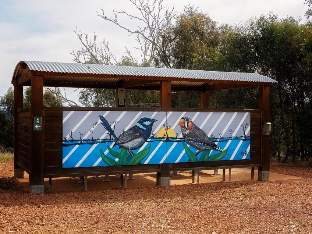
Bird Populations
Since 2013 the Birdlife Murray Goulburn group has undertaken quarterly bird surveys at the wetlands. Over time, there has been an increase in the bird species visiting the wetlands. In their last survey, they noted 168 species across 16 sites. The most abundant species were Sulphur-Crested Cockatoos and Grey Teals. However, Red-rumped Parrots, Galahs, Magpies, Tree Martins, Welcome Swallows, White Plumed Honeyeater, Pacific Black Duck and Superb Fairy Wren were also seen. We saw plenty of Cockatoos, Pacific Black Duck, Herons, and Magpies on our visit. And one black snake that we steered well clear of.
Wildlife
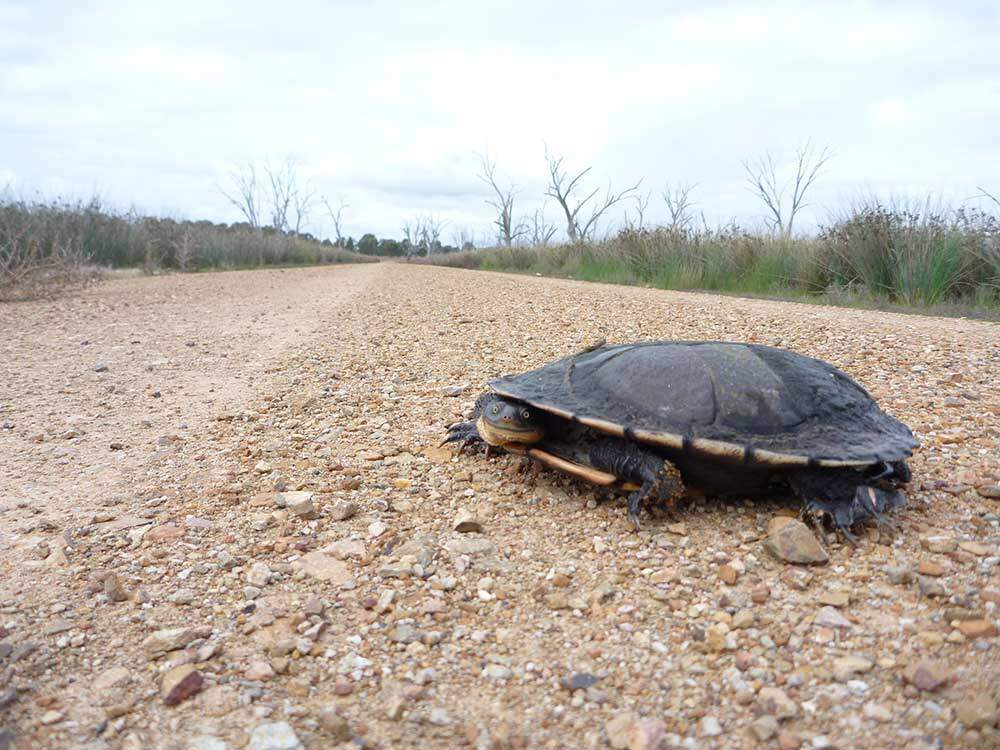
Eastern Long-necked Turtles and Murray River turtles have returned to the wetlands and use the shallow edges of the wetland swamps for laying eggs. They are seen almost daily over October each year as they travel between the swamps laying eggs. Growling Grass Frogs were last recorded in the wetlands in the 1970s. The Winton Wetlands trust is now working toward reintroducing the frogs back to the swamps and hopes to have a small population by the end of 2022.
River Red Gums

The flooding of the wetlands in the 1970s also caused the death of 1500 river redgum trees. Their skeletal trunks and branches still line roads within the wetlands today. Telegraph poles also dot the landscape. They were the only means of communication for the far-flung farms in the early days. It’s an eerie, silent and still landscape. With no sound save for the occasional screeching cockatoo, its not hard to imagine the isolation of the original farmers.


Luminar Neo is arguably the best sky replacement out there. With a host of new tools, including layer masking, it’s hard to go past.
A brief history
Initially released by Macphun, Luminar has been around for over ten years now. The company was started in 2008 by two Ukrainian gaming software developers. As the company grew, its focus moved to creative photography. In 2015, Macphun partnered with Trey Ratcliff and developed an HDR program named Aurora. Luminar, intended as an all-in-one alternative to Photoshop, was released in 2015.
Initially, Luminar was only available for the macOS. However, in 2018 Luminar also included a Windows PC version in its release, and it was at this time, Macphun changed its name to Skylum. Luminar Ai was released in 2021, and Luminar Neo followed in 2022. All Luminar products have featured sky replacement, with each new release improving the technology. Over the years, Luminar has won many prestigious industry awards for photo editing innovation, including four gold awards at the Digital Camera Grand Prix.


Luminar Ai
Luminar Ai was a brand new product – not an upgrade to Luminar 3 or 4. Instead, it offered an entirely new approach to photo editing powered by artificial intelligence. Luminar Ai also introduced various tools for portraits and enhanced the landscape tools. The sky replacement in Luminar Ai also received a significant upgrade.
Luminar Neo


Like Luminar Ai – Luminar Neo was a new product built from the ground up – not an upgrade. The portrait bokeh is excellent, with Neo automatically masking out your subject to isolate the background. You then adjust the sliders to your liking to create a creamy bokeh behind your subject. How much bokeh remains entirely within your control. The Relight feature is another excellent addition. Neo calculates the depth of the image and creates a 3D map. You can then adjust the light naturally from front to back.


However, the sky replacement is why I use Luminar in all its iterations. Too often, I have taken a shot that I was happy with, except for the bland sky. Returning time and time again to get the shot in perfect conditions isn’t always feasible. So sky replacement saves the day. I remember when sky replacement was in its infancy, and trying to do it in a heavily treed image almost drove me to drink! In Neo, adding your own custom skies is much easier, and the replacement sky will now also reflect onto the water, ensuring your sky replacement looks more natural.


Do You Need Both?
So, the big question is, I guess, do you need Luminar Neo if you already have Luminar 4 or Ai? Well, it depends on which one you have. Luminar 4 was notoriously (painfully) slow to load and process images, so if you didn’t upgrade from Luminar 4 to Luminar Ai, I would definitely recommend you take the plunge for Luminar Neo. If, however, you do have Luminar Ai, I would still consider Luminar Neo a good investment. This is because the loading and processing of Neo are markedly faster again. In addition, the interface is more intuitive and straightforward. Plus, there are all those lovely new features.


Neo’s rebuilt engine has much better speed and performance than Ai, and with Neo, you gain the ability to add layers, much like Photoshop. Luminar Neo also has the Remove Powerlines and Remove Dust Spots. Both work with a single click without time-consuming manual masking. There is, however, a brush option to manually remove more complicated power lines and dust spots. However, at the time of writing this, only Luminar Ai has Dodge and Burn and Clone. However, neither of those tools is a deal-breaker to me, as I have them in Photoshop.


Sale Starts today!
Skylum’s summer sale starts today with a massive 60% saving on Luminar Neo. Luminar Neo is usually priced at $123 Au – less the loyalty discount if you already have a Skylum product. Both programs offer a free trial and give a 30 money-back guarantee on your purchase. Lifetime licences with standard updates are included.
- The summer sale price of Luminar Neo, a one-time purchase, is $67 for one licence or $84 for two licences(around $50 off). They are also including Aurora HDR and Nature templates for free
Click HERE for the special sale price – Sale ends June 10, 2022
Verdict
I have been with Luminar since Luminar 4. I then bought Luminar Ai as soon as it was released. The following year I purchased Luminar Neo with the early bird special – and I can say unreservedly, I love it. It’s packed with more advanced features than Luminar Ai and is faster and simpler to use. I still have Ai on the computer for when I want to access the few things Neo doesn’t have, and Skylum is still putting out updates to Luminar Ai. I do expect, however, that Luminar Neo will eventually catch up, and when that happens, I will uninstall Luminar Ai. If you own Luminar Ai, upgrading to Neo will give you a better experience, and with your loyalty discount, it’s excellent value. For me, Luminar Neo, with its superior sky replacement and faster processing, is a clear winner.

disclosure:
The links given here are affiliate links. While they won’t cost you any extra, I may receive a commission if you purchase using the links in this post. However, these are programs I bought myself and are highly recommended.

The charming town of Nagambie is just 138 km from Melbourne. Situated on the Goulburn Valley Highway, it’s around halfway between Seymour and Shepparton in the heart of the Nagambie Lakes wine region. It is full of history, horse studs, vineyards and waterways. Nagambie was named in 1872, and in the local aboriginal language means “still waters”. The area is well known for its beautiful lake, attracting fishermen, rowers, and water skiers.

Black Caviar Statue
Black Caviar’s life-sized bronze statue is located at Jacobson’s Outlook in High Street Nagambie. Created by sculptor Mitch Mitchell, the statue was formally opened in October 2013. The statue is based on a photograph of jockey Luke Nolen riding Black Caviar in the Schweppes Stakes at Moonee Valley in October 2011.

Champion racehorse Black Caviar was born on 18 August 2006 at Gilgai Farm, Nagambie, growing up to become the fastest horse globally, winning all 25 of its races and earning $8 million in prize money. In 2013, Black Caviar retired from racing.

Lake Nagambie
Behind the Black Caviar statue lies beautiful Lake Nagambie. It is man-made and the largest body of water in the area covering 170 hectares. Before the construction of the Goulburn Weir, the “lake” was a swampy lagoon. Since its creation, however, it has become an increasingly popular destination. Fishing is a hugely popular pastime on the lake. The annual Go Fish Nagambie takes place each February and sees fishermen vying to catch the biggest Murray Cod for an $80k prize. In addition, rowing and yachting regattas, including the ‘Head of the River’, occur on the lake. Lake Nagambie recently also hosted the International Rowing Championships.
The lake’s eastern shore follows the tree-lined High Street with a wide centre median boasting a grassy picnic area with tables and public toilets.
Jacobson’s Outlook
A Methodist church originally stood on the site where Black Caviar now stands. The church was built in 1885 by the townspeople and stood for 118 years. However, in June 2003, a semi-trailer veered off the highway, colliding with the church. The semi-trailer came to rest inside the church, which resulted in the collapse of the building.
Goulburn Weir

The historic Goulburn Weir was built between 1887 to 1891 to regulate water flow for irrigation in Victoria. It is the first significant diversion structure building for irrigation in Australia. The dam wall is 209 metres long and 16 metres high. The Goulburn Wier diverts water via the Stuart Murray Canal and Cattanach Canal for later irrigation of nearby farming crops. The design of the Goulburn Weir was considered very advanced. It was so unique that the back of half sovereigns and ten shilling notes featured the design from 1913 to 1933.

The weir also contained one of the first two hydroelectric turbines in the southern hemisphere. In 1983 and 1988, stabilising and refurbishment works were undertaken. However, two original gates and gear have been preserved to recognise their place in Victoria’s history. The lush park around the weir includes a playground, picnic tables, electric BBQs and public toilets.
Kirwin’s Bridge

The heritage-listed Kirwin’s Bridge is a short 6km north of the lake. Kirwin’s bridge is a single-lane timber bridge, 310 metres long. The bridge opened in 1890 and is still used today for motor traffic. It features a unique design with a mid-river bend and two passing bays for vehicles. Kirwins Bridge is one of Victoria’s oldest timber bridges still in operation.
Chinamans Bridge

The heritage-listed Chinamans Bridge opened in 1891 and is another of Victoria’s oldest surviving timber road bridges. The bridge was one of several “strutted-stringer” river bridges built in Victoria. However, its timber lift span made it unique, which was constructed to allow riverboat traffic to pass under. The bridge takes its name from the Chinese market gardeners who farmed the rich soils of the Goulburn River.
Royal Mail Hotel


The Royal Mail Hotel is known by locals as the ‘The Top Pub’ and sits on the top end of High Street. Built in 1871, it was originally a stopover for mail delivery for Cobb & Co. and passenger accommodation.
Tahbilk Winery
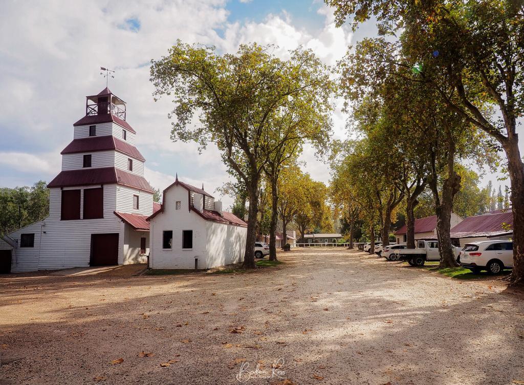
The handmade brick and mudstone winery was built alongside the Goulburn River in the 1860s. Tahbilk celebrated its 160th birthday in 2020 and has been in the Purbrick family for five generations. As a result, Tahbilk is recognised as the oldest winery in Victoria and gained heritage status in 2004. The area Tabilk-Tabilk, meaning “place of many waterholes”, by the local Daung-wurrung clans. The cellar door is open daily, and the original underground cellar is still available for visitors to wander through.

Cellar Door Hours
Weekdays 9 am to 5pm Weekends and Public Holidays 10 am to 5pm
Tahbilk Eco-Trail and Wetlands Walk


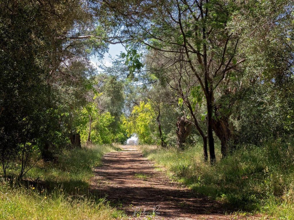
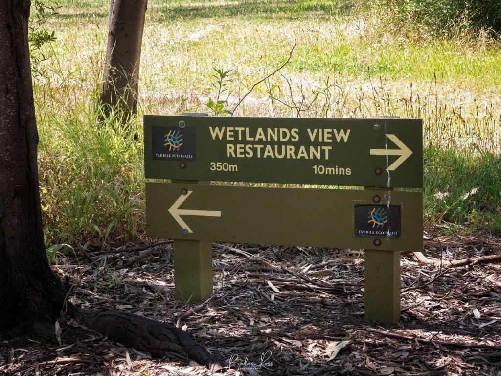
Behind the Tahbilk Wetlands View Restaurant lies a hidden oasis of wetlands and a walking trail. The 6.3km trail follows the Goulburn River as it meanders through billabongs, river flats, bridges, bird hides and past lily ponds. Visitors must register at the restaurant before beginning the walk. Dogs are not permitted on the trails. In addition, on days of a total fire ban, the walk is closed.
Mitchelton Winery

Famous Architect Robin Boyd CBE (1919-1971) drew up the plans for the winery, cellar door and tower, and renowned architect Ted Ashton completed them. The first crop of vines were planted in 1969. The winery was named after historic explorer Major Thomas Mitchell.

The iconic building opened in 1974 and boasts a world-class restaurant surrounded by lush lawns, making it a popular destination for outdoor concerts in the ‘on the green’ setting. Gerry Ryan OAM purchased Michelton in 2011. A $16m luxury boutique hotel and day spa were added in 2016. The ‘Airstream Hotel’ opened in 2020 with seven full-sized, sparkling silver RVs for guests. The winery has vineyards in Nagambie and Heathcote and purchases grapes from growers across Victoria.
Cellar Door HOURS
Open 7 Days Mon-Thurs 10:00 am – 4:00 pm and Fri-Sun 10.00 am – 6.00 pm for Wine Tastings, Education and Wine Sales.

The Wedge-tail Eagle, known colloquially as a ‘wedgie’, is the largest Australian raptor (bird of prey), standing at a metre tall. A truly magnificent bird, the Wedge-tail Eagle has an average wingspan of 2.3 metres though it can be up to 2.8 metres. They are Australia’s biggest bird of prey and one of the biggest eagles in the world and are similar in size to the American Bald Eagle. The Wedge-tail Eagle has a pale pink to cream beak, dark brown eyes, off-white feet and a wedge-shaped tail. They have a lifespan of 20 to 40 years. Males are 3.2 to 4 kg, while females are a slightly paler colour, larger and heavier at 4.2 to 5kg. Both sexes become progressively darker for the first ten years of their life.
Habitat & Distribution

The Wedge-tailed Eagle prefers wooded, forested land and open county. However, they can also be found in the mountains, near the sea, soaring in the air, or high in trees surveying their territory. The Wedge-tail is located in mainland Australia, Tasmania, and New Guinea. However, the Tasmanian Wedge-tail eagle is a distinct sub-species with genetic testing revealing the two species separated 200 to 1000 years ago. The Tasmanian population was established by mainland individuals flying across Bass Strait. Tasmanian Wedge-tails are darker in colour, have larger bodies and produce only one egg per clutch.
Diet

The Wedge-tails’ primary food source is carrion, preying on ground-dwelling animals and attacking with a fast swooping motion. Their diet consists of rabbits, mammals, lizards, possums, foxes, feral cats and carrion, and the eggs of other birds. They can carry prey up to 5kg in weight in their talons.
Eyesight
The Wedge-tail has binocular vision in which they can see their prey from great distances and in 8 times more detail than humans. In addition, their uniquely adapted eyes allow them to squeeze and extend their eyeball, enabling them to use their eyes similar to the zoom lens on a camera. Eagles have a third eyelid called the nictitating membrane. This eyelid is translucent and sweeps quickly across the eye from the inside corner. The eagle will sweep the nictitating membrane across the eye every few seconds to moisten and lubricate it. While it’s not completely clear, it still allows them to see.
Breeding
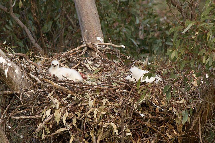
The breeding season occurs from June to October. They are monogamous, mating for life. Both the male and female groom each other during the breeding season. They build the nest together from sticks and leaves in the tallest tree in their area. The nest measures up to two metres wide and three metres deep. They often reuse the same nest year after year. A breeding pair usually only lays one clutch of eggs a year.

The female Wedge-tail lays a clutch of between 1 to 3 eggs over several days. Because of this, the eggs also hatch at different times. The female primarily incubates the eggs, while the male lines the nest daily with fresh leaves. The eggs hatch after 45 days, and chicks emerge covered in white downy feathers. The first chick that hatches is always the largest and sometimes kills the other chicks. The chicks are dependent on their parents for food for the first five weeks. The young Wedge-tail eagle leaves the nest after 12 weeks. However, they are not fully mature for six to eight years.
Threats

Wedge-tail Eagles are very common in Victoria. Sadly, farmers once considered them a menace. Convinced that the eagles carried off lambs, thousands of eagles were shot or poisoned. Subsequent research has found this false, as they rarely attack healthy lambs and never full-grown sheep. Current threats to Wedge-tails are loss of habitat due to clearing land and secondary poisoning from eating animals that have died from pesticides and baits. Road vehicle accidents also account for many deaths, with cars hitting the eagles while they are on the road eating roadkill. Additionally, wind farms also have an impact on their numbers.

Status
Wedge-tail eagles are protected in Victoria. Their status in Victoria is ‘secure’, and fines of up to $8000 apply to anyone found “killing, harassing or disturbing” the eagles.

While the Great Ocean Road actually starts at Anglesea, the seaside town of Lorne known as the gateway due to the Memorial Arch. Lorne is a popular spot for surfers, with thriving shops and cafe culture. There is an arts community, Qdos ARTS, with a gallery and sculpture park at Lorne. In addition, Teddy’s lookout, the Memorial Arch, and many waterfalls are just out of town.
The Memorial Arch
The Great Ocean Road was built in memory of Australians who lost their lives in World War One. At 240km long, the road is officially the world’s largest war memorial. The current arch is the fourth iteration of the arch. It spans the road at Eastern view – the site of the original toll booth that helped fund construction costs. It was rebuilt in 1974 after a truck hit the arch and demolished one side. 1983 saw the Ash Wednesday bushfires destroy the arch again, leading to a new metal arch built to resist fires. In 1990 a storm brought the arch down once more, resulting in the last rebuild.
Surprisingly the original “great ocean road” sign has survived the fire, storm and truck. It has been rehung over the arch each time the arch was rebuilt. A sculpture to the left of the arch depicts two men working on the road alongside two plaques added for the 50th and 75th anniversary of the road.
Teddys Lookout

Teddys Lookout is located at 53 George St, Lorne, Teddy’s lookout gives one of the best views of the road where the St George River empties into a small cove. Park at the end of George St, and then it’s a short walk to the two lookouts.
Erskine Falls
Where: Erskine Falls Access Road, Lorne
A 10km drive out of Lorne will bring you to Erskine Falls. Two lookouts on this well-known waterfall offer scenic views of water cascading 30 metres down into a gully. A short walk from the carpark brings you to the first lookout. You can take the 310 steps down to the lower lookout if you have a good fitness level.
Lorne Beach
Lorne beach has two distinct sections. The surf beach and the Main Beach. The sheltered 2km Main beach is located on the coast of Louttit Bay near the Lorne Swing Bridge. The main beach is the only part of the coastline that Life-Saving Victoria patrols during the summer months. The surf beach is on Mountjoy Parade.


The Rainbow Lorikeet is one of seven species of lorikeet and is native to Australia. They can be found all along the east coast of Australia, from northern Queensland through to South Australia. While they are similar in size to the Eastern Rosella, their brightly coloured plumage makes them easily distinguishable.

Habitats
The habitat of the Rainbow Lorikeet is coastal bushland, woodland, mangroves, rainforests and urban areas. They are communal roosters and join up into large, noisy flocks in the evening and early morning. However, they travel mainly in pairs. They are territorial birds, and each pair will aggressively defend its nesting and feeding area against all other birds. This aggression extends to larger birds as well as other Rainbow Lorikeets. They roost in treetops and rarely come to the ground.

Diet
Rainbow Lorikeets are herbivores and feed mainly on fruit, pollen and nectar. Their unique tongue is adapted to their diet and is long and flexible, allowing them to reach the nectar deep inside the flower. The tip of the tongue features a ‘bristle brush’ that helps lap up the nectar. Rainbow Lorikeets are the only birds in the world with this type of tongue. In addition, their muscular gizzard and intestinal tract are shorter than most birds. This makes consuming nectar highly efficient but ineffective at digesting seeds. While nectar forms most of their diet, they will also consume soft fruits such as apples, grapes, pears or figs, grains, insects, or larvae.
Breeding and lifestyle
Rainbow Lorikeets are monogamous and generally mate for life. They nest in tree hollows of eucalypts, paperbarks, honey myrtles and tea trees, choosing deep hollows from three to thirty metres off the ground to provide a safe nest away from predators. The female will lay 1-2 white, oval eggs up to three times a year. While their habitat includes rainforests, they prefer open country for nesting and generally don’t nest in rainforests. In Australia’s South and Eastern parts, they nest from August to January. In all other parts of Australia, nesting occurs year-round except for March. When the chicks hatch, they have no feathers and closed eyes. The fledgelings leave the nest after 54 to 57 days and join the communal roost. The Rainbow Lorikeet lives up to ten years in the wild and twenty-five years as pets.

Lorikeets as Pests
The Rainbow Lorikeet is considered a feral species in Western Australia (WA) after being accidentally released in 1968 from the University of WA campus. It is estimated there are now over 40,000 Rainbow Lorikeets in the wild in WA. The Department of Agriculture in WA has declared the Rainbow Lorikeet a ‘declared pest’ due to its behaviour of damaging fruit crops and bullying native birds out of their nesting sites. Consequently, they are considered a significant threat to declining birds species in WA, such as the Red-capped Parrot, Western Rosella, Australian Ringneck. The Rainbow Lorikeet is also a threat to the endangered Carnaby’s Black Cockatoo, Forest Red-tailed Black Cockatoo and Baudin’s Black Cockatoo.

Illegal releases of aviary birds in New Zealand in the 1990s resulted in a feral population of 150 to 200 birds. Subsequently, a live capture initiative from 2000 to 2002 eradicated them from the wild. However, they are also emerging as an invasive threat in Tasmania, where they compete for food and nests with the Musk Lorikeet, Swift Parrot and Green Rosella. Flocks of up to 100 birds have been spotted around the state though exact numbers in Tasmania are unknown. This has prompted authorities to trial a trapping program.

Urban explorers, often called urbex, range across all demographics from all walks of life. From young to old, male or female, Urbex is attracted by the lure of decay.
A constant search
I always have one eye peeled for abandoned, dilapidated, decrepit structures when travelling to family events, holidays, or other appointments. From schools, orphanages, asylums, hospitals, factories and railway stations to tram yards, amusement parks or old houses, If I find one, I mark it down for future investigation.

Risks and Legalities
Can it be dangerous? Most certainly. However, is it illegal to enter a property? That depends. If it’s completely abandoned, if there are no Keep Out signs, if it’s not fenced off or marked as private property, if you aren’t armed with bolt cutters or don’t need to break in to enter, you will prob get a polite move along if approached. However, entering an active, working building is an entirely different kettle of fish and strongly discouraged. The term ‘infiltration’ is applied to these ventures and carries the genuine risk of civil prosecution.

“If it’s a long-abandoned house, and they’re able to enter without doing any damage, there’s no sign forbidding people from entering the property, and they have no intention of committing any crime while on the premises — they’re simply photographing or noting what they see — it may be that no offence is committed.”
ABC News

Abandoned Beauty
Completely abandoned buildings are the most common lure to an urbex. Sadly, it doesn’t take long for them to become graffiti or vandalism targets once abandoned. By far, the most significant majority of abandoned structures fall into this category. Some, those with greater security, fare a little better. Finding an abandoned but undamaged building is akin to finding the holy grail. Abandoned sites are popular with photographers, historians, and ghost hunters as there is a sad but infinite beauty in the decay. As you walk the empty spaces, you can feel the history—the hopes, fears and pain of those who lived or worked there before. The silent walls that once enveloped the sounds of children, families, machinery humming or nurses tending sick have stories to tell. If only those walls could talk.

Storm Drains
Another common form of urban exploration is storm drains. Entry into these is referred to as “draining”. Groups, such as Cave Clan in Australia have sprung up dedicated to this. However, exploring storm drains carries vastly different risks than above-ground structures as they can be subject to flash flooding and toxic air. In addition, there is a specific set of rules around draining – such as “when it rains, no drains”! This is because of the dangers associated with becoming trapped or drowned during periods of rain when the sewers flood.

Safety First
Above-ground abandoned buildings are often unstable. Entry always carries risk. There could be asbestos, dodgy flooring or dangerous roofs. Live wires are a less common risk, but stray voltage is still possible. There is always broken glass, often holes in walls and floors. Sometimes rats or hostile squatters. Motion detectors or guard dogs guard some locations. The rule to live by is never going alone. Be alert and cautious where you step.

Locations and Secrecy
A common creed among urban explorers is never to disclose a location. This is partly to protect the site, and partly if it becomes viral more security will be employed. Images of abandoned places that are common knowledge or abandoned locations that have become tourist attractions will usually have a location. But a new site, one just found or in prime condition, will rarely have a location listed.


Leave No Footprints
While urban exploration doesn’t have rules as such, common-sense guidelines to follow are:
- Never break into a site. Forcible entry could land you in serious trouble. There is usually a broken window, a missing door, sometimes even an entire wall down that allows access without you causing further damage.
- Do not vandalise. Urban exploration is to explore and document. Not spray paint, break windows, smash doors and make it worse for the next explorer.
- Don’t steal or take souvenirs. Again – serious criminal trouble.
- Don’t share information about the location. So many buildings are now gone as arsonists found the sites. Loftus Tramsheds, Sydney, St. Johns Boys Home, Goulburn are victims of this. Sharing a location opens it up to vandals, junkies, thieves and arsonists. Only share with fellow Urbex and close friends you can trust to keep the site private.
- Never explore alone. You need to have at least one other person with you. Then, if one of you gets seriously hurt, they can go for help.
- Accept some sites are impossible to enter. For example, I would have loved to explore Box Hill Brickworks. But, unfortunately, it’s been pulled down now, so that chance has gone. But because physical safety was off the charts, it also had high security.
- More common sense, but if you are spotted, don’t run. You will, in all likelihood, only get asked to leave if you are only exploring or taking images. But running in an abandoned building is never a good idea. Safety above all

Document and Photograph!
Once abandoned, there is only a narrow window to photograph before the vandalism destroys the building. As the buildings deteriorate further, they either get demolished or security increases. So take lots of photos and share them on social media – without the location. Let others see places they won’t get to. If you are unlucky enough to be caught, taking photos also helps you avoid prosecution – you can show you were only taking images and not causing damage.


Detroit
For the lure of decay, Detroit is king. The city of Detroit has around ten abandoned neighbourhoods. I drool over images from Detroit as it has around 70,000 abandoned buildings plus 31,000 abandoned homes. It’s an urbex paradise. The city of Detroit actually declared bankruptcy with an $18 billion debt in the fallout of the global financial crisis. An excellent documentary on Detroit’s buildings can be seen below.

In 2009, following weeks of drought and extreme heat, Victoria was a tinderbox waiting for the match to fall. The devastating bushfires that swept across Victoria on February 7, 2009, now famously known by all as Black Saturday, was the realisation of that nightmare. Just 95km from Melbourne via The Black Spur, Marysville was almost wiped from the map that day. However, Marysville has risen from the ashes in the thirteen years since then.
Black Saturday
The Black Saturday fires started on February 7, with over 400 burning across victoria. It remains the worst bushfire regarding lives lost in Australia’s history to this day. The fires followed an extreme heatwave, coupled with low humidity. This led to Melbourne enduring 43°C for three consecutive days, reaching 46°C on Saturday. As a result, Premier of the day John Brumby issued a public warning that Saturday was expected to be the “worst day for fire conditions, in the state’s history”.

On Saturday, Victorians woke to winds above 100km an hour, bringing hot air down from Central Australia. The Kilmore East/Kinglake fire began at 11.47 am when the winds brought down power lines at Kilmore East, and the sparks ignited the dry grass. Crucially, that single powerline fault led to the deaths of 119 people within hours.
Fire Outbreaks
By 1.58 pm, the Kilmore East fire had burnt through light forests and grassy paddocks. It threatened homes at Wandong before heading towards Mt Disappointment. The strong winds blew embers as far as 40 kms ahead of the main fire front, causing spot fires to break out. By 7 pm, it entered the Kinglake National Forest. As a result of a wind change, the eastern flank suddenly became the fire front, and the town of Kinglake came under heavy ember attack.
The Murrindindi fires that decimated Marysville began near the Murrindindi Mill at 3 pm before spreading through the Murrindindi State Forest and Black Range. After burning through Narbethong, it hit Marysville at 6.45 pm before burning through Buxton and Taggerty. A coronial inquest into the Murrindini fire found it began with the failure of AusNet electricity poles 5 and 6 and broken conductors lying across a fence on Wilhelmina Falls Road, Murrindindi. As a result, the fence became electrified and ignited the vegetation. This fire resulted in the loss of 500 properties and the deaths of 40 people at Marysville, Buxton and Narbethong. Ausnet settled a claim for $260m without admitting liability.

Stastistics
The statistics are heart-rending. 173 lives were lost, 120 in the Kinglake area alone. A further 414 were injured, 3,500 buildings were lost, including 2,029 homes. The RSPCA estimated up to one million wild and domestic animals perished. 200,00 trout boiled in the water at a trout farm. Fires ranged over 450,00 hectares of land. The 400 homes and buildings lost at Marysville included the primary school, police station, Bruno’s Garden, the Cumberland Guest House and Steavensons Falls infrastructure. Arson was the cause of most of the bushfires. However, some fires resulted from collapsed power lines in the 100km winds that day, and lightning strikes also started other fires. Burning for 26 days, the Murrindindi forefront that decimated Marysville was not extinguished until March 13.
The Kinglake Fire Complex was the most significant fire which evolved from the merging of the Kilmore East and Murrindindi fires on 8 February. It swept through state forests and national parks with flames recorded at 30 metres in height.
National Museum Australia
In the years since businesses have rebuilt, Marysville is once again a thriving community, with gardens, wineries, golf course, trout farm and galleries. Two of my favourites are Steavensons falls and Bruno’s sculpture garden.
Steavensons Falls
A short 4kms out of Marysville on the Steaveson River will bring you to one of the tallest falls in Australia. The bushfires of Black Saturday destroyed all of the picnic areas, toilet blocks, walks and paths etc. and decimated the surrounding forest. Parks Victoria has since rebuilt new amenities blocks and added new paths and walking tracks.

The falls are an easy 700-metre walk from the carpark with improved paths and infrastructure. Steaveson Falls has five cascades and plummet 84 metres into the Steavenson River. The cross-flow turbine generates electricity and powers the lights on the falls from dusk to 11 pm.

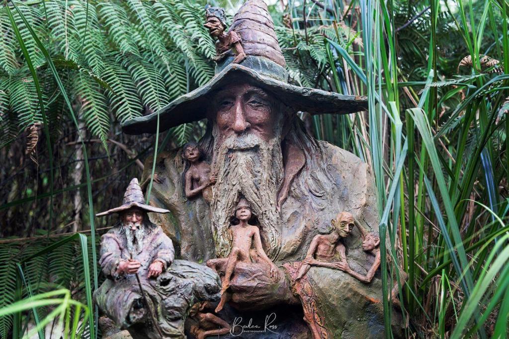
Bruno’s Art and Sculpture Garden
It was days before the residents of Marysville were allowed back to the remains of their shattered town. When Bruno returned, he found his Art and Sculpture Garden a blackened, charcoal wasteland. Gone was his home, workshop, and years of work.
With the help and support of family, friends, and strangers from across the globe who had visited and loved the garden, Bruno began the painful task of rebuilding. First, Bruno repaired the Sculptures and since then added new ones. Thirteen years later, it is again a lush wonderland with barely a trace of the devastation that was. The garden is a testament to a skilled artisan’s tenacity and fertile imagination.


Where to find it?
Bruno’s Art & Sculpture Garden, 51 Falls Road Marysville, 3779
Adult entry is $10 for the garden ($15 if you include the gallery). Under 16 is $10, and for children under five, it is free.
The garden is open seven days a week from 10 am to 5 pm. The gallery is open Saturday, Sunday and public holidays.

Narooma NSW is a little slice of heaven on the NSW far south coast. With pristine blue waterways, it’s a popular destination for photographers, fishermen or families who want to chill out or surf spectacular beaches. Unfortunately, our schedule only allowed for two days. So sadly, we didn’t get to see and do all we wanted; how I would have loved to stay longer.

History
Narooma takes its name from the Aboriginal language meaning “clear blue waters”, and with the intense blues and greens of the area’s waters, it’s not hard to see why. After discovering gold in nearby Central Tilba, the town sprung up in 1883. A school was added in 1886, and the post office followed in 1889. The oyster industry was established in 1900. The Narooma Oyster Festival is held in May each year – celebrating the heart of Rock Oyster country.

Getting There
From Sydney, it’s a pleasant 350km drive to Narooma, following the coast along the Princes Highway. The route is 220km via the Kings and Princes Highways from Canberra or 684kms from Melbourne via the Princes Hwy. While the journey from Melbourne is longer, you get to drive through Lakes Entrance, Eden, and Bermagui. All are great seaside towns and deserving of an overnight visit.

Attractions and Landmarks
While we were there for the photography, Narooma had plenty to keep everyone happy.
- Cycle or stroll along the Mill Bay Boardwalk and spot the stingrays, dolphins or seals
- Hit a few balls at the Narooma Golf Club and the famous Hogans Hole.
- A stroll along the surf beach will take you to Glasshouse Rocks
- At Bar Beach, you can enjoy a swim or snorkel in its sheltered waters where NZ and Australian fur seals also enjoy a sunbake
- Forsters Bay is perfect for kayaking around the oyster farms on the western side of town
- Bermagui – Camel Rock and Horse Head rock – only 30 mins away
- Montague Island. It boasts a historic lighthouse and nature reserve. If only we could have gone there. Because there is no bridge, you have to take a ferry – and none were running that day due to a heavy swell, so we missed out. Tours are available from Montague Island Tours or Narooma Charters

Accommodation
We stayed at the Narooma Golfers Lodge, which was very good. While not golfers, we picked it for its views, price and the easy walk to the Golf Club Bistro. They offer clean and comfortable one and two-bedroom apartments at very reasonable prices. Airbnb also has loads of accommodation options in the area, and there are plenty of hotels and motels.


Australia’s largest flying Bird – The Pelican, is a familiar sight along the Australian coast. It is often seen roosting on sandbanks, rocky breakwaters, swimming in lagoons, bays and rivers, and congregating in large numbers around fishing villages or where fishermen clean their catch. They are large waterbirds with a long pink bill for catching fish and draining the scooped up contents before swallowing.

Appearance
Pelicans species are mainly white except for the brown and Peruvian pelicans. The Australian Pelican is the largest of all eight pelican species. However, it weighs just 7kg because it has the lightest bones of any bird in the world, with air sacs in the bones and a network of air sacs under its skin. Their bill, the largest of all the Pelican species, is 40-50cm long, and they are voracious eaters, consuming up to 9kg of food per day eating fish, shrimps and yabbies.

With a wingspan of 2.3 – 2.6, they can soar to a height of 3000m and fly 1,000 in 24 hours. They are found throughout Australia, Papua New Guinea and western Indonesia, with occasional reports in New Zealand and various western Pacific islands.

Behaviour
Pelicans plunge their bills into the water to catch their prey, using it as a net to scoop up prey. While they may feed alone, they more often work together to drive fish into a concentrated mass before herding the fish into shallow water or ever-decreasing circles. On a trip to Lake Menindee one year, we went out to shoot a sunset at the local weir. We found a flock of pelicans waiting at the wall for dinner on arrival. As fish swept over the top of the weir, they would scoop them up at the bottom. Pelican version of automatic food dispenser 🙂


During food shortages, they have been known to capture and eat seagulls or ducklings, holding them under the water until they drown and then eating them head first. They will also rob other birds of their prey and take handouts from humans.

Mythology
Pelicans also feature in many myths and Christian iconology, including the ‘Book of Beasts”, a Christian compendium of real and imaginary beasts, with the Pelican symbolising selflessness and sacrifice. Colin Theile wrote the beloved Australian book ‘Storm Boy’, the story of a young boy living a lonely life with his reclusive father on the beach in Coorong, an isolated wetland region in South Australia. The boy finds and raises three orphaned Pelican chicks forming a close bond with them. In 1976 the book was adapted into a film, with a sequel in 2019. Mr Percival, the Pelican, died in Adelaide Zoo in 2009, aged 33 years old.

Breeding Site
All Australian pelicans mainly derive from just two breeding sites. On islands in the north of the Coorong, S.A. – Storm Boy country – the rookery produces almost all of Australia’s pelican chicks. The other is on various waterways of the Lake Eyre basin during rare flooding events. This year there was also a large breeding colony on Lake Brewster NSW, a remote inland lake.
In 1990, around 100,000 pelicans (perhaps a third of all the pelicans in Australia) on Lake Eyre produced 80,000 to 90,000 chicks, which later dispersed throughout the continent, including Canberra’s lakes.
About Regional

Breeding
Pelicans are gregarious birds and are monogamous for a single season, breeding in large colonies. While up to four chalky white eggs are laid, the usual number is two. Incubation is for 32 to 35 days. After hatching, the larger chick is fed more, and the smaller one eventually dies of starvation or siblicide by the other chick. The young Pelican can fly at around three months of age but still depend on its parents for food.

Landing and Take Off
Pelicans can remain in the air for 24 hours. However, they cannot sustain flapping flights over long periods. They use thermal currents to swoop and soar and cover great distances to overcome this. The landing appears similar to an amphibious aeroplane landing on a water runway, gliding to a stop using its webbed feet as brakes. Then, they skim across the water on takeoff, building up speed, flapping wings, and lifting into the air.
Pelican Feeding
Where can you see Pelicans being fed? Every day at midday on the foreshore by the pier at San Remo, Vic. The Pelican feeding at The Entrance in NSW has been temporarily halted due to Covid. You can see them fed at Ian Dipple Lagoon on the Gold Coast at 1.30 pm daily. The pelican feeding has been permanently cancelled at Kingscote, Kangaroo Island, SA.


Day one saw us head off on our Outback Road Trip from Nagambie with our first stop, Redesdale, just on an hour away. Situated in the Agnes Mumford Reserve on the corner of Lyell Road and Heathcote-Redesdale Road is the Redesdale Water Tank Art. Painted by Damian Arena in 2019, it marks the 10th anniversary of ‘Black Saturday’ when fourteen homes were destroyed along with 7086 hectares of land.


The Agnes Mumford Reserve is directly opposite the Redesdale Hotel – so either works for a pit stop. We parked in the reserve and enjoyed our cookies and hot coffee. As we never know where we are going to find an image – we always travel with snacks and a thermos 🙂
Avoca
From Redesdale, we headed to Avoca. Jimmy Busuttil has been working on the Avoca silo for a couple of months now, but work has come to a standstill while they await permission to paint the other side, which is almost on the railway line, so a few OH&S issues need to be solved. When it is finished, it will have a background of the night sky behind the owl; his eyes and stars will be glow in the dark paint – and it will be lit up at night.

We also stopped off at the railway cafe, up the road from the silo, for a late lunch – but they seemed to be mainly catering to cakes and coffee – and while they were open – there was no one there to serve us.
From Avoca, we headed off on the final leg of the days’ journey – to St Arnaud. Arriving in St Arnaud, we drove around photographing the street murals and silo – all done by Kyle Torney and featuring locals of the town or its history.
St Arnaud


Mural Locations
- The Hope silo – Mc Mahon st
- Ron Reyne Mural – opposite the Hope silo at 14 Mc Mahon st
- Mates Mural – Cnr Wills St and Kings Ave
- The Miner Mural – 22 Kings Ave
- CFA Mural – Cnr Napier and Alma Sts
- Andrea Hicks Mural – side of the wall at 117 Napier St
- Loss Hamilton Mural – 36 Alma St
- Torneys Fighting Fit Gym – cnr of Alma and McMahon sts
- Owen – sidewall of 18 Napier St
- St Arnaud Primary school – observe from Dundas Street
- Royal Hotel Beer Garden at 60 Napier St
We were booked into the Motel St Arnaud for the night before an early start the next day to Sea Lake via the Silo Art Trail. Our motel was clean, beds and shower were good, and the free wifi was fast – for a budget motel it’s excellent value. Dinner that night was at the Royal Hotel, built in 1874 its full of character and old-world charm and decorated throughout with antiques and another mural in the beer garden. We enjoyed wine by the open fire before heading into the dining room for dinner.


